What Is El Salvador Known For?
Volcanoes, surf at El Tunco, pupusas, high-grown coffee, and Bitcoin. What El Salvador is known for and where to experience each one on a real trip.
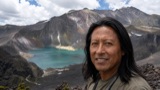 Written with Carlos Hernández, Santa Ana Volcano tour guide & hiking specialist
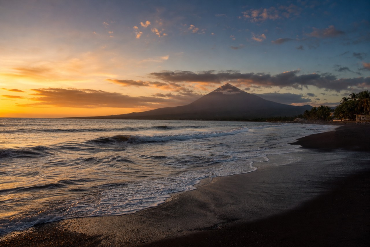
Short answer
El Salvador is known for its volcanoes, above all Santa Ana with its turquoise crater lake, for world-class surf at El Tunco and El Zonte, for pupusas, for high-grown coffee, and for adopting Bitcoin as legal tender in 2021. It is the smallest country in Central America, and 2025 set a visitor record at 4.1 million.
From the rim of Santa Ana I can point at most of the answers to this question. The crater steams below, coffee farms stripe the lower slopes, Izalco's black cone stands to the south, and on a clear day the Pacific glints where the surf towns sit. I have guided travelers up here since 2018, and the ones who arrive knowing only one thing about El Salvador usually leave having collected all six.
What is El Salvador known for?
Six things, mainly: volcanoes, with Santa Ana as the flagship, Pacific surf centered on El Tunco and El Zonte, pupusas as the national dish, coffee grown on volcanic slopes, the 2021 adoption of Bitcoin as legal tender, and its size, the smallest country in Central America yet dense with all of the above.
The compactness is the quiet superpower. Because the country is so small, the famous things sit close together, and a single trip can cover most of the list without a single internal flight.
| Known for | Why it is famous | Where to experience it |
|---|---|---|
| Volcanoes | Highest concentration of drama per kilometer in the region | Santa Ana summit, Cerro Verde National Park |
| Surf | Consistent Pacific point breaks, "Surf City" branding | El Tunco, El Zonte |
| Pupusas | The national dish, eaten everywhere daily | Any town, best from a busy roadside comal |
| Coffee | High-grown beans from volcanic soil | The Santa Ana highlands and western coffee country |
| Bitcoin | First country to make it legal tender, in 2021 | El Zonte, nicknamed Bitcoin Beach |
| Small size | Central America's smallest country | Everywhere: most drives run one to two hours |
Tourism has caught up with the list. El Salvador received a record 4.1 million international visitors in 2025, and arrivals in early 2026 ran 35 percent above the year before. The official board's own presentation of the country leads with the volcanoes, and its page on Ilamatepec shows why.
Why are the volcanoes the headline?
Because they deliver a genuine summit experience in a single morning. Santa Ana, the country's highest at 2,381 m, offers a moderate 6.9 km round-trip hike to a steaming turquoise crater lake, while Izalco and Cerro Verde stand within sight of it. Few countries put this much volcano within a day trip of the capital.
The lineup reads like a family portrait, three peaks around one national park.
| Volcano | The essentials | The experience |
|---|---|---|
| Santa Ana (Ilamatepec) | 2,381 m, highest in the country, last erupted October 2005 | Moderate guided hike to the turquoise crater, 3 to 4 hours |
| Izalco | The young black cone, "Lighthouse of the Pacific" | A separate, steeper climb on loose volcanic slopes |
| Cerro Verde | Forested, with the national park at about 2,000 m | Easy trails and the classic viewpoint over the other two |
Santa Ana is the one most travelers do, and the trail data explains why: a 4.8 rating on AllTrails, around 470 m of gain, and a mandatory local guide system that makes it beginner-friendly. My side-by-side of Izalco versus Santa Ana sorts out which suits you if you have legs for only one.
The practical route into all this is simple. Most visitors base in San Salvador or on the coast, then book the guided day tour and check live availability and prices on Viator, which packages hotel pickup, the guided summit climb with admission included, and lunch on Lake Coatepeque into one 4.9-rated day.
How good is the surf, really?
Good enough that the government built a national brand on it. El Tunco and El Zonte anchor the "Surf City" stretch of Pacific coast, known for consistent right-hand point breaks, warm water, and a laid-back town scene. The coast has hosted international surf competitions, and the volcano is still reachable from it.
I am a mountain guide, not a surf coach, but plenty of my hikers come up from the coast, salt still in their hair. El Tunco is the social hub, all restaurants and surfboards leaning on walls. El Zonte is quieter and picked up the nickname Bitcoin Beach for its early cryptocurrency experiment, which helped push the country toward the 2021 law.
Here is the part that surprises people: the surf towns and the summit combine in one trip without repacking. The guided volcano day covers pickup from El Tunco and El Zonte as well as San Salvador hotels, and the drive from the coast runs about two hours. My route notes on doing the volcano from El Tunco walk through the timing, which matters because the group ascent has a fixed late-morning window.
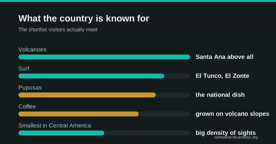
How do you fit the famous things into one short trip?
Easily, because the drives are short. San Salvador to the volcano is about 1 to 1.25 hours, the surf coast to the volcano roughly 2 hours, and Lake Coatepeque sits on the way down. A three-to-five-day route can cover the summit, the lake, pupusas, coffee country, and the beach without an internal flight.
The smallest country in Central America rewards a simple plan. Here is a worked example built on the drive times and the fixed volcano schedule, framed as planning allowances rather than a script.
| Day | Base | What you cover | Timing note |
|---|---|---|---|
| 1 | San Salvador | Arrive, first pupusas, early night | The volcano day starts early |
| 2 | San Salvador | The guided volcano day: summit hike, Coatepeque lunch | Group ascent 9:30 to 10:00, last start 11:00; back by evening |
| 3 | Santa Ana city or the highlands | Coffee country, the city's theatre and cathedral | About 1 h from the volcano area |
| 4 | El Tunco or El Zonte | Surf coast, Bitcoin Beach, sunset | Roughly 2 h from the volcano area |
| 5 | Coast | Second surf morning, fly out from the capital | Allow the drive back to San Salvador |
The volcano day is the piece with the least flexibility, so I plan everything else around it. The daily group ascent forms around 9:30 to 10:00 with a last start at 11:00, and the crater area closes around 13:00, which is why the guided day with pickup exists: it gets you there inside the window from the capital or the coast without a hire car. Coffee country and the city can be done on the same axis as the volcano, and the coast closes the loop. My guides to how many days El Salvador needs and to a full volcano itinerary turn this sketch into real routes.
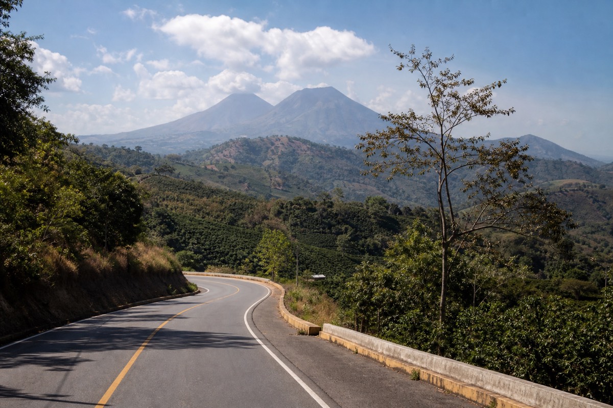
What is Lake Coatepeque, and why do Salvadorans rank it with the volcano?
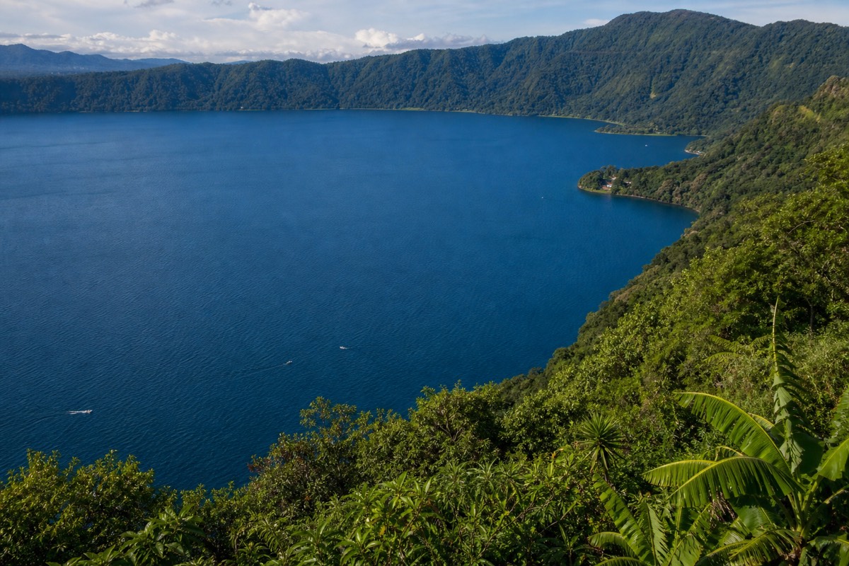
Coatepeque is a caldera lake roughly 10 km across, deep blue, swimmable, and ringed by restaurants and docks below the volcano. It is where the guided day stops for lunch, where families spend weekends, and where this year's trip reports mention jet-ski rental. It is the swimming lake; the volcano's crater lake is not.
If Santa Ana is the country's headline, Coatepeque is the paragraph everyone underlines afterward. From the upper trail you see it spread out to the east, a blue disc in a bowl of green walls, and by early afternoon you can be sitting beside it with a plate of food.
The two lakes cause more confusion than anything else I explain. The crater lake at the summit is sulfuric, acidic, steaming, and strictly prohibited for swimming, with rim access managed. Coatepeque, in the caldera below, is the opposite: swimmable, sociable, and built for a long lunch. Guided groups typically spend about 2 hours there after the descent, lunch included, and reviewers this year mention renting jet skis and swimming off the docks. If you plan your own day, allow time and cash for it, because it is the natural reward for the climb.
For Salvadorans it is a place in its own right, not an add-on. Weekend traffic heads there from San Salvador, lakeside houses fill with families, and the water is a fixture of holiday photos in a way the surf coast only recently matched. My full guide to Lake Coatepeque covers how to get there and what to expect on the shore, and my crater lake guide explains, once and for all, why nobody swims at the summit.
What is Cerro Verde National Park known for?
Cerro Verde is the forested volcano at about 2,000 m that holds the national park between Santa Ana and Izalco. It is known for cool cloud forest, the classic viewpoint over both neighbors, and being the gateway to the Santa Ana climb. Entrance is $3 for foreigners, $1.50 for Salvadorans, cash only, with trailhead access from about 7:00.
Most visitors experience Cerro Verde as the place the van stops, and then walk straight past it. That is a shame, because it is the calm, green center of the whole volcanic complex, and the reason the park sits where it does.
| Park fact | Detail |
|---|---|
| Elevation of the park area | About 2,000 m, between the three volcanoes |
| Entrance fee | $3 foreigners, $1.50 Salvadorans, cash only |
| Group guide fee for the Santa Ana climb | About $4 per person, mandatory |
| Parking | $3 |
| Trailhead access | From about 7:00 |
| Group ascent | Forms about 9:30 to 10:00, last start 11:00, crater closes around 13:00 |
| The view | Santa Ana's crater to one side, Izalco's black cone to the other |
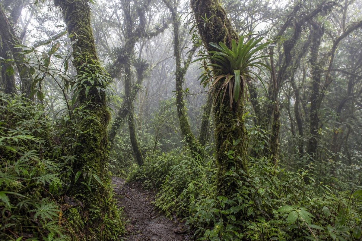
The cloud forest is the surprise. After the heat of the lowlands, the park is cool and damp, with moss on the trunks and birds you hear before you see. Izalco stands to the south, bare and black, and its separate, steeper hike starts from this side too. Santa Ana rises to the north, and its trail climbs through farmland and forest before the rock. Because the park is the hub for all three, it is also where the cash-only fees are paid, so arrive with small bills. My guide to Cerro Verde National Park covers what to do there beyond the main climb.
When is the best season to see what El Salvador is known for?
November through April for the volcano and its clearest turquoise; the dry season also suits the coast and coffee country. May through October is the green season, lush and warm, with afternoon cloud on the summit that the late-morning ascent mostly beats. There is no wrong season, only different photographs.
The country's famous things do not all peak at the same moment, but they overlap well enough that one trip can catch most of them. Here is how I would weigh the calendar as a guide who watches the summit weather every week.
| Period | The volcano | The coast and lake | Coffee country | Planning note |
|---|---|---|---|---|
| November to April | Dry season, clearest crater, best views | Warm, dry, busy on weekends | Dry, dusty, hills fading to gold | The safe bet for a first visit |
| May to October | Green season, lush trail, afternoon cloud | Warm, greener, afternoon rain | Vivid green, farms at their prettiest | Trust the late-morning ascent; pack a layer for the rim |
The one constant is the summit itself: cooler and windier than the base whatever the month, and always run on the fixed group schedule. That schedule is the reason green-season hikers usually still see the crater. The ascent forms around 9:30 to 10:00, so groups are on the rim before the cloud builds, and the crater area closes around 13:00 anyway. If you can only pick one variable to control, pick the month; if you cannot, pick the earliest start you can manage. My guide to the best time to hike goes month by month, and my rainy season hike report shows what a green-season day actually looks like from the trail.
What do first-time visitors get wrong about El Salvador?
In my experience since 2018, five things: they expect a dangerous country and find a Level 1 advisory, they expect a big country and find one where drives run one to two hours, they expect to swim in the crater lake, they arrive at the volcano after the 11:00 last start, and they arrive without cash for the cash-only park fees.
None of these mistakes are stupid; they come from a picture of the country that is a decade or two out of date, or from confusing the two lakes. Here is the pattern I see and the correction that fixes it.
| The expectation | The reality | What to do instead |
|---|---|---|
| El Salvador is unsafe to visit | US State Department Level 1, exercise normal precautions; a record 4.1 million visitors in 2025 | Read the advisory yourself, then apply ordinary travel sense |
| It takes days to cross the country | Most famous drives run about 1 to 2 hours | Base in two places at most |
| You swim in the volcano's crater lake | Sulfuric, acidic, prohibited; Coatepeque is the swimming lake | Plan the swim for the caldera lake after the hike |
| You can turn up at the volcano whenever | Group ascent 9:30 to 10:00, last start 11:00, crater closes about 13:00 | Book transport that respects the window |
| Cards work everywhere | Park fees are cash only, in US dollars | Carry small bills for the gate and the paleta seller |
The safety point is the one I spend the most time on, and I keep it factual: the country holds the State Department's lowest advisory tier, tourism set a record in 2025 and grew a further 35 percent in early 2026, and the normal precautions still apply. My full safety guide covers the context. The timing point is the one that costs people the most, because a missed cutoff cannot be fixed the same day. If you would rather have the timing handled, the guided day tour with hotel pickup builds the whole day around the window; if you are doing it yourself, sleep in Santa Ana city and catch the early bus.
What food and drink is El Salvador famous for?
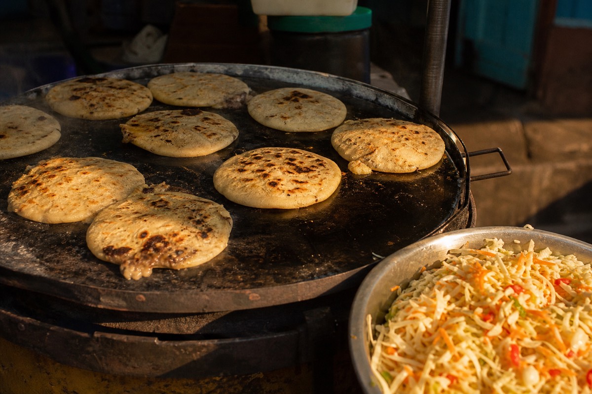
Pupusas, above everything: thick corn griddle cakes stuffed with cheese, beans, or pork, pressed by hand and eaten with curtido and thin tomato salsa. They are the national dish with their own celebration day. The other icon is coffee, high-grown on volcanic slopes, long central to the country's economy and identity.
A pupusa costs little, arrives hot off the comal, and works for breakfast, lunch, or the meal after a volcano. Watching a pupusera slap the dough flat is half the pleasure. Every one of my groups that tries them orders a second round, and the debate between revuelta and queso con loroco has ended friendships, or at least paused them.
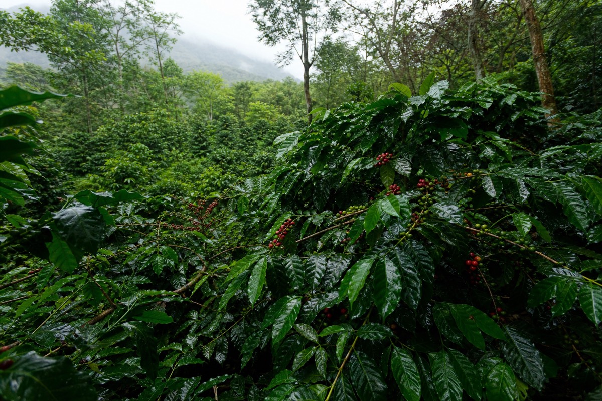
Coffee is the deeper story. The western highlands around Santa Ana grew wealthy on it more than a century ago, and the volcanic soil that makes the hiking dramatic is the same soil that makes the beans worth exporting. On the lower trail you walk straight past coffee plants under shade trees, which delights the caffeine-inclined members of every group. The city of Santa Ana itself carries that coffee-boom architecture to this day, something I unpack in what Santa Ana city is known for.
What about Bitcoin, and what should travelers actually expect?
In 2021 El Salvador became the first country to adopt Bitcoin as legal tender, a factual milestone that put it in global headlines. In daily practice the economy runs on US dollars, which have been the currency since 2001, and travelers should carry cash: the volcano park fees, for instance, are cash only.
I keep this section factual because that is what a visitor needs. You will see Bitcoin accepted in some places, most visibly around El Zonte, and you will pay for nearly everything else in ordinary dollars. Park entrance at the volcano is $3 for foreigners, the local group guide fee is about $4, and parking is $3, all in cash. No crypto wallet required on the trail, though the paleta seller at the summit has heard every joke about it.
| Quick country facts | Detail |
|---|---|
| Size | Smallest country in Central America |
| Currency in practice | US dollar, official since 2001 |
| Bitcoin status | Legal tender since 2021, a world first |
| 2025 visitors | 4.1 million, a national record |
| Early 2026 trend | Arrivals up 35 percent year over year |
| Safety rating | US State Department Level 1, lowest advisory tier |
So that is the list: volcanoes, surf, pupusas, coffee, Bitcoin, and a country small enough to sample all of it in one short trip. My bias is public and unashamed, start with the volcano. It is the experience the country itself leads with, and once you have looked down into that turquoise crater with a paleta in hand, the rest of El Salvador makes a kind of sense from above.