Green Season on Ilamatepec, a Hike Report
What climbing Santa Ana Volcano is really like from May to October: lush forest, afternoon cloud, when the crater still shows, and how to pack for it.
 By Carlos Hernández, Santa Ana Volcano tour guide & hiking specialist
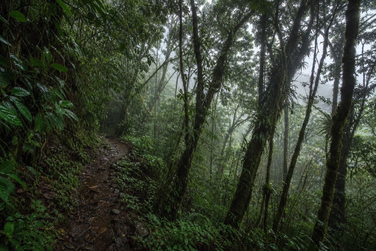
June on the lower trail smells like wet earth and crushed leaves, and the forest is so green it looks lit from inside. I have guided this mountain since 2018, through eight rainy seasons, and I still stop at the same bend where the vegetation closes over the path like a tunnel. Travelers keep asking me whether they should skip Ilamatepec if they visit between May and October. This is my honest report from the green months, written for anyone whose flight lands in the middle of them.
Is the rainy season a bad time to climb?
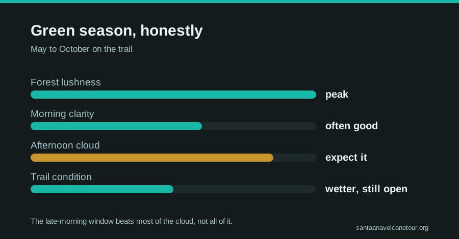
No. May to October is the green season: the forest is at its lushest, mornings are frequently clear, and rain falls mostly as afternoon showers. The late-morning group ascent is timed so hikers typically summit before the heaviest cloud builds. You trade guaranteed views for greenery, softer light, and thinner crowds.
The name "rainy season" does the mountain a disservice. It rarely means all-day rain here. The typical pattern is a bright or hazy morning, cloud building through midday, and showers in the afternoon, by which time the daily ascent is already finished. Remember the schedule the mountain runs on: group start around 9:30 to 10:00, last start 11:00, crater area closed by about 13:00. That window exists for management reasons, but in the green months it doubles as weather strategy. You are up and back down before the sky usually breaks.
What you gain is the forest. The dry-season trail is beautiful in a stark, dusty way. The green-season trail is another mountain entirely: dripping vegetation on the lower slopes, flowers, that dense smell of growth. If you are deciding between months, my best time to hike guide goes deeper, but do not let the season name scare you off by itself.
Will you still see the crater lake?
Often, yes. The crater sits at 2,381 meters and afternoon cloud is the enemy, so the earlier your group tops out, the better your odds. Summit before noon and the turquoise lake shows itself on many green-season days, sometimes through drifting cloud that opens and closes like a curtain. There are no guarantees in any month.
I will not sell you certainty. I have stood at the rim in July in cloud so thick the lake was a rumor, and I have stood there the next day in light so clean the turquoise hurt to look at. What I can give you is the timing logic I use myself:
| Time of day (May-Oct) | What the sky usually does | What it means for you |
|---|---|---|
| 7:00-9:30 | Clearest window; trailhead opens at 7:00 | Arrive early, sort fees and poles, enjoy the views on the drive up |
| 9:30-11:00 | Group ascent starts; cloud beginning to build on some days | The earlier start within the window is worth taking |
| 11:00-13:00 | Summit hours; cloud can drift across the rim and open again | Wait ten minutes before declaring defeat, the curtain moves |
| After 13:00 | Crater area closed; showers most likely | You are descending or already at lunch, exactly where you want to be |
That "wait ten minutes" line is real guiding advice. Green-season cloud at the rim moves fast. I have watched entire groups get their photos in a two-minute gap after twenty minutes of grey. Patience at the top costs nothing.
How do the green and dry seasons actually compare?
Dry season, November to April, brings the clearest crater views, dust on the trail, and the biggest crowds. Green season, May to October, brings lush forest, afternoon showers, softer temperatures, and fewer hikers. The trail distance, fees, group system, and the 11:00 last start are identical year round.
Here is the comparison I sketch for guests, side by side:
| Factor | Dry season (Nov-Apr) | Green season (May-Oct) |
|---|---|---|
| Crater visibility | Most reliable of the year | Good before noon, cloud risk after |
| Trail surface | Dusty, loose rock near summit | Damp lower trail, same rocky summit stretch |
| Scenery | Golden, open, volcanic | Intensely green lower forest |
| Crowds | Peak | Noticeably lighter |
| Rain risk | Low | Afternoon showers common |
| Schedule and fees | Identical: $3 entrance, ~$4 guide, last start 11:00 | Identical |
Note the last row. Nothing structural changes with the calendar. The mandatory guide, the group ascent, the 6.9 kilometer round trip with about 470 meters of gain, the roughly 3.5 to 4 hours of hiking: all of it holds in every month. AllTrails, where the route carries a 4.8 rating, shows recent activity across the whole year on the trail page, which matches what I see at the trailhead.
For green-season visitors the tour logic actually strengthens. Timing is everything from May to October, and the guided day is built around the ascent window, with hotel pickup calculated so you never miss the last start. If your trip lands in these months, book the guided day tour and check live availability and prices on Viator, and let someone else do the wet-road driving while you watch the forest go past.
What should you pack differently from May to October?
Everything from the dry-season list, plus a light rain shell, a dry layer in a plastic bag, and shoes with real grip for the damp lower trail. Keep the two liters of water: cloud cover does not cancel dehydration at altitude. Poles, about $2 at the trailhead, matter even more when rock is wet.
The official guidance from MARN is blunt and season-proof: the ascent is not to be improvised, carry water, leave no litter, and you can check the volcano's monitored status anytime at snet.gob.sv. On top of that baseline, here is my green-season packing delta:
| Item | Dry season | Green season adjustment |
|---|---|---|
| Rain shell | Optional | Bring it, always |
| Footwear | Sturdy shoes, ankle support recommended | Same, but prioritize wet-rock grip |
| Spare layer | One warm layer for the windy summit | Warm layer plus a dry shirt in a sealed bag |
| Water | 2 liters minimum | 2 liters, no reduction for cloudy skies |
| Poles | Nice to have, ~$2 rental | Strongly recommended for the slick descent |
| Phone/camera | Normal care | A zip bag; rim mist is fine spray, not just fog |
The summit deserves its own warning in any season: it is cooler and windier up there than at the base, and in the green months a sweat-soaked shirt plus rim wind equals shivering while everyone else eats paletas. The dry-shirt trick is the single best piece of packing advice I give. My full checklist lives in the what to bring guide.
How wet does each part of the trail actually get?
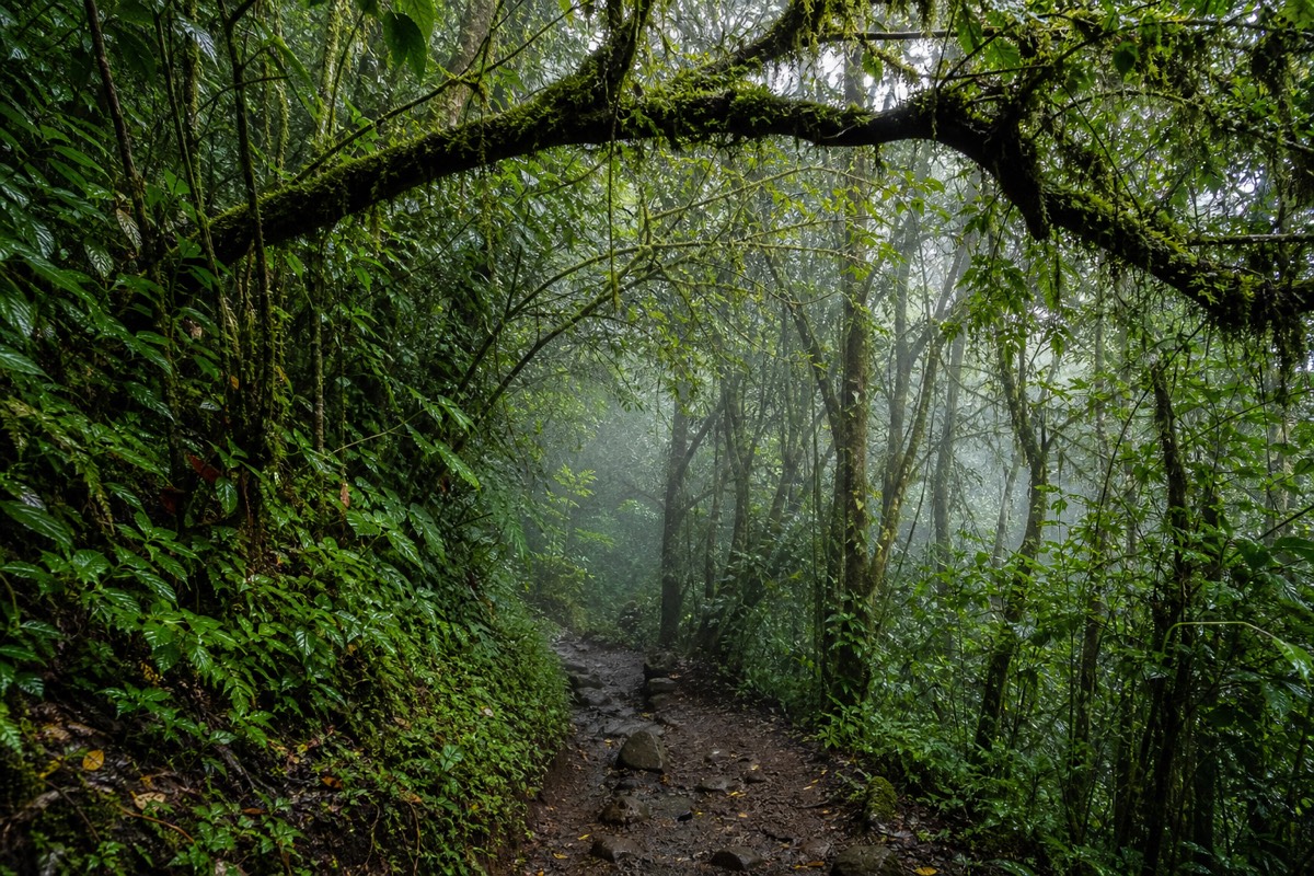
The lower forest is where the green season shows: damp, shaded, and slick in places, with vegetation closing over the path. The middle slopes dry quickly once the sun is on them. The rocky final stretch near the summit is the same loose rock as in the dry months, only greasy when a shower has passed. Nothing on the route becomes impassable.
People imagine mud from bottom to top. It is not that. The 6.9 kilometer round trip changes character three times, and the rain touches each part differently. Here is how I brief a green-season group at the trailhead, as a set of planning allowances rather than promises:
| Trail segment | Dry season feel | Green season feel | Pacing allowance |
|---|---|---|---|
| Lower forest from El Tibet | Dusty, shaded, easy | Damp, dripping, some slick roots and packed earth | Steady walking; watch footing on the tunnel stretch |
| Middle open slopes | Sunny, warm, loose gravel | Drying quickly by late morning; occasional soft patches | Same pace as dry season |
| Upper rocky section to the rim | Loose rock, exposed, windy | Same rock, wet after showers, more wind and cloud | Slow down; poles do the work here |
| Descent, whole route | Knees and dust | Knees, plus wet rock near the top | Allow a little more than the usual hour and a half |
The pacing column is my own judgment after eight rainy seasons on this mountain, and it is planning advice, not a timetable. The overall trip still fits inside the usual three to four hours, roughly two up and an hour and a half down, for most hikers who take the descent seriously.
The upper section is the part I watch. It is rocky in every season, which is why recent reviews keep recommending ankle support and the $2 poles, and wet rock adds an extra reason. AllTrails still calls the route moderate at 4.8, and I agree, with the footnote that "moderate" assumes you are not running down loose wet stone. My difficulty guide goes deeper on that section: how hard is the hike, really.
Who should skip the green-season climb, and who should go anyway?
Skip it if you need a guaranteed crater view for the trip to feel complete: book the dry months instead. Skip it in any season if you have back or heart conditions or are pregnant, since the guided day itself excludes those, and note the route is not wheelchair accessible. Go anyway if forest, cooler air, and lighter crowds sound like a fair trade.
I would rather lose a booking than send the wrong person up in July. So here is the honest sorting table I use, framed as planning guidance:
| Traveler | Green-season verdict | Why |
|---|---|---|
| "I only care about the turquoise lake" | Choose November to April | Dry season gives the most reliable crater view; green mornings are good, afternoons are not |
| Photographers | Go, with a zip bag | Moving cloud and green light beat flat dry-season haze for drama |
| Nervous first-time hikers | Go, take the poles | Same moderate route, wet only in patches, and lighter crowds mean a calmer group |
| Back, heart, or pregnancy concerns | Skip in every season | The featured day tour excludes these; the climb is real effort at altitude |
| Wheelchair users | Not accessible | The route is a rocky mountain trail; the guided day is not wheelchair accessible |
| Short-trip travelers who can only come now | Go | The late-morning ascent usually beats the cloud, and Coatepeque waits below it |
The middle rows are where I lose people to their own caution, and I try to talk them back. The mountain in the green months is not harder in any way that changes the verdict. The fees, the guide system, the last start at 11:00, the crater area closing around 13:00: all identical. What changes is the odds on the view, and I have already given you my honest answer on that, which is "often, not always."
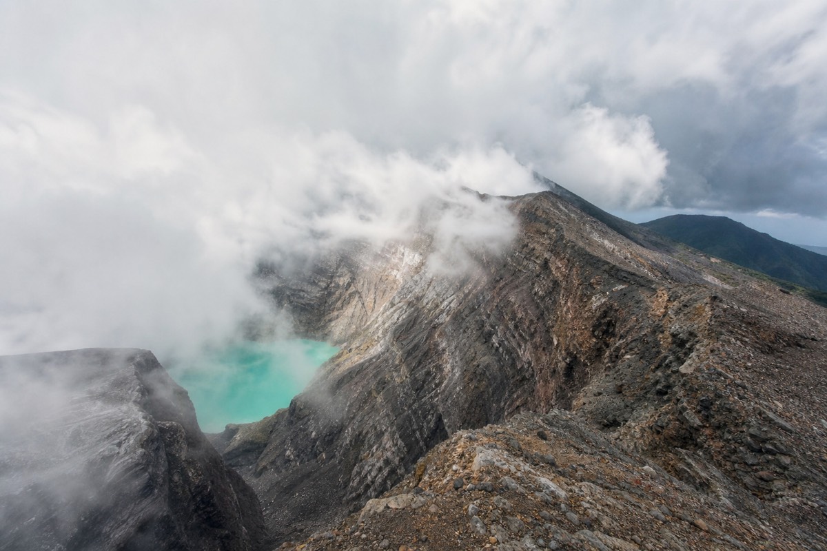
If you fall in the first row and your dates are flexible, plan around the dry months. If you are curious why the lake's color moves even in clear weather, why the crater lake changes color explains it. Everyone else: come. The forest is waiting.
What green-season mistakes do I see hikers make most?
Wearing cotton to a windy 2,381 meter summit, giving up at the rim after five minutes of cloud, leaving the rain shell in the car because the morning was bright, skipping the poles for the wet descent, and cutting the trailhead arrival fine on wet roads. All are avoidable, and I watch at least one every week from May to October.
I keep this list because it is the same list every year. Not the same people, the same list.
Cotton first. A cotton shirt soaked from the climb meets summit wind and you shiver through the best view in El Salvador. The dry-shirt-in-a-bag trick fixes it and costs nothing.
Then the rim. Green-season cloud opens and closes; five minutes of grey means nothing. Sit down, drink, wait. I have seen groups turn their backs to a hidden lake and start down as it opened behind them.
The shell. Bright mornings are the whole pattern from May to October, and they say nothing about the afternoon. It goes in the pack, always. The poles, about $2, are the cheapest insurance on the mountain when the upper rock is wet, and skipping them to save the price of a paleta is false economy.
Last, the clock. Wet roads slow the drive from San Salvador, which already runs one to one and a quarter hours, and the last start at 11:00 does not move for weather. Independent drivers should leave earlier than they think. The guided day builds its pickup around that window, which is one reason I point green-season travelers toward it; if you want the timing handled for you, the guided day tour is built for exactly this.
None of this is a reason to stay home. It is a reason to pack a shell, rent the poles, and bring patience to the rim.
Is the guided day still worth it when cloud is possible?
Yes, because the day was never only about the crater. You still get the forest at its greenest, the climb itself, the summit atmosphere, and then two hours at Lake Coatepeque with lunch included, and the big caldera lake sits lower than the cloud that troubles the rim. One turquoise lake usually shows up even when the other hides.
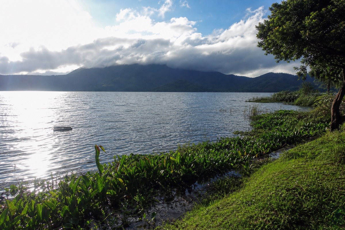
That is the quiet insurance policy built into the volcano-plus-Coatepeque format. The crater lake at the top is weather-dependent. The caldera lake below, ten kilometers across, is not hiding anywhere. On my greyest green-season summit days, guests still ended the afternoon eating lunch over blue water, some of them out on rented jet skis, sunburned by two in the afternoon under a sky that had rained on the volcano an hour earlier. I put more about that side of the day in the Lake Coatepeque guide.
My last green-season note is sentimental, so forgive me. The mountain in June, wrapped in moving cloud, dripping and green and half-hidden, is the version of Ilamatepec I would show a friend. The dry season gives you the postcard. The rainy season gives you the volcano.