The Santa Ana Volcano Hike, Step by Step
A segment-by-segment walkthrough of the Santa Ana volcano hike: trailhead to crater rim, timing for every stretch, the ascent window, and the fees you pay in cash.
 Written with Carlos Hernández, Santa Ana Volcano tour guide & hiking specialist
Short answer
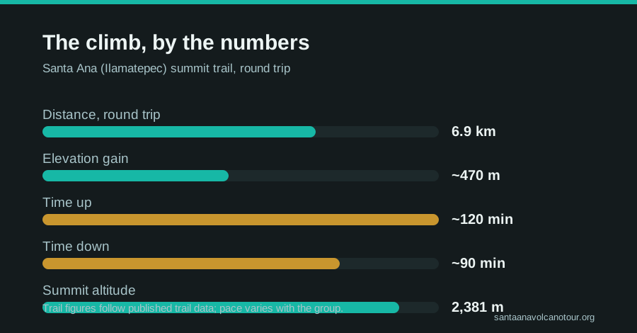
The Santa Ana volcano hike is a 6.9 km round trip gaining about 470 m to the 2,381 m crater rim, the highest point of any volcano in El Salvador. Count on roughly 2 hours up and 1.5 down with the mandatory local guide, starting in the 9:30 to 11:00 window.
The sulfur reaches you before the view does. Somewhere past the halfway mark the trees thin out, the wind picks up, and a faint mineral edge drifts down from a crater you still cannot see. I have been guiding people up Ilamatepec since 2018, more than a thousand travellers by my own count, and that first whiff still makes my pulse jump every single time. What follows is the walkthrough I give friends before their first climb: what each stretch of trail looks like, how long it takes, what you pay, and what is waiting at the rim.
What are the basic stats of the trail?
The hike is a 6.9 km (4.3 mi) round trip gaining about 470 m to the summit at 2,381 m, the highest volcano in El Salvador. Most people take around 2 hours up and 1.5 hours down, 3 to 4 hours in total. It is rated moderate, and a local guide is mandatory for everyone, no exceptions.
| Stat | Figure |
|---|---|
| Round-trip distance | 6.9 km / 4.3 mi |
| Elevation gain | ~470 m |
| Summit elevation | 2,381 m |
| Time up | ~2 hours |
| Time down | ~1.5 hours |
| Total hiking time | 3 to 4 hours |
| Difficulty | Moderate |
| Guide | Mandatory, hired at the trailhead |
Those numbers line up with what hikers log on AllTrails, where the route holds a 4.8 star average. The distance is honest and so is the gain: this is not a stroll, but it is nothing like the multi-day volcano treks elsewhere in Central America. If you can handle two hours of steady uphill walking with a few breathers, the mountain will let you in, whatever your gym attendance looks like.
What does the trail look like, section by section?
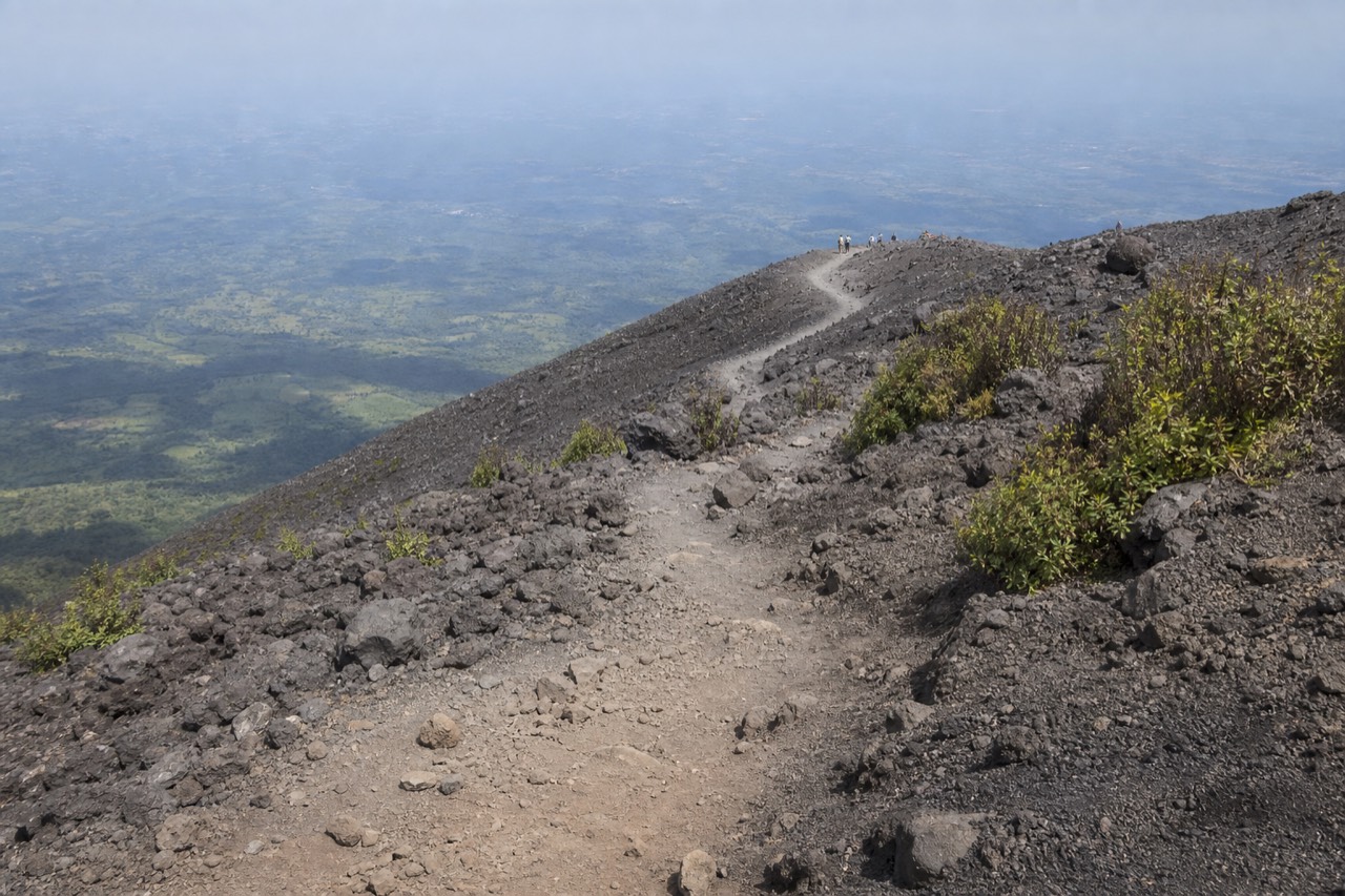
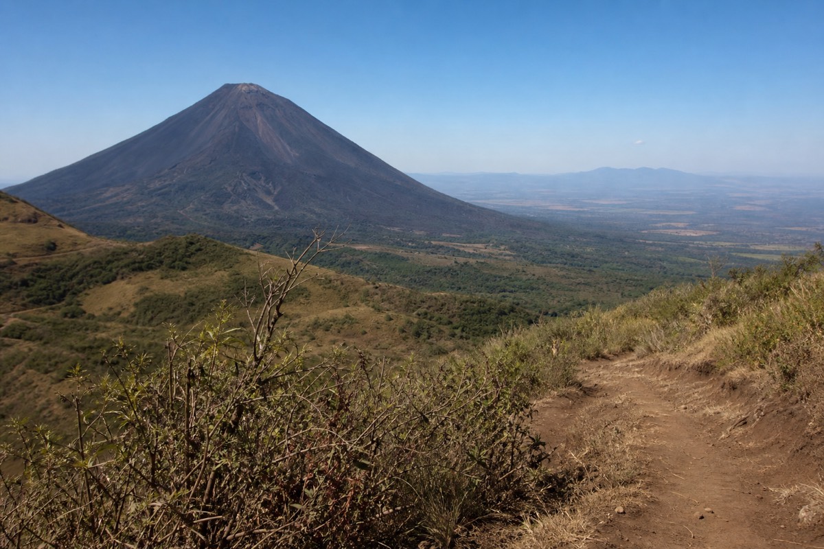
The climb has three distinct characters: a gentle, shaded forest approach, an open middle stretch with views across to the black cone of Izalco, and a final rocky push over loose volcanic ground to the rim. The terrain gets harder in the exact order your legs warm up, which is kind of the mountain.
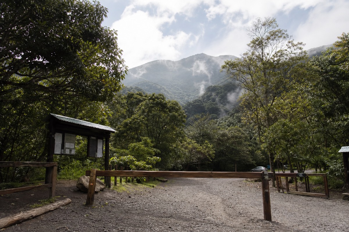
From the El Tibet trailhead you walk into green shade almost immediately. This first stretch rolls more than it climbs, with birdsong overhead and a soft dirt path underfoot. It lulls a few people into thinking the whole hike will feel like this. It will not.
The forest then tilts uphill and does real work for a while before the vegetation opens. Suddenly you get the payoff views: Izalco's dark, bare cone to one side, the huge blue sheet of Lake Coatepeque appearing behind you as you gain height. Guides usually call a water break here, and nobody argues.
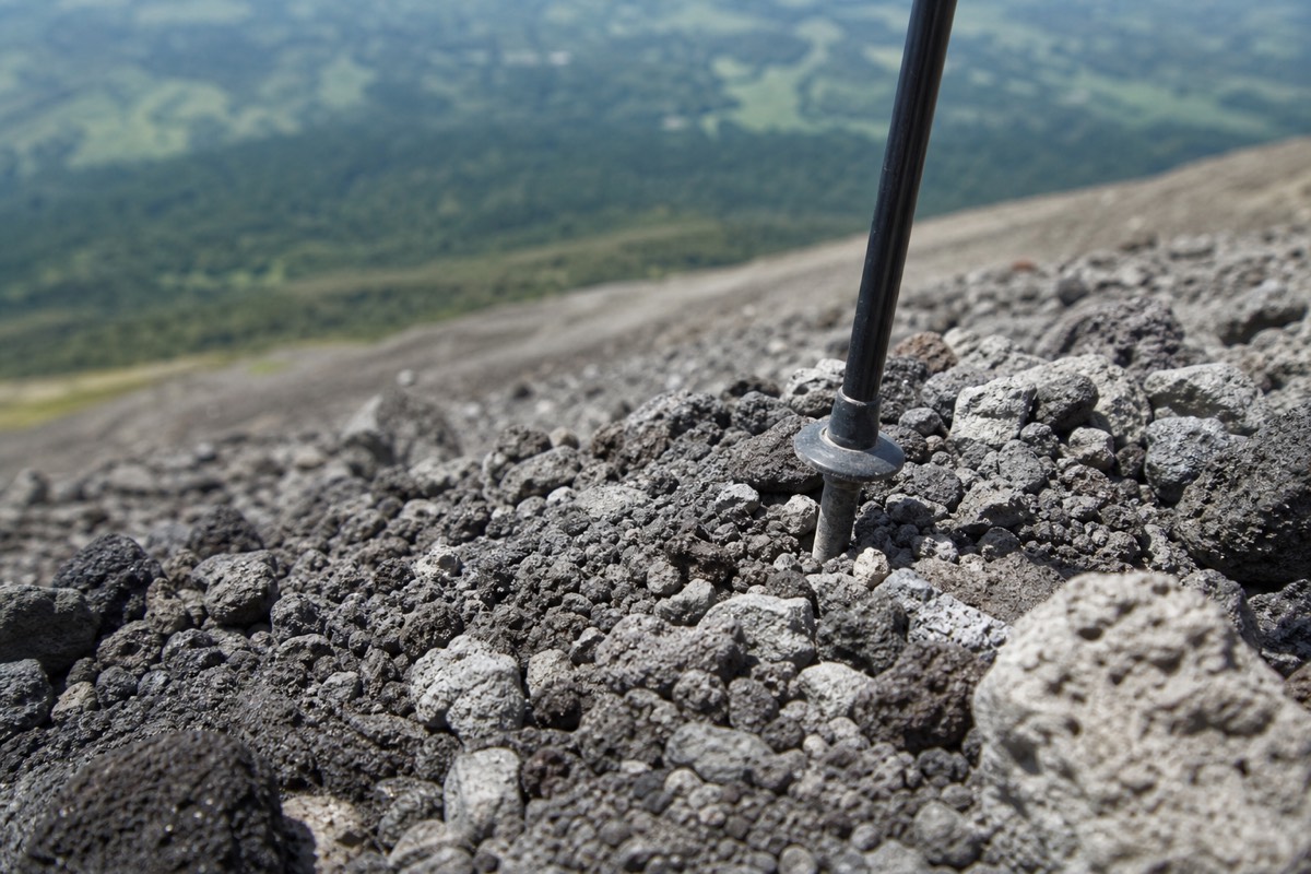
The last section is the one people remember. The plants give up, the ground turns to loose volcanic rock, and the wind starts pushing. Footing matters more than fitness here. Ankle support earns its keep, and the trekking poles rented at the trailhead for about $2 stop being a joke purchase. I cover footwear and the rest of the kit in what to bring for the climb.
| Segment | Character | My typical pace going up |
|---|---|---|
| Trailhead through the lower forest | Shaded, gentle, rolling | ~30 minutes |
| Forest climb | Steady uphill under cover | ~30 to 35 minutes |
| Open slopes with Izalco views | Exposed, moderate grade, breezy | ~25 to 30 minutes |
| Rocky summit push | Loose rock, steepest part, windy | ~30 to 35 minutes |
| Descent, rim to trailhead | Same route, easier but slippery | ~1.5 hours |
Those segment times are from my own pacing over hundreds of ascents, not a stopwatch study. Add ten minutes per segment if your group photographs everything, and honestly, you should.
When can you actually start the climb?
Ascents run on a fixed daily window. The organized group starts between about 9:30 and 10:00, the last start is 11:00, and the crater area closes around 13:00. The trailhead itself opens from about 7:00, so early arrivals wait. You cannot legally walk up alone at whatever hour you like.
This surprises people used to alpine starts. The system exists because every hiker goes up with a local guide, and the guides move the day's visitors up the mountain together. MARN, the ministry that monitors the volcano through SNET, is blunt about it: the ascent is not to be improvised. An active, monitored volcano with a managed rim gets a managed schedule.
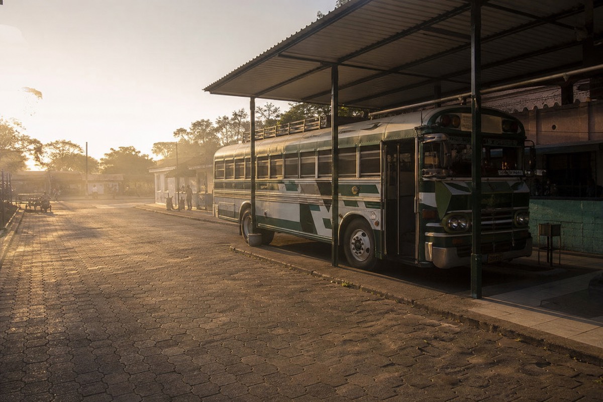
The window shapes your whole morning logistics. Bus 248 out of Santa Ana city leaves La Vencedora terminal around 7:30 to 7:40, costs about $0.70, and takes roughly 2 hours, which lands you at the trailhead in time. From San Salvador or El Tunco there is no workable public route that hits the window, which is exactly why organized transport exists. I map every option in how to get to the volcano.
What do you pay, and where?
Everything on the mountain is cash only, in US dollars, paid on the spot. Foreigners pay $3 to enter the park, the shared local guide runs about $4 per person, and parking is $3. One independent hiker in April 2025 reported an all-in do-it-yourself day of about $17.
| Item | Cost (cash, USD) |
|---|---|
| Park entrance, foreigners | $3 |
| Park entrance, Salvadorans | $1.50 |
| Local guide, shared group | ~$4 per person |
| Local guide, private | ~$35 to $40 |
| Parking | $3 |
| Trekking pole rental | ~$2 |
| Reported DIY all-in day (Apr 2025) | ~$17 |
Bring small bills. Nobody at a volcano trailhead is breaking a fifty for a $3 fee, and the paleta seller at the summit certainly is not.
What is the crater rim actually like?
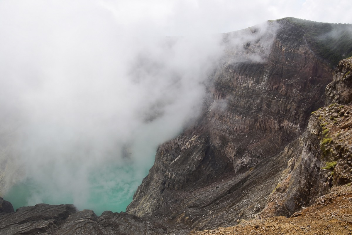
The rim is a wide arc of bare rock above a startling turquoise crater lake. The water is sulfuric and acidic, so swimming is impossible and prohibited, and access along the rim is managed. It is noticeably cooler and windier than the trailhead, and on clear days the views run from Izalco to Coatepeque.
Photos undersell it. The lake sits far below you in a steaming bowl, an unnatural milky blue-green that shifts with the light, and the scale only registers when you watch clouds move across the crater floor. Guides keep everyone inside the managed section of rim and keep an eye on the 13:00 closing time, so budget your photo stops.
Two details people never expect. First, the wind: bring a layer even when the trailhead feels tropical. Second, there is usually someone selling paletas, Salvadoran ice pops, at 2,381 m, and buying one on a volcano summit is a small perfect moment. Why the lake has that color, and why you absolutely should not touch it, gets its own explainer in the crater lake guide.
What does a worked-example day look like, hour by hour?
Build the day backwards from the 11:00 last start. From Santa Ana city, bus 248 leaves La Vencedora around 7:30 to 7:40 and takes roughly 2 hours, landing you at the trailhead for a 10:00 group. From San Salvador, allow 1 to 1.25 hours of driving and leave with a cushion. Either way you are on the rim near midday and back down mid-afternoon.
People plan this hike as if the mountain waits for them. It does not, so here is the day laid out the way I sketch it on a napkin for guests. The times are planning allowances built from the trail figures, not a promise about traffic.
| Time (allow) | Bus day from Santa Ana city | Driving from San Salvador |
|---|---|---|
| ~7:30 to 7:40 | Bus 248 leaves La Vencedora, ~$0.70 | Still finishing coffee; leave by about 8:00 |
| ~9:30 to 9:45 | Arrive at the El Tibet trailhead area | Arrive after a 1 to 1.25 hour drive, park ($3) |
| ~9:30 to 10:00 | Pay entrance, join the forming group | Same, with the same ~$4 shared guide |
| ~10:00 to 12:00 | The climb, roughly 2 hours with breaks | Same group, same pace |
| ~12:00 to 12:45 | Rim time, photos, a paleta, wind layer on | Crater area closes around 13:00 regardless |
| ~12:45 to 14:15 | Descent, about 1.5 hours on the same trail | Same, poles help |
| Mid-afternoon | Back to the road for the return bus | Drive to Coatepeque for a swim or straight home |
Two things jump out of that grid. First, the crater closing time is not negotiable, so a late start eats your rim time rather than pushing everything later. A group leaving at 11:00 reaches the top around 13:00 with the crater already closing behind it. Second, the driving day has slack the bus day lacks; miss the 7:40 bus and you have most likely missed the mountain. The transport question in full, including why San Salvador and El Tunco have no public option that fits, is in how to get to the volcano.
How does the group ascent actually form at the trailhead?
Everyone pays at the gate, cash only, and waits while a local guide is assigned and a group gathers. The first group leaves around 9:30 to 10:00, later arrivals join follow-on starts until the 11:00 cutoff, and after that nobody goes up. The trailhead itself is open from about 7:00, so early birds simply wait longer.
The forming of the group is the part of the morning that confuses first-timers, because there is no ticket booth with departure times printed on it. You arrive, pay your $3 entrance and $3 parking if you drove, and a guide is attached to the day's visitors at roughly $4 a head for a shared group. Then you stand around. That standing around is the system working, not failing: the guides move the day's hikers up together, which is how an active, monitored volcano keeps a managed rim from turning into a free-for-all.
| You arrive at | What happens |
|---|---|
| ~7:00 to 9:00 | Gate is open, you pay and wait; bring a snack |
| ~9:00 to 9:30 | The first group gathers, guides sort people out |
| ~9:30 to 10:00 | First ascent leaves |
| ~10:00 to 11:00 | Later starts still possible as guides become free |
| 11:00 | Last start, full stop |
| After 11:00 | No ascent today; the crater area closes around 13:00 |
The window is short and the mountain does not extend it for good stories about traffic. On the featured guided day the group is already formed when the van pulls in, which is a quiet advantage nobody puts on a brochure. If you are coming independently from Santa Ana city, the bus timing in the previous section is the whole game, and the fuller independent picture sits in hiking without a guide, a page whose title gives away its answer: you cannot, but you can arrange one on arrival.
What mistakes do I watch people make on this trail every week?
The same handful, on repeat: arriving with only large notes, aiming for the 11:00 start and missing it, wearing smooth-soled shoes onto loose rock, carrying too little water, and racing the climb so hard there is nothing left at the rim. None of them costs money to fix. All of them cost the day.
I keep this list because it barely changes from year to year. Since 2018 the trail has stayed the same and so have the errors, which tells me the problem is information, not fitness. So, from my own notebook, the weekly repeats and what I tell people instead. Treat the table as planning advice from a guide, not a rulebook from any operator.
| The mistake I see | What it costs you | What I tell hikers |
|---|---|---|
| Only $20s and $50s in the wallet | Awkward waits at every cash point | Break a $20 into ones and fives before you leave town |
| Planning to "make the 11:00 start" | Often means no hike at all | Aim for the 9:30 to 10:00 group; treat 11:00 as the emergency exit |
| Smooth soles or sandals | A miserable, sliding descent | Closed shoes with grip; rent the $2 poles |
| One small bottle of water | Fading on the open upper half | Carry 2 liters, drink before you feel thirsty |
| Sprinting the lower forest | Nothing left for the rocky push | Match the guide's pace; nobody needs to lead |
| No layer for the rim | Cold, rushed summit photos | One packable windbreaker in the top of the bag |
| Trying the crater edge beyond the managed rim | Real danger and a guide's whistle | Stay where the guide puts you; the lake is acidic and the rock is loose |
The one I feel worst about is the water mistake, because it looks like nothing at the trailhead and turns into a headache above the treeline. Two liters per person is the figure MARN itself puts in its short ascent guidance, and I have never had a hiker tell me they regretted the weight. The full first-timer list, with the stories behind each entry, is in first-time mistakes on Santa Ana volcano.
How do you get down the loose-rock section without a fall?
Short steps, weight slightly back, poles planted before your feet move, and no hurry. The loose volcanic rock near the summit is the only place on the hike where technique matters more than fitness, and you cross it tired on the way down. Ankle support and the $2 rental poles turn a skid into a walk.
The descent is where the trail collects its debts. Going up, loose rock is slow and annoying; going down, with two hours of climbing already in your legs, it becomes the one stretch that produces real slips. I have watched hundreds of people cross it and the pattern is consistent: the fallers are almost never the unfit ones. They are the confident ones who take long strides.
Here is what works. Plant both poles ahead of you before each step, so three points touch the ground while the fourth moves. Keep steps short enough that your foot lands under your hips, not out in front, because a foot out front on gravel is a foot that slides. Look two steps ahead rather than at your toes, which keeps your posture upright and your balance centered. And let the group spread out; bunching up on loose ground means one person's slide becomes three people's.
The recent reviews say the same thing in fewer words: rent the poles, wear something with ankle support, and the descent stops being scary. It is honestly the best $2 on the mountain. Once you are back under the trees the surface returns to soft dirt and the hardest part of the day is behind you, which is a good moment to look back up at the rim you were standing on an hour ago. If your knees or back are already a concern, read the fitness notes in how hard the hike really is before you commit, because that hour of descent is what the operator's health exclusions are protecting you from.
How does the climb change through the year?
The trail is the same in every month; the sky is not. Dry season, November through April, brings the clearest crater and the strongest sun. Green season, May through October, brings lush slopes, softer light and afternoon cloud, which the late-morning group ascent usually beats. The rim is cooler and windier than the base all year.
Guests ask which month is "best" as if there were a wrong answer, and there really is not, only trades. In the dry months the turquoise of the crater lake is at its most outrageous and Coatepeque sits sharp and blue behind you the whole climb; the price is heat on the open upper half and a stronger case for the full 2 liters of water. In the green months the lower forest is dense and dripping, the light is kinder for photos, and the risk is cloud rolling into the crater in the afternoon. That is precisely why the ascent starts late morning rather than early: the schedule is built to put you on the rim before the buildup.
| Season | Crater visibility | Trail surface | Sun and cloud | What I tell hikers |
|---|---|---|---|---|
| Dry, Nov to Apr | Clearest of the year | Firm underfoot on the open sections | Strong sun, little cloud | Sun cover, full water, go for the first group |
| Green, May to Oct | Usually fine late morning, can cloud in by afternoon | Softer, muddy patches under the trees | Humid, cloud builds after midday | Rain shell in the bag, don't dawdle on the rim |
| Rim, any month | Depends on the day | Loose rock regardless | Cooler and windier than the base | Layer on before the last push |
The honest edge case is a green-season day when cloud arrives early. You still get the forest, the wind, the paleta and the strange, sulfur-tinged quiet of the rim; you may not get the lake in full color. I wrote up one such day in the rainy season hike report, and the wider month-by-month reasoning lives in the best time to hike. If crater color is the entire reason you flew here, weight the dry months. If the climb itself is the point, any month works, and the guided day runs year round.
Should you do it independently or take the guided day?
Independent hikers with a car and an early start can do this cheaply. Everyone else fights the ascent window. The guided day solves pickup, timing, admission and lunch in one booking, holds a 4.9 star average across 869 Viator reviews, and cancels free up to 24 hours before.
Here is my honest split after years on this trail. If you are already based in Santa Ana city with cash in hand and no schedule stress, the bus and the $4 group guide make a great budget day. If you are starting from San Salvador, El Tunco or El Zonte, the math changes: to make the last 11:00 start you need wheels, and by then you are arranging a driver anyway. In that case, book the guided day tour and check live availability and prices on Viator rather than gambling the window on traffic. Admission is included, groups stay small, and the day ends with lunch on the shore of Lake Coatepeque instead of a scramble back to a bus terminal.
One last thing from me. The hike rewards slowness. Every group has someone racing the trail like it owes them money, and they stand at the rim for five minutes before rushing down. Walk it, look back at Coatepeque every few hundred meters, buy the paleta. The volcano has been here since long before the trail had a fee grid. Give it a full morning.