Santa Ana Volcano from El Tunco: The Surf Coast Day Trip
Santa Ana Volcano from El Tunco: why public transport cannot hit the ascent window, how tour pickup from the surf coast works, and what the day costs.
 Written with Carlos Hernández, Santa Ana Volcano tour guide & hiking specialist
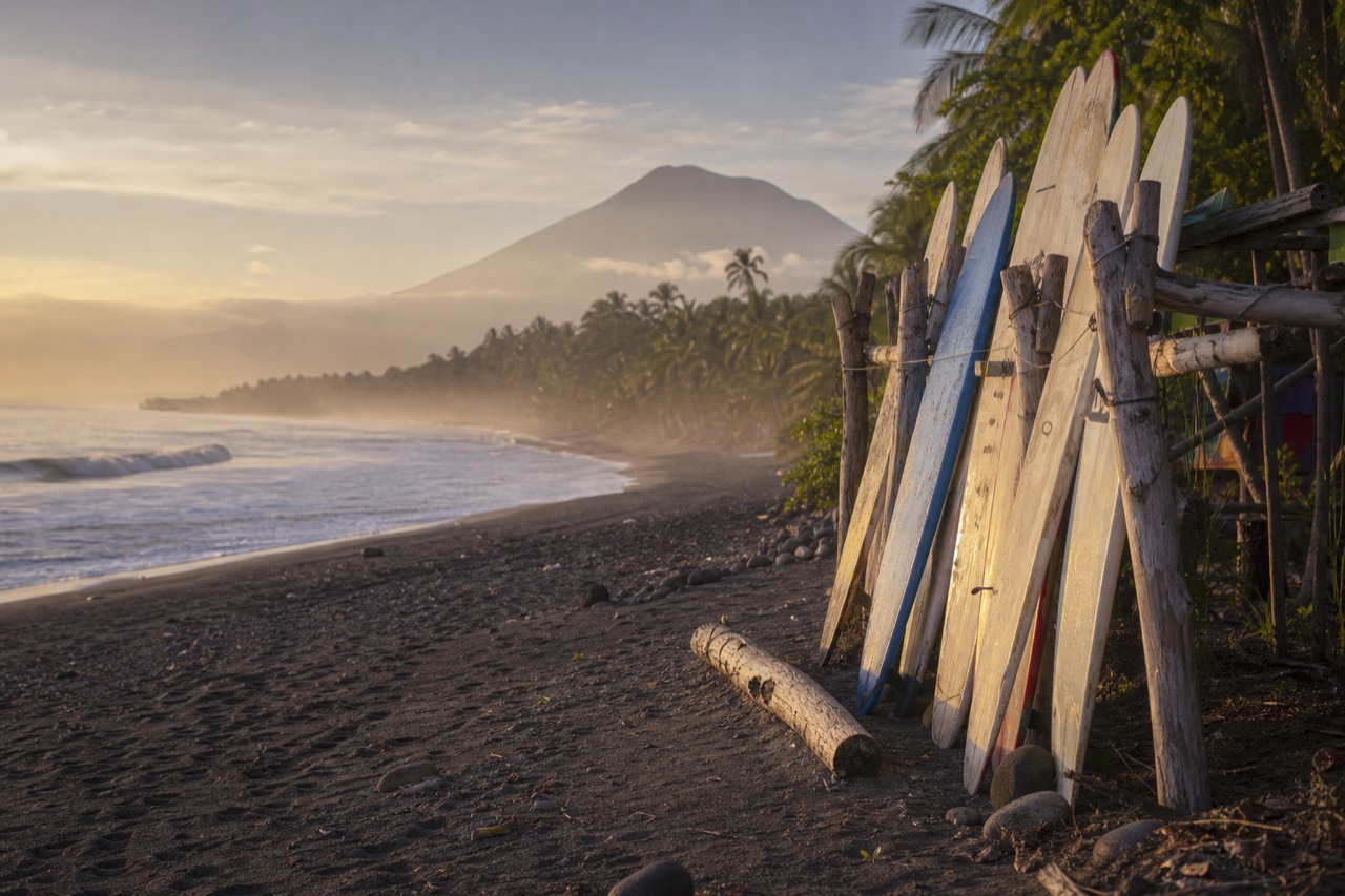
Short answer
There is no workable public transport from El Tunco that reaches the trailhead before the 11:00 am last ascent start. The featured day tour picks up in El Tunco and El Zonte, a Surf City surcharge may apply but is waived for groups, and the drive runs about two hours each way.
Half the hikers I greet at the summit these days smell faintly of surf wax. El Tunco to Ilamatepec has become one of El Salvador's classic combinations, salt water one day, crater lake the next, and I understand why: the country is small enough to make a volcano a day trip from the beach. What surprises coast-based travelers is how unforgiving the logistics are. I have guided this trail since 2018, and the El Tunco question has one honest answer with several caveats.
Can you do the volcano as a day trip from El Tunco?
Yes, comfortably, but only with your own car or a tour pickup. The drive is about 2 hours each way, the mandatory guided ascent starts between 9:30 and 11:00 am, and no public transport chain from the coast reaches the El Tibet trailhead before that window closes.
The distances mislead people. On a map El Tunco and the volcano look close, and in a straight line they are. But the route runs up from the coast, around or through the capital's orbit, then climbs into the highlands, and two hours is the realistic figure with normal traffic.
That still leaves a workable day. Leave the beach around 6:30 to 7:00, hike the 6.9 km round trip in 3 to 4 hours, and you can be back in the water for the evening glass-off. The trail itself is moderate, about 470 m of gain to the 2,381 m summit, with a rocky final stretch; the trail data on AllTrails matches what I see daily, and hikers rate it 4.8. Surfers usually find the cardio easy and the loose rock the only surprise. Flip-flops stay at the hostel.
What does not work is improvising. The whole mountain runs on the daily group ascent, and if the coast leg runs late you do not get a second chance that day.
Is there a public transport route from El Tunco that works?
No. Chained buses from El Tunco run through San Salvador or Sonsonate and cannot reach the trailhead before the 11:00 last start. The only bus that arrives in time, the 248, leaves from Santa Ana city at about 7:30 am, which means sleeping in Santa Ana the night before.
I wish I had better news, because the bus network here is cheap and mostly pleasant. The problem is arithmetic, not adventure. Bus 248 departs La Vencedora terminal in Santa Ana city around 7:30 to 7:40 and takes about 2 hours to El Tibet, landing squarely inside the window. Every chain from the coast has to reach that terminal, or the trailhead itself, by mid morning, and none does.
So the public-transport version of this trip is really a two-day version: travel to Santa Ana city, sleep there, ride the 248 up in the morning. That is a fine plan, and if your itinerary has slack I cover the city option in where to stay in Santa Ana. But it is not a day trip from El Tunco, and anyone who tells you otherwise has not tried to make those connections at 5 am.
| Option from El Tunco | Door to trailhead | Makes the window? | Rough cost | Verdict |
|---|---|---|---|---|
| Chained public buses, same day | 4+ h with transfers | No | A few dollars | Not workable |
| Overnight in Santa Ana + bus 248 | 2 days total | Yes | Bus fares + a night's lodging + ~$7 fees | Good with spare days |
| Rental car, same day | ~2 h | Yes, leave by 7:00 | Fuel + $3 parking + ~$7 fees | Works for confident drivers |
| Guided day with coast pickup | ~2 h, handled | Built around it | One price, admission and lunch in | The straightforward one |
How does the tour pickup from El Tunco and El Zonte work?
The featured guided day collects travelers from El Tunco and El Zonte as well as San Salvador hotels. A surcharge can apply for Surf City pickups, waived for groups, so ask when booking. You ride an air-conditioned van, admission is included, and the day runs 7 to 10 hours door to door.
This is the piece that turned the surf-coast volcano day from a headache into a routine. The operator, El Salvador Positive Tours, runs the day at 4.9 stars across 869 Viator reviews with a Badge of Excellence, and the reviews read like the days I watch from the trail: small groups around 10 people, guides like Josue, Gaby, and Diego mentioned by name, roughly 3.5 hours of actual hiking.
For coast travelers the value sits in three places. The pickup itself, since two hours each way in someone else's van beats white-knuckling an unfamiliar highland road after a dawn start. The timing, because the operator plans the morning around the ascent window, which is the single thing DIY plans get wrong. And the return leg, which detours to Lake Coatepeque for an included lakeside lunch, a caldera roughly 10 km across where recent guests mention renting jet skis; more on that stop in the Lake Coatepeque guide.
If you are weighing it against the rental-car version, the honest comparison is convenience against flexibility, and for a group of surf friends splitting the day, the surcharge waiver tips it further. When you are ready, book the guided day tour and check live availability and prices on Viator, and note in the booking that your pickup is El Tunco or El Zonte.
What does the day from El Tunco look like, hour by hour?
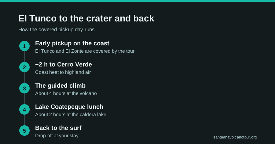
Plan a 7 to 10 hour day: an early-morning pickup on the coast, about 2 hours to the trailhead, a 3 to 4 hour hike inside the group ascent, then the Lake Coatepeque lunch stop before the ride back. You are usually on the beach again by late afternoon.
Here is the shape of the day as it actually runs.
| Time (typical) | What happens |
|---|---|
| ~6:30 to 7:00 | Pickup in El Tunco or El Zonte, air-conditioned van |
| ~9:00 | Arrive at the El Tibet trailhead, restrooms, pole rental (~$2) |
| 9:30 to 11:00 | Join the guided group ascent, roughly 2 h to the crater rim |
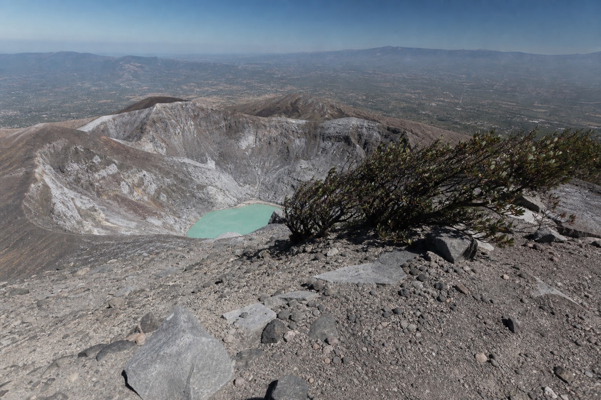
| ~12:00 | Summit time above the turquoise crater lake; paletas sold at the top |
| ~13:00 | Crater area closes, descend, about 1.5 h down |
| Mid afternoon | Lakeside lunch at Coatepeque, included; swim or jet ski if you like |
| Late afternoon | Drive back, drop-off at your coast lodging |
Two field notes. The crater lake at the summit is the acid one: turquoise, sulfuric, absolutely no swimming, which is prohibited anyway. The swimmable water is Coatepeque, and the sequence, hot climb first, lake after, is the best-designed part of the day. And the summit runs cooler and windier than the beach by a wide margin, so pack the one warm layer your surf wardrobe owns. My full packing list is in what to bring.
What time do you really need to leave the beach?
Leave El Tunco or El Zonte between 6:30 and 7:00. The drive to the El Tibet trailhead is about 2 hours, the group ascent starts between 9:30 and 11:00, and the last permitted start is 11:00. A 7:00 departure lands you around 9:00 with a comfortable margin; anything after 8:30 is gambling with the whole day.
Every coast-based plan is a subtraction problem. Start with the 11:00 cutoff, take away 2 hours of road, take away the time it takes to pay the fees and rent poles, and take away the buffer for whatever the highway does that morning. What is left is your alarm.
| Leave the coast | Reach the trailhead | Where that puts you | My verdict |
|---|---|---|---|
| 6:30 | ~8:30 | Coffee, poles, first movement of the group | Ideal, especially in green season |
| 7:00 | ~9:00 | Fees paid before the group forms | The standard plan |
| 8:00 | ~10:00 | Inside the window, no room for a slow truck | Tight but workable |
| 8:30 | ~10:30 | One delay from missing the last start | Only if everything goes right |
| 9:00 or later | ~11:00 or later | The trail is closed to new hikers | Do not try it |
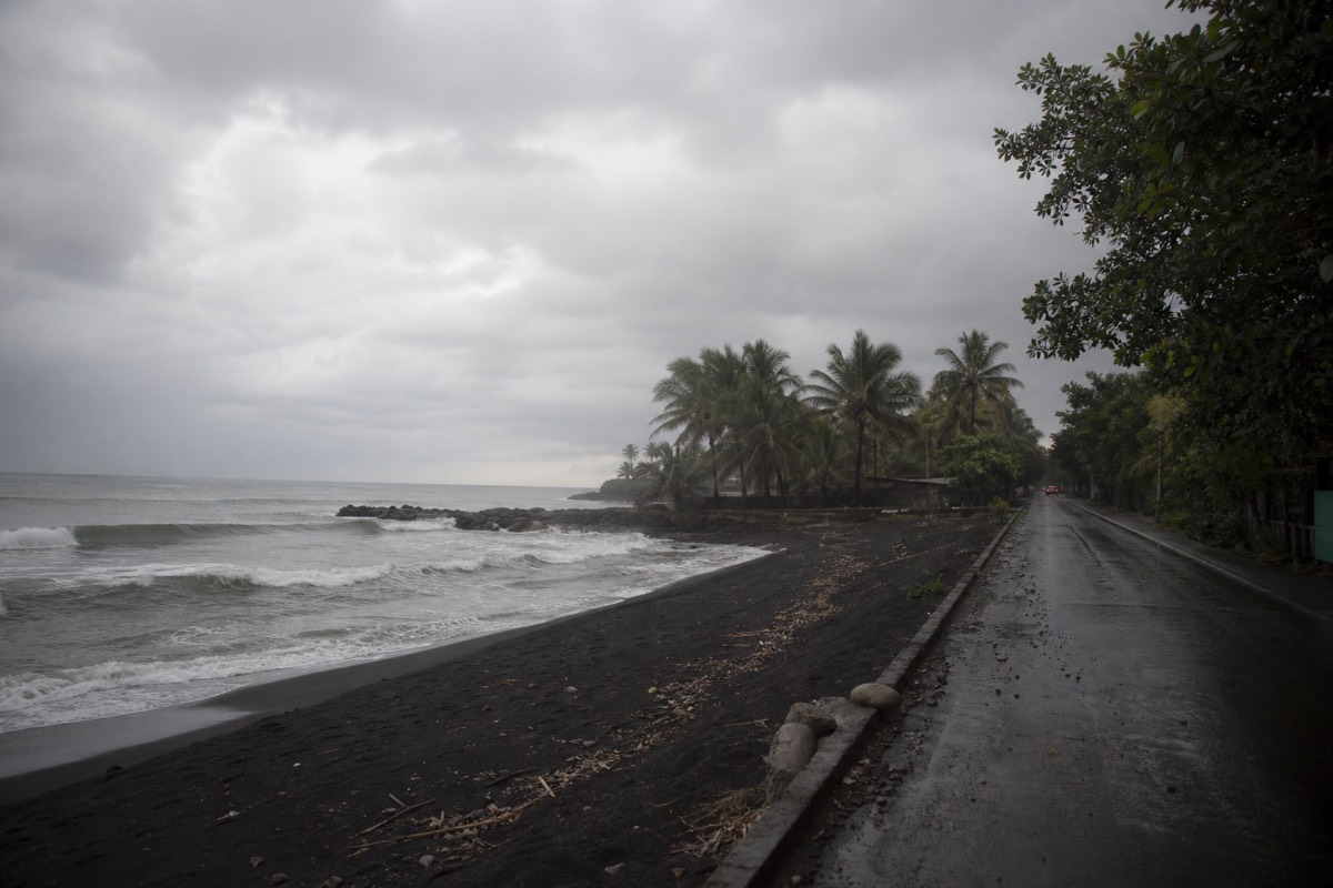
I put those verdicts in the table because the middle rows are where people fool themselves. Two hours is a real average, not a best case, and the road up from the coast collects everything that can slow a morning: market traffic in the towns, trucks on the grades into the highlands, the last winding approach signed for Cerro Verde. On the guided day this arithmetic belongs to the driver, which is honestly the main thing you are paying for. On a DIY morning it belongs to you, and the only reliable trick is to leave earlier than feels necessary.
There is a second, quieter reason to favour the 6:30 to 7:00 departure. In green season, May to October, cloud builds over the crater in the afternoon, and the group that sets off at 9:45 stands a much better chance of a clear turquoise lake than the group that starts at 10:50. From the beach the sky can look perfect at 8:00; the mountain has its own weather two hours away. Read the best time to hike guide before you pick a month, and then set the alarm anyway.
What should a surfer pack for a volcano day?
Real shoes with ankle support, 2 litres of water, sun protection, one warm layer for a summit that runs cooler and windier than the beach, and small US bills for the roughly $2 pole rental and the paletas at the top. Leave the flip-flops, the wetsuit and the big board bag at the hostel.
Surf wardrobes are built for heat and salt, and the mountain asks for almost the opposite. The trail is 6.9 km round trip with about 470 m of gain, moderate by any standard, but the last stretch to the crater rim is loose volcanic rock, and it is that section, not the distance, that punishes soft footwear.
| Item | Why it matters on Ilamatepec | Surf-kit substitute that works |
|---|---|---|
| Closed shoes with ankle support | Loose rock on the upper trail | Trail runners at minimum; sandals fail |
| 2 litres of water | 3 to 4 hours of climbing in tropical sun | Any bottle; refill before you leave the coast |
| Warm layer | Summit wind at 2,381 m | A hoodie or windbreaker over the rash guard |
| Sun protection | Little shade above the forest line | The surf sunscreen and a hat you already own |
| Small US bills | Poles ~$2, paletas, tips; nothing takes cards | Break notes at the beach the day before |
| Light rain layer, May to October | Afternoon cloud and showers in green season | The packable jacket, not the wetsuit |
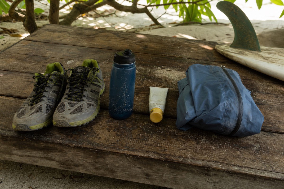
The pole rental deserves a word, because surfers tend to wave it away. For about $2 you get a stick that turns the rocky descent from an ankle test into a walk, and the guides I work alongside see the difference every day. Rent one. Recent hikers on the featured day mention exactly that, and the poles are among the most praised small details in the reviews.
Two more items belong on the list without being gear. The first is a paper or offline copy of your booking if you are on the guided day, since it is wiser not to count on mobile signal on a mountain road. The second is a plan for the return: on the tour, the van waits and Coatepeque lunch follows; on a DIY morning, know where the car is and how much fuel is in it. My full packing list, written for every base and not just the coast, is in what to bring.
Should you turn the coast trip into an overnight instead?
If your itinerary has a spare night, yes: sleep in Santa Ana city and ride bus 248 up at about 7:30 for roughly $0.70, or overnight beside Lake Coatepeque and drive the short hop to the trailhead. Both remove the 2-hour dawn drive from the coast. If you have only one day, take the pickup and go.
The day trip works, and the tour makes it easy, but I would be a poor guide if I pretended it was the only shape. Coast travellers with a loose schedule can do something better than a long day: they can move the mountain to the middle of the trip.
The Santa Ana city version is the budget classic. Travel up from the coast at your leisure the afternoon before, sleep near the historic centre, and in the morning La Vencedora terminal is a short walk away and the 248 does the climbing for you. Two hours later you step off at El Tibet inside the ascent window with the day's whole logistics behind you. It costs the price of a bed and a bus fare, and it opens up an evening in a city most coast visitors never see. I have written up the neighbourhoods in where to stay in Santa Ana.
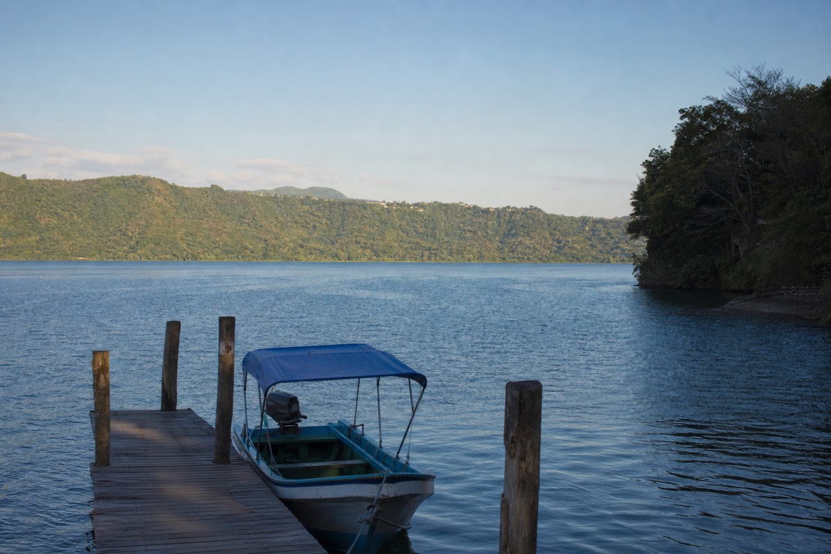
The Coatepeque version is the indulgent one. The caldera lake sits below the volcano, roughly 10 km across, ringed with docks and lakeside restaurants, and if you sleep there the trailhead is a far shorter morning than anything from the coast. You climb, you descend by early afternoon, and you are back on the water by the time the guided day's guests are sitting down to their included lunch. It turns the same mountain into two lazy days instead of one urgent one; the Lake Coatepeque guide has the detail.
What none of these versions fix is the window. Whether you arrive from El Tunco, from Santa Ana city or from a lakeside hammock, the group ascent still leaves between 9:30 and 11:00 and the crater still closes around 13:00. Overnighting buys you calm, not extra hours on the rim.
How does the season change the surf-coast day?
Dry season, November to April, gives the clearest crater and the busiest trailhead; green season, May to October, gives lush slopes, afternoon cloud, and quieter mornings. The 2-hour drive and the ascent window do not change. What changes is how much a late start costs you, and in the wet months it can cost you the view.
Surf seasons and volcano seasons do not line up neatly, which is part of why the combination is so popular: there is always something good happening on one side of the drive.
| Factor | Dry season, Nov to Apr | Green season, May to Oct |
|---|---|---|
| Crater visibility | Clearest of the year | Usually clear at the late-morning start, cloud by afternoon |
| Trailhead crowds | Busiest mornings, especially weekends | Calmer, more room in the group |
| Slopes and coffee country | Dusty greens and browns | Deep green, at their most photogenic |
| Road from the coast | Dry, predictable | Wetter surfaces; leave the extra margin |
| Summit conditions | Cooler and windier than the beach | Cooler and windier, with rain a possibility |
| Best departure from the coast | 6:30 to 7:00 | 6:30, without exception |
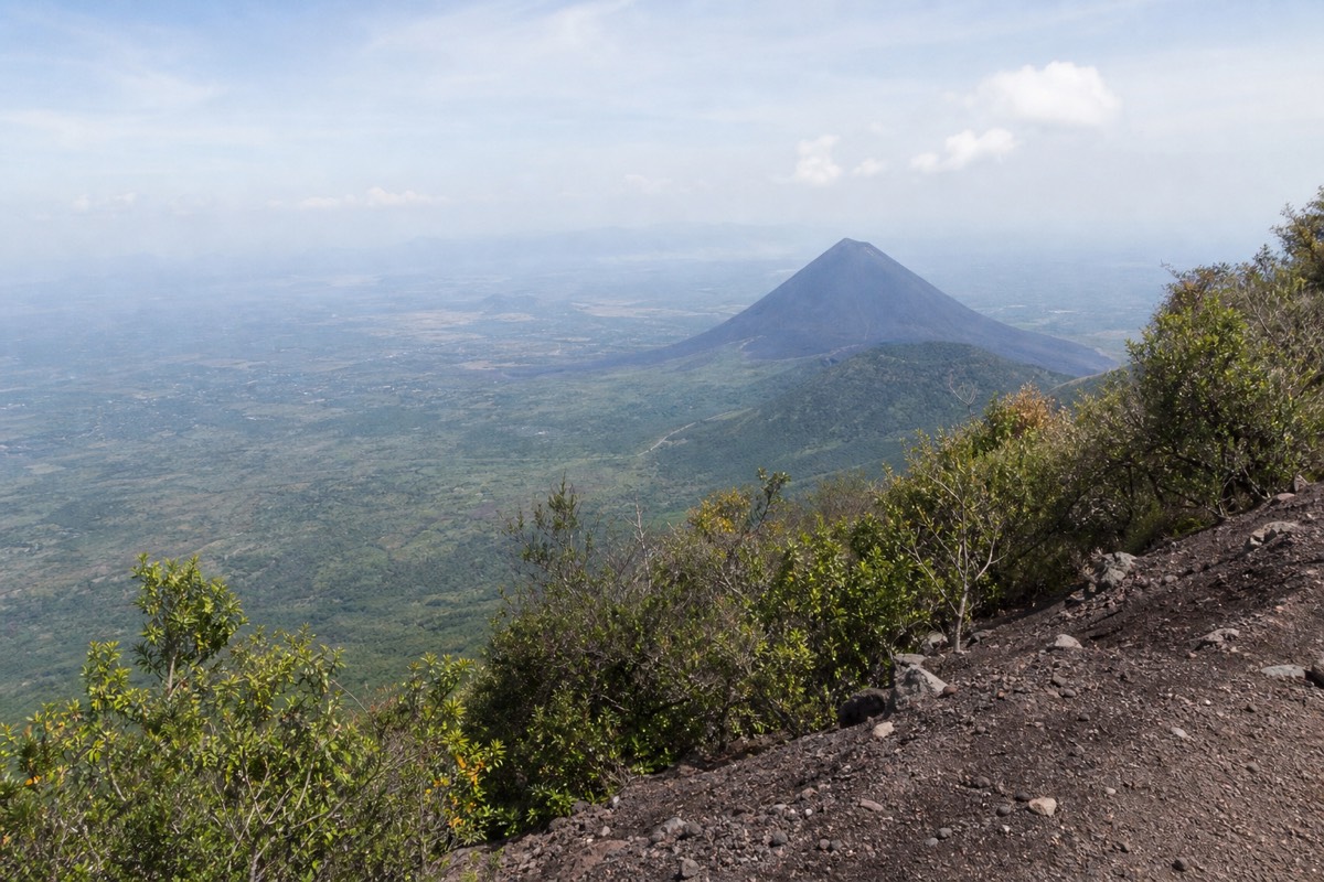
I hike this mountain in every month, and the reader who arrives from the coast tends to have already chosen a season for the surf. So the honest advice is about adapting rather than choosing. In dry season your enemy is the crowd: get to the trailhead early enough to be at the front of the group and away from the shuffle on the loose upper rock. In green season your enemy is the clock, and the whole day is a race against cloud you cannot see from the beach.
The good news for wet-season travellers is that the late-morning group ascent was designed with that cloud in mind, and it works most days. The summit is cooler and windier than the base year round, so the warm layer goes in the bag whatever the calendar says. If the forecast really turns, the featured day allows free cancellation up to 24 hours before, which is the one advantage the tour has over a rental car booked weeks ahead. There is a wet-morning account in the rainy season hike report if you want to know what the worst reasonable case looks like.
Who should skip the volcano day from El Tunco?
Anyone the operator advises against, travellers with back problems, heart conditions or pregnancy, and anyone who needs wheelchair access, since the trail is rock and the tour is not accessible. Also anyone with a flight or a fixed evening commitment that a 7 to 10 hour day plus 2 hours of road could threaten. Everyone else who can walk 4 hours can do it.
I say this as someone who wants people on my mountain, not off it. The climb is moderate and the reviews are full of first-timers who found it "not super easy but not as difficult as anticipated." But the coast day is long, and honesty about who it does not suit is part of guiding.
| Traveller | Verdict | Better plan |
|---|---|---|
| Back, heart or pregnancy concerns | Skip; the operator advises against it | Lake Coatepeque for the day, or a gentle visit to Cerro Verde park |
| Needs step-free access | Skip; not wheelchair accessible | Coatepeque lakeside, roughly 10 km of caldera to enjoy from a dock |
| Flying out that evening | Risky; the day runs 7 to 10 hours plus the coast leg | Move the volcano to an earlier day |
| Only comfortable at a walking pace | Go; the group pace is set for mixed hikers | Rent poles, start at the front, take the rim slowly |
| Wants Izalco too | Not the same day; it is a separate, steeper hike | See Izalco vs Santa Ana and give it its own morning |
| Nervous about safety in El Salvador | Go; the country sits at US Level 1, normal precautions | Read the current advisory and the safety guide |
The health caveats come straight from the tour listing and I repeat them without softening, because the trailhead is not the place to discover them. The trail gains about 470 m over rough ground, the air at 2,381 m is thinner than at sea level, and the crater area closes around 13:00 whether you have reached it or not. Nobody is timing you, but the mountain is.
For those who do go, the reward is stranger and better than the numbers suggest. You climb from a surf town to the country's highest volcano, look down into a turquoise lake you could never swim in, then descend to a caldera lake you can. Whether the country itself is worth the detour is a question I answer at length in is Santa Ana Volcano worth it; the short version, from someone who has watched over a thousand people reach the rim by his own count, is that almost nobody regrets the alarm.
What does the volcano day cost from El Tunco?
DIY drivers pay the mountain fees in cash: $3 entrance for foreigners, about $4 for the group guide, $3 parking, plus fuel and the rental. On the tour, admission and lunch are included and the mountain cash shrinks to extras like the $2 pole rental and summit paletas.
| Cost item | DIY by rental car | On the guided day |
|---|---|---|
| Transport from the coast | Rental + fuel, ~4 h driving | Included, with pickup |
| Park entrance | $3 (foreigners; $1.50 Salvadorans) | Included |
| Local guide | ~$4 per person, cash | Included (certified bilingual guide) |
| Parking | $3 | Not needed |
| Lunch | Your own plan | Included at Lake Coatepeque |
| Poles, paletas | ~$2 + snack money, cash | Same, bring small bills |
| Surf City pickup surcharge | n/a | Possible, waived for groups |
Whichever column you choose, carry small US bills. Nothing on the mountain takes cards. One more reassurance for coast-based readers weighing the trip at all: El Salvador currently sits at the US State Department's Level 1, exercise normal precautions, per the official travel advisory, and the volcano is an active but calm, continuously monitored stratovolcano with no current advisories, which you can verify at SNET. The mountain has not erupted since October 2005. The waves you left behind in El Tunco are, statistically, the wilder part of your week.