The Best Time to Climb Santa Ana Volcano in 2026
When to hike Santa Ana Volcano, month by month. Dry-season crater views, green-season cloud timing, the late-morning window, and when crowds peak.
 Written with Carlos Hernández, Santa Ana Volcano tour guide & hiking specialist
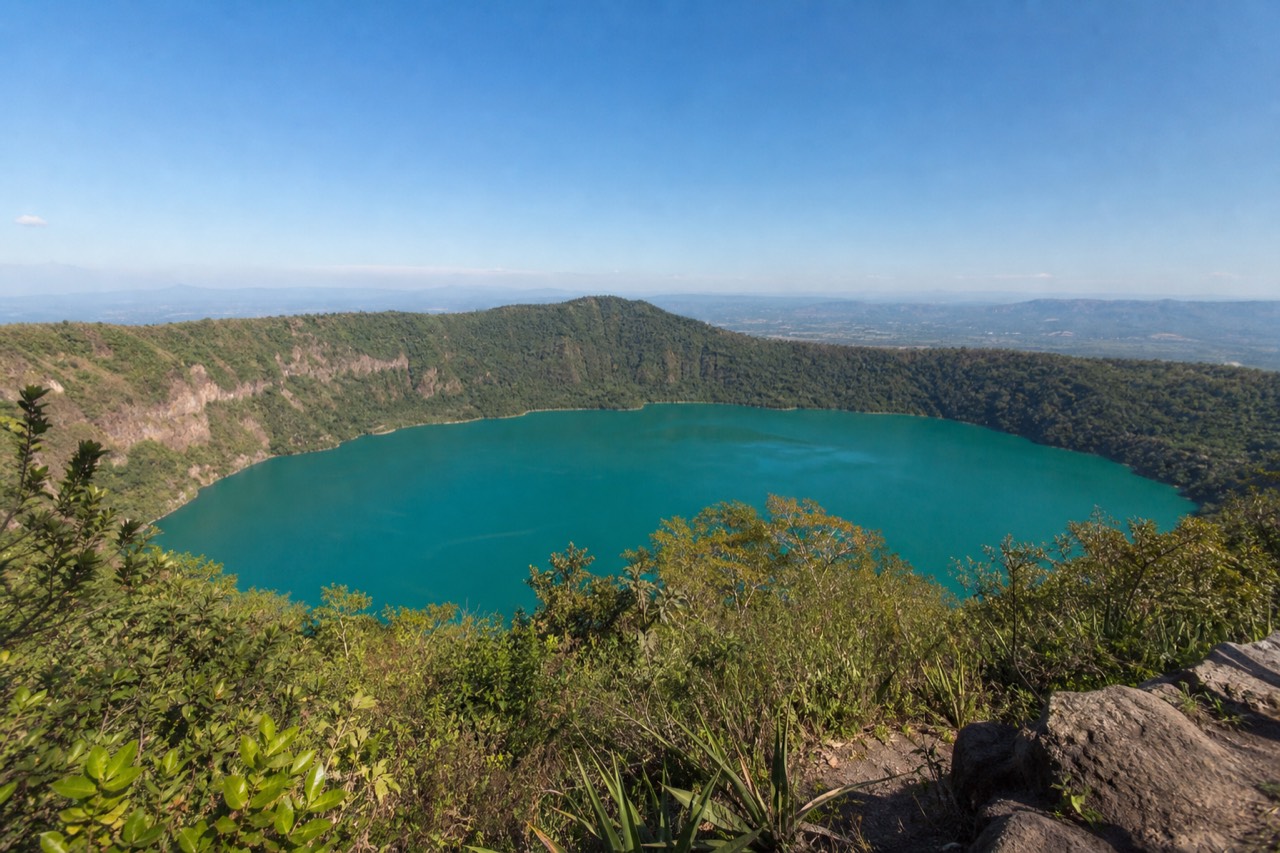
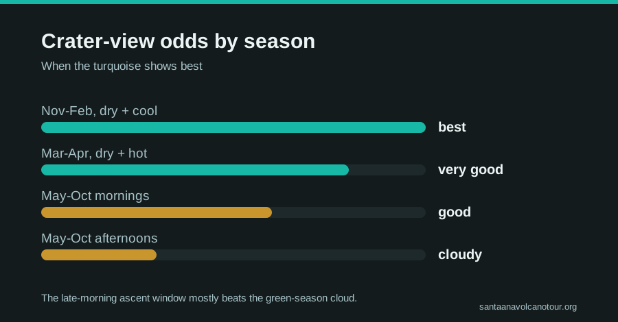
Short answer
The clearest crater views come in the dry season, November through April, with December to February the most reliable. The green season, May through October, trades some visibility for lush slopes, and afternoon cloud is the pattern, which the late-morning group ascent usually beats. The window runs roughly 9:30 to 11:00 year round.
People ask me for the perfect month more than any other question, and my honest answer is that I have seen the crater glow turquoise in January and disappear into fog in January. I have hiked through drizzle in June and come out above a sea of cloud that made grown adults go quiet. Since 2018 I have watched every season repeat itself up there, and the pattern is real, just looser than the internet makes it sound. Here is how the year actually behaves on Ilamatepec, and why your start time matters as much as your calendar.
What is the best month to hike Santa Ana Volcano?
November through April, the dry season, gives the highest odds of a clear crater, with December to February the sweet spot: settled skies, cool mornings, firm trail. May through October is the green season, lusher and quieter, with afternoon cloud that the late-morning ascent usually beats. There is no closed season.
The dry season is when the volcano shows off. The air settles, the haze burns off early, and from the 2,381 m summit you can look down into the sulfuric crater lake on one side and across to Izalco's black cone and Lake Coatepeque on the other. This is also when the country fills up. El Salvador logged a record 4.1 million international visitors in 2025 and the first four months of 2026 ran 35% ahead of that pace, so the December to February trail is busier than anything I saw in my early guiding years.
The green season flips the trade. The slopes go emerald, the crowds thin, and the mornings often start clear before cloud builds through the afternoon. Rain here is mostly an afternoon event, not an all-day soak, and the ascent window sits ahead of the worst of it.
| Month | Season | Crater visibility odds | Trail traffic |
|---|---|---|---|
| January | Dry | Excellent | High |
| February | Dry | Excellent | High |
| March | Dry | Very good | High |
| April | Dry to transition | Good | Moderate to high |
| May | Green | Mixed, best before noon | Moderate |
| June | Green | Mixed, best before noon | Moderate |
| July | Green | Mixed, morning clearest | Moderate |
| August | Green | Mixed, morning clearest | Moderate |
| September | Green | Lowest, afternoon cloud likely | Lower |
| October | Green | Improving late month | Lower |
| November | Early dry | Very good | Rising |
| December | Dry | Excellent | Peak |
Treat the visibility column as odds, not promises. Mountains do not read forecasts.
Should you choose the dry season or the green season?
Choose dry season for the postcard crater and the classic long views, and accept more people on the rim. Choose green season for saturated green slopes, thinner groups and moodier skies, and accept that some summits top out inside a cloud. Both seasons run the same schedule and the same fees.
I genuinely like both, for different reasons, and the table below is the conversation I have with hikers who cannot decide:
| Factor | Dry season (Nov-Apr) | Green season (May-Oct) |
|---|---|---|
| Crater lake views | Most reliable | Morning-dependent |
| Scenery on the slopes | Golden, dusty, wide views | Deep green, wildflowers |
| Afternoon rain | Rare | Common, usually after the descent |
| Trail surface | Dry and firm | Can be slick on the rocky top section |
| Crowds at the summit | Peak, especially Dec-Feb | Noticeably lighter |
| Photography | Long clear panoramas | Dramatic cloud seas when it breaks |
Whichever season you pick, the same rules hold: the local guide is mandatory, the group leaves once a day, and the crater area closes around 13:00. Route logistics are the same year round too, covered in how to get to the trailhead. And in the green season especially, the packing list earns its keep, so read what to bring on the climb before you go. The summit is cooler and windier than the base in every month of the year.
What time of day should you start the climb?
You do not fully choose. The mandatory group ascent starts between about 9:30 and 10:00, the last start is 11:00, and the crater area closes around 13:00. That late-morning window is not an accident: it puts you on the rim before the afternoon cloud builds, which matters most in the green season.
The trailhead opens around 7:00, and early arrivals wait for the group to form. The published pattern from the monitoring side is blunt: MARN, which watches this active volcano through its SNET monitoring network, says the ascent is not to be improvised, and the single daily escorted group is how that gets enforced. There are special dawn ascents for sunrise on certain occasions, but the standard day is the late-morning window.
| Timing question | Reality on the mountain |
|---|---|
| Trailhead access opens | ~7:00 |
| Group ascent starts | ~9:30-10:00 |
| Last permitted start | 11:00 |
| Time to the summit | ~2 h up, ~1.5 h down |
| Crater area closes | ~13:00 |
| Green-season cloud build | Typically afternoon, after the window |
This schedule is why the DIY bus plan is so tight. Bus 248 leaves Santa Ana city around 7:30 to 7:40 and takes about two hours, which lands you at the trailhead just in time. From San Salvador or El Tunco there is no public route that makes the window at all. That is the quiet reason most short-trip travelers book the guided day tour and check live availability and prices on Viator: the operator times pickup so the window simply is not your problem, in any season.
When is the trail most and least crowded?
Crowds peak December through February and around holidays, when the daily group swells. September and October are the quietest months on the rim. The tourism boom means every season is busier than it was a few years ago, so book ahead for dry-season weekends.
The numbers behind the crowding are national, not just local. Record arrivals in 2025, another 35% jump in early 2026: that growth funnels straight up this trail, because Ilamatepec is one of the country's marquee days out and the official tourism board promotes it hard on its Santa Ana Volcano page. On a January Saturday the single group ascent can feel like a small parade. On a September Tuesday you might share the rim with a handful of people and the wind.
If you want the dry-season views with fewer bodies, aim for midweek in November or March, the shoulders of the peak. If solitude matters more than a guaranteed turquoise photo, September and October are your months, and honestly the cloud-sea mornings then can beat the postcards.
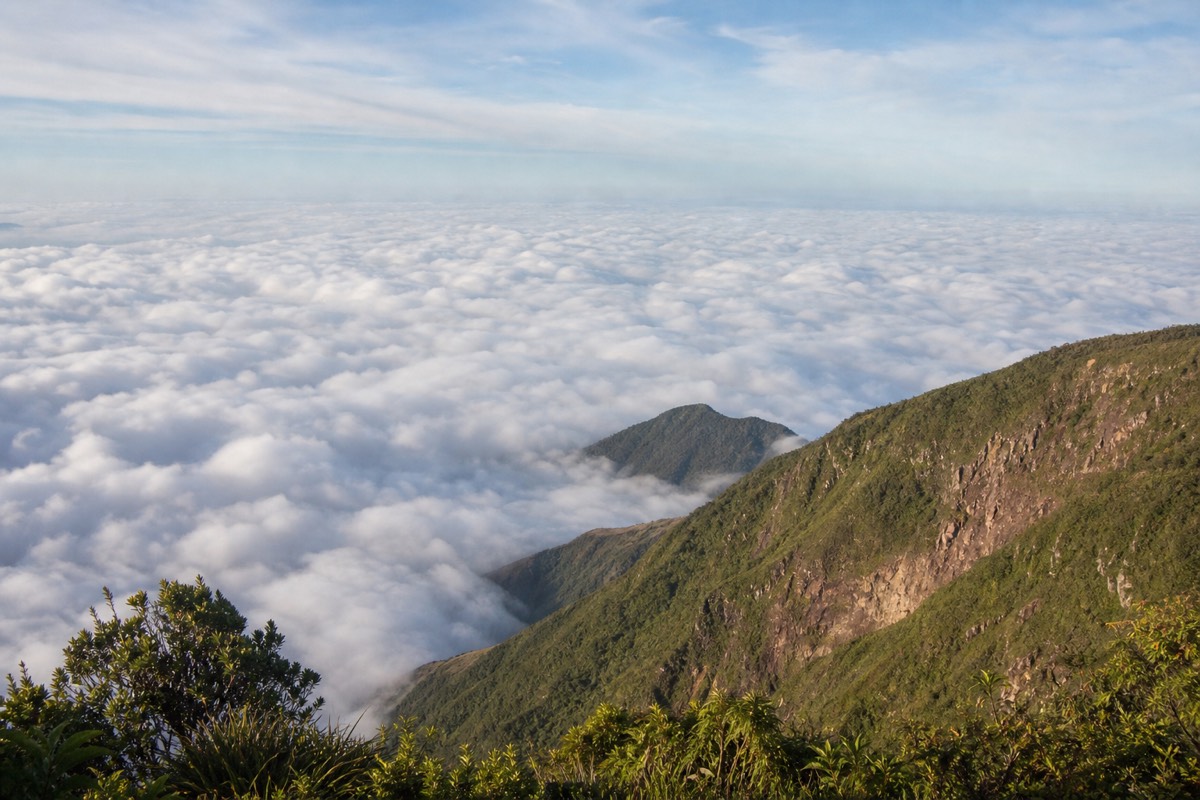
How does a green-season morning actually unfold on the trail?
A typical May to October day starts clear, the group forms between 9:30 and 10:00, you climb about 2 hours through thickening but usually broken cloud, reach the 2,381 m rim near midday with a fair chance of a view, and are heading down before the afternoon build-in. The crater area closes around 13:00, ahead of the wettest hours.
I want to describe the shape of a green-season day honestly, because "rainy season" scares people off a mountain that is, most mornings, perfectly hikeable. Rain here is mostly an afternoon event. The morning belongs to the sun, the cloud grows through the middle of the day, and the ascent window sits inside the calm part of that curve. Treat the timings below as the pattern I have watched since 2018, not a forecast.
| Time (allow) | Typical green-season sky | What you are doing |
|---|---|---|
| ~7:00 | Often clear, cool at the trailhead | Trailhead access opens; early arrivals wait |
| ~9:30-10:00 | Sun, first cloud on the ridges | Group forms and starts; last start 11:00 |
| ~10:00-12:00 | Broken cloud drifting through | The ~2 h climb, forest first, then rock |
| ~12:00 | Mixed; often a window into the crater | Summit rim, photos, a paleta |
| ~13:00 | Cloud thickening | Crater area closes; you are on the way down |
| Afternoon | Rain likely | You are at Coatepeque or on the bus |
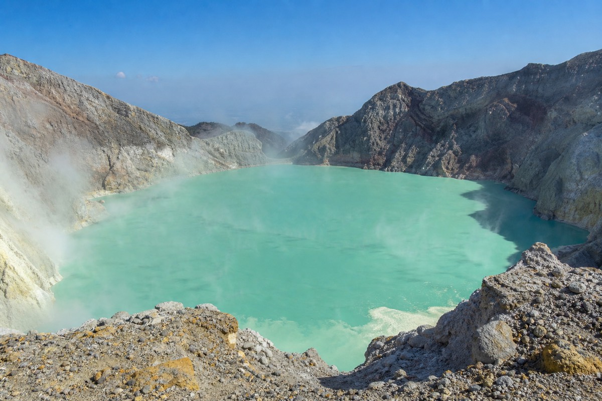
The rim itself is the wildcard. Some green-season summits open a clean window straight down into the sulfuric lake, some give you thirty seconds of turquoise between drifting banks, some stay in the white the whole time. The odds tilt toward the morning, which is the whole reason the schedule looks the way it does. Nobody in the park is guessing.
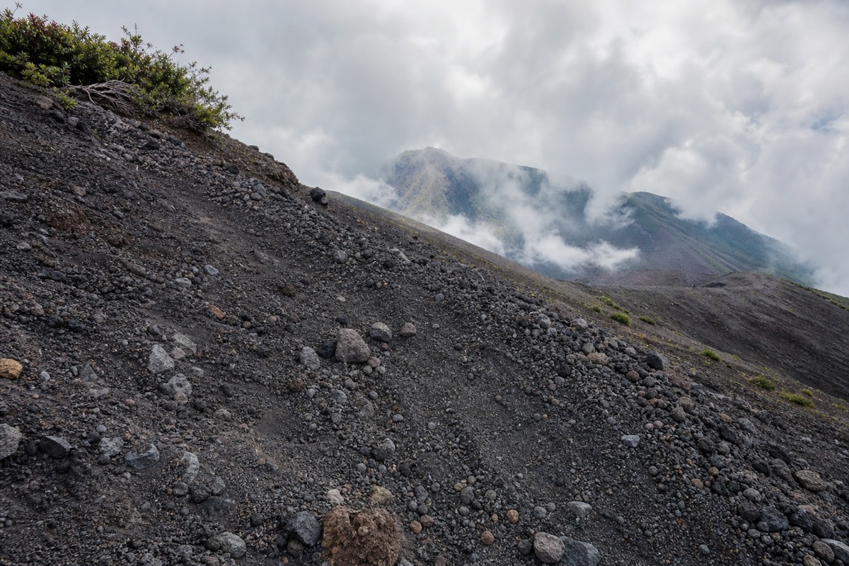
What changes on the ground is footing. The upper trail is rocky in every month, and moisture makes it slower, which is why the $2 rental poles get so much love in green-season reviews. Give the descent its full 1.5 hours and do not race the cloud, because the cloud always wins that race and the rock does not care. I wrote up one soaked-then-glorious day in full in the rainy-season hike report if you want to see how the pattern plays out on a real date.
What should you wear and carry in each season?
The core kit never changes: 2 liters of water, sun protection, shoes with ankle support, small cash for the $3 entrance, ~$4 guide and $2 poles, and a warm layer for a summit that is cooler and windier than the base. Dry season adds more sun defence; green season adds a rain shell and a dry bag for your phone.
Packing for Ilamatepec is a summit problem, not a trailhead problem. The trailhead at Cerro Verde sits high already, around 2,000 m, and the rim at 2,381 m is exposed to whatever wind is crossing the country that day. People dress for the tropical lowland they woke up in and shiver at the top. That happens in January as often as in July.
| Item | Dry season (Nov-Apr) | Green season (May-Oct) |
|---|---|---|
| Water | 2 L minimum; the sun is relentless | 2 L; humidity makes you sweat more than you notice |
| Footwear | Trail shoes with ankle support | Same, with grip that handles slick rock |
| Layers | Windproof top for the rim | Rain shell plus a warm layer |
| Sun kit | Hat, sunscreen, sunglasses, essential | Still needed; cloud is not shade |
| Poles | Rent for $2 at the trailhead | Rent for $2; earns its keep on the descent |
| Electronics | Dust is the enemy | Dry bag or zip bag for phone and camera |
| Cash | Ones and fives for every fee | Same, kept dry |
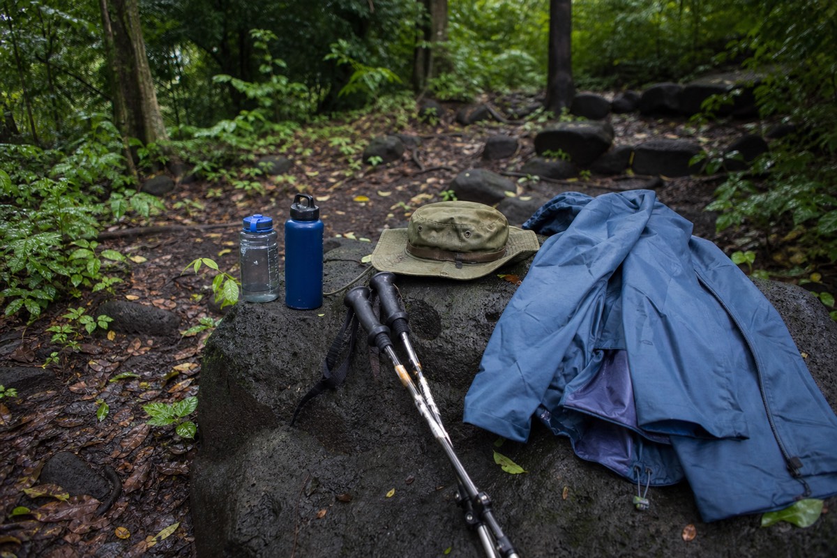
The green-season addition is small in weight and huge in comfort. A light shell that stuffs into a pocket covers the afternoon risk on the way down and doubles as wind protection at the rim. In dry season I swap that for a windproof layer, because the air is clearer and the wind at the top has nothing to soften it. Either way the top of the pack should hold whatever you will want first at the summit, so nobody stands on the rim unpacking.
The trail itself sets the footwear rule. It is 6.9 km round trip and about 470 m of gain, moderate on AllTrails, and the final section to the rim is loose rock in every season. Ankle support gets recommended in review after review for that stretch, and it is the one item I would not compromise on for any date. The full item-by-item list, with what to leave in the hotel, is in what to bring on the climb, and if you are unsure whether the grade suits you, how hard the hike really is walks through it section by section.
How does the season affect Izalco and Cerro Verde compared with Santa Ana?
All three sit in the same park, so the same dry-clear, green-cloudy pattern applies, but the exposure differs. Santa Ana's rim at 2,381 m gets the biggest views and the strongest wind. Izalco is a bare black cone, steeper and separate, harsher in sun and slicker in rain. Cerro Verde's forest trails around 2,000 m are the most forgiving.
Cerro Verde park is the pivot of the whole western volcano country. The three peaks stand close enough that you see the others from each, which is why the season conversation should include them. Ilamatepec is the one with the mandatory guide, the single daily group and the crater lake. Izalco, the "Lighthouse of the Pacific," is the black cone you watch across the valley from the Santa Ana trail, and it is a separate, steeper hike on a different day. Cerro Verde itself is the old, forested volcano with the park facilities.
| Peak | Character | Dry season edge | Green season edge |
|---|---|---|---|
| Santa Ana (Ilamatepec), 2,381 m | Crater lake, guided group, rocky top | Clearest lake, widest panoramas | Cloud seas, lush slopes, quieter rim |
| Izalco | Bare black cone, steeper, separate hike | Firm cinder, hard sun | Slick surface, dramatic mist |
| Cerro Verde park, ~2,000 m | Cloud-forest trails, viewpoints | Best long views of both cones | Forest at its greenest, cool and damp |
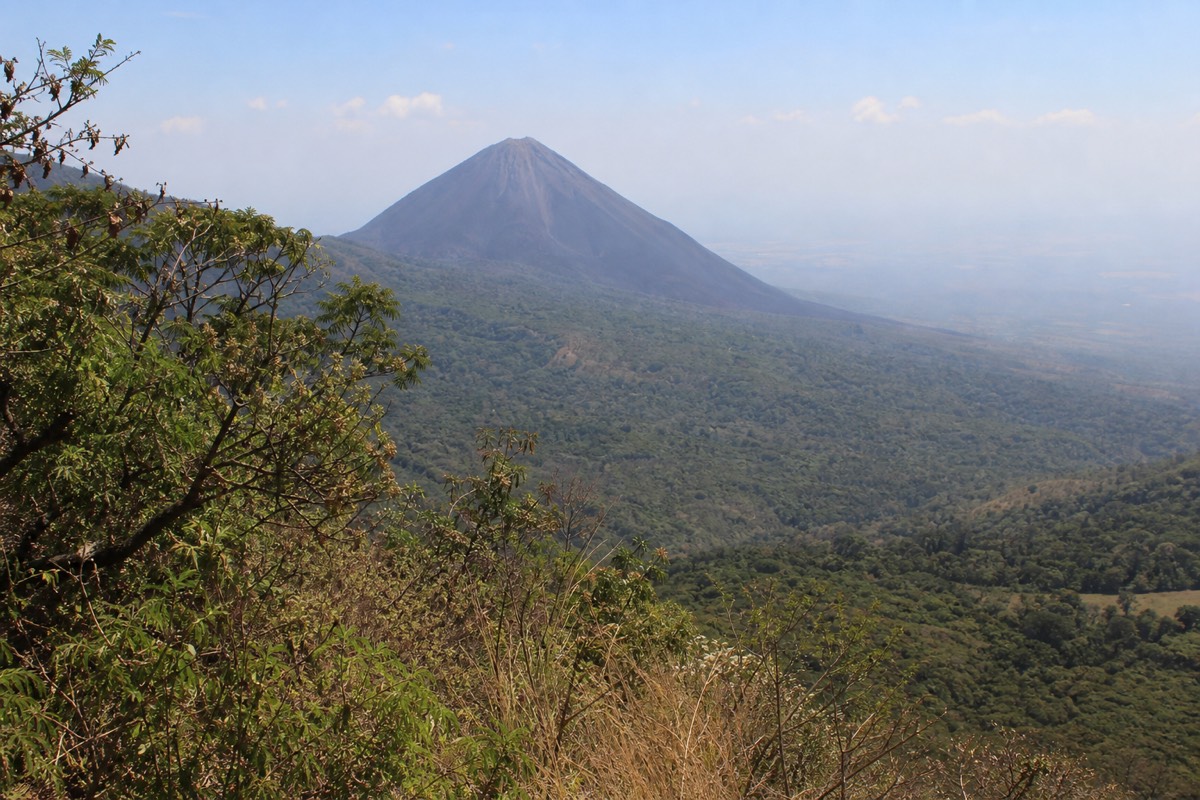
If you only have one volcano morning, Santa Ana is the one in any season, and I say that as someone who loves the black cone across the way. The crater lake is the reason, and the dry season makes it more likely you actually see it. If you have two mornings and one is in the green season, give the cloudier day to Cerro Verde's forest, where cloud is atmosphere rather than a lost view, and save Santa Ana for the day the forecast looks kinder.
Izalco is its own decision. It is not part of the standard escorted Santa Ana ascent, and the steepness that makes it thrilling in dry conditions makes it a slog in rain. The full head-to-head is in Izalco versus Santa Ana. And whichever season you choose, the guided day builds the Santa Ana climb around the late-morning window and puts you at Coatepeque afterward, which is the sequence I would pick for a first visit in every month of the year.
What timing mistakes does Carlos see hikers make every week?
The repeat offenders, from my own notes since 2018: aiming for a sunset summit when the crater area closes around 13:00, arriving at noon and finding the group gone, trusting a beach forecast for a 2,381 m rim, dressing for the lowlands, and trying to reach the trailhead from El Tunco by bus on the same morning.
I keep a running list of the ways good plans go wrong on this mountain, and almost none of them involve the volcano itself. They involve clocks. Here is the list, framed as things I have watched happen and how I would avoid them, not as any rule from an operator.
| The mistake | Why it fails | The fix |
|---|---|---|
| Planning a sunset or late-afternoon climb | The crater area closes ~13:00; the group leaves late morning | Build the day around the 9:30-11:00 window |
| Arriving around noon | The single daily group has already gone | Be at the trailhead by ~9:30 |
| Reading the coastal forecast | The rim is cooler, windier and cloudier than El Tunco | Pack for the summit, not the beach |
| Bus from San Salvador or El Tunco "in the morning" | No public route reaches the 11:00 last start | Overnight in Santa Ana city for the 7:30 bus, or take the tour |
| Assuming a clear dawn means a clear noon | Green-season cloud builds through the day | Go early in the window, hold the view loosely |
| Betting on one specific date for the photo | Mountains do not read forecasts | Give yourself a spare morning if the crater shot matters |
The forecast mistake is the one that catches careful people. They check the weather for El Tunco or San Salvador, see sun, and pack a T-shirt for a summit that sits well over 2,000 m higher and a couple of hours away. The rim makes its own weather. Cooler and windier than the base is the rule in every month, and the app on your phone is describing a different place.
The bus mistake is the expensive one. Bus 248 leaves Santa Ana city around 7:30 to 7:40 and takes about two hours, and it is the only public option that fits the window. From the capital or the coast, nothing does. People who discover this at 10:00 in a hostel are the ones I meet on the trail the following day, if they have a following day. On a short trip, this is exactly the risk the bundled pickup removes, and it is why so many first-timers book the guided day tour rather than gamble a scarce morning on a timetable.
How do you decide when the forecast is mixed?
Go, and go early in the window. In both seasons the late-morning ascent beats most of the cloud, and the mountain does not close for weather. If you booked the guided day, free cancellation to 24 hours before lets you shift a date, but only do that for a genuinely bad outlook, not a few clouds.
Mixed forecasts are the normal condition on Ilamatepec, and the people who wait for a perfect one often run out of trip. My rule of thumb: a forecast that says cloud says nothing about the crater at 11:30, because the rim sits above a lot of what the lowland stations measure. I have summited into blue on mornings the app called grey, and I have stood in fog on days it promised sun. The window is designed for exactly this uncertainty.
There is a difference between weather and safety, and it matters here. Weather is cloud, wind and afternoon rain, and none of it closes the mountain. Safety is the volcano's own status, and that is monitored continuously by MARN through its SNET network, with no current advisories or closures. The mandatory guide system is how the park manages the rim regardless of the sky, so you are never improvising up there. MARN's own guidance says the ascent is not to be improvised, and the escorted group is the practical form that takes.
So the decision tree is short. If the volcano is open, which it currently is, and you can make the window, go. Take the earliest start you can, pack the layer and the shell, rent the poles, and accept that the crater may or may not appear. If it does not, the walk itself, the forest, the black cone of Izalco across the valley and the wind on the rim are still the day people talk about. Then, if you have a spare morning and the photo matters to you, come back. The fees will be the same three dollars.
Does the season change safety or trail conditions?
No season closes the mountain. Santa Ana is an active, monitored stratovolcano, last eruption October 2005, with no current advisories or closures, and the mandatory guide system runs year round. Green-season hikers should mind the slick rocky section near the summit; ankle support helps in every month.
The volcano's status is watched continuously and the picture at the moment is calm. What the season does change is footing. The final stretch to the rim is rocky in all months, and recent hikers describe the climb as "not super easy but not as difficult as anticipated." Wet-season moisture makes that top section slower, which is one reason the $2 rental poles at the trailhead get praised so often in reviews. The rest of the risk picture is national rather than volcanic, and I cover that fully in is El Salvador safe for tourists.
If I had to hand you one date, I would say a midweek morning in early February. But I have watched September hikers get a private summit above a rolling white ocean, so hold the "best time" loosely. Pick your season for the mood you want, respect the window, and the mountain will meet you halfway.