An El Salvador Itinerary Built Around the Volcano
Five and seven day El Salvador itineraries built around the Santa Ana hike, with Lake Coatepeque, Ruta de las Flores, El Tunco and real transport times.
 Written with Carlos Hernández, Santa Ana Volcano tour guide & hiking specialist
Short answer
Five days is the working minimum, arrive in San Salvador, hike Santa Ana volcano with lunch at Lake Coatepeque on day two, give a day to the Ruta de las Flores, then finish with two nights at El Tunco. Seven days adds Santa Ana city and a spare morning in case weather moves the hike.
People email me their route before they email me anything about the trail. I understand why. The hike itself is settled, 6.9 km round trip, roughly 470 m of climbing, done inside four hours. The hard part is fitting one fixed morning window into a country you also want to see. So here is how I would build the trip if a friend handed me their dates, with the volcano as the anchor and everything else arranged around it.
How many days do you need for a volcano-centered trip to El Salvador?
Five days is the honest minimum: one to arrive in San Salvador, one for the Santa Ana summit with Lake Coatepeque, one for the Ruta de las Flores, and two for the coast at El Tunco. Seven days adds Santa Ana city, a slower coffee day, and a spare morning if cloud or fatigue shifts your plans.
The reason five works is that El Salvador is small. Driving from the capital to the volcano takes about 1 to 1.25 hours, and El Tunco sits roughly 2 hours from the trailhead. Nothing on this route involves a long travel day, which is rare in Central America.
The constraint is the ascent window, not distance. Everyone climbs Ilamatepec with the daily guided group, which starts around 9:30 to 10:00 and accepts nobody after 11:00. The crater area clears out by about 13:00. Miss the window and your volcano day evaporates, so the itinerary below puts the hike early in the trip, leaving later days free to absorb it if anything goes wrong. If you want the full picture of what the climb involves, the main hike guide walks through it hour by hour.
One more framing note. The country is genuinely easy to travel right now. The US State Department has El Salvador at Level 1, exercise normal precautions, its lowest tier, and 2025 closed with a record 4.1 million international visitors. You are not building a route through a difficult country. You are building it around one strict morning.
What does a five-day itinerary look like?
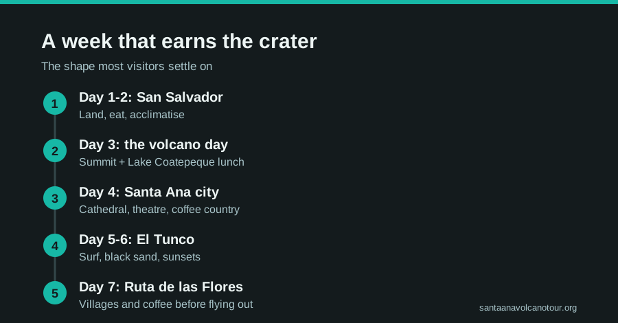
Fly into San Salvador, sleep there, and do the volcano on day two while your legs are fresh: hotel pickup, the summit, lunch at Lake Coatepeque, back by evening. Day three is the Ruta de las Flores coffee towns, then two days of surf and recovery at El Tunco before flying home.
| Day | Base | Plan |
|---|---|---|
| 1 | San Salvador | Arrive, settle in, early night before the hike |
| 2 | San Salvador | Volcano summit + Lake Coatepeque lunch, 7 to 10 h door to door |
| 3 | San Salvador or Ataco | Ruta de las Flores: Juayúa, Apaneca, Ataco coffee towns |
| 4 | El Tunco | Transfer to the coast, afternoon in the surf, sunset on the black sand |
| 5 | El Tunco | Slow morning, beach, depart (airport is close to the coast road) |
Day two is the hinge. On the guided day you are collected from your San Salvador hotel, driven west, walked to the crater with admission handled, then fed lunch on the shore of Lake Coatepeque before the ride back. The lake stop matters more than people expect: after the rocky final stretch of trail, sitting over a caldera nearly 10 km across with a plate in front of you is the reward half of the day. I cover the lake itself separately in the Coatepeque guide.
Days four and five need no structure. El Tunco is a compact surf village, and the whole point is to stop planning.
What does the seven-day version add?
Two things: Santa Ana city as a real stop rather than a drive-through, and slack. You get a night near the historic center, a full unhurried Ruta de las Flores day, and a buffer morning that can catch the hike if rain or a rough arrival pushes it back.
| Day | Base | Plan |
|---|---|---|
| 1 | San Salvador | Arrive, recover from the flight |
| 2 | San Salvador | Volcano summit + Lake Coatepeque lunch |
| 3 | Santa Ana city | Transfer, cathedral and the historic theatre, evening around the plaza |
| 4 | Santa Ana city or Ataco | Ruta de las Flores at full length, coffee farms, murals |
| 5 | El Tunco | Head for the coast, first surf session |
| 6 | El Tunco | Beach day, optional lesson, hammock time |
| 7 | El Tunco | Late breakfast, depart |
The buffer logic is simple. If day two collapses, the hike slides to day three or four and the city day compresses. In the dry months, November through April, that insurance rarely gets used, the crater view is at its clearest then. In the green season, May through October, afternoons cloud over, though the late-morning group ascent beats most of it. The official tourism page for Ilamatepec is worth a look while you plan, it sets expectations for the landscape you will be moving through.
Santa Ana city earns its night. It is the country's second city, the cathedral and the old theatre face the same square, and evenings there feel local in a way San Salvador's hotel districts do not.
How do you get between the stops?
Short hops, all of them. San Salvador to the trailhead runs about 1 to 1.25 hours by road, El Tunco about 2 hours, and the bus 248 from Santa Ana city takes around 2 hours for roughly $0.70. No leg of this route is longer than a morning.
| Leg | Time | How |
|---|---|---|
| San Salvador → trailhead | ~1 to 1.25 h | Tour vehicle or private car |
| El Tunco → trailhead | ~2 h | Tour pickup covers Surf City |
| Santa Ana city → trailhead | ~2 h | Bus 248, La Vencedora terminal, ~7:30 am, ~$0.70 |
| San Salvador → Santa Ana city | ~1 h | Intercity bus or shuttle |
| San Salvador → El Tunco | ~45 min to 1 h | Shuttle or taxi along the coast road |
The one route that does not exist is a workable public bus from San Salvador or El Tunco that reaches the trailhead before the 11:00 cutoff. DIY hikers solve this by sleeping in Santa Ana city and riding the 248 at dawn, which I break down in the getting there guide. Everyone else takes the guided day, which is built around the window.
What does the volcano day look like hour by hour?
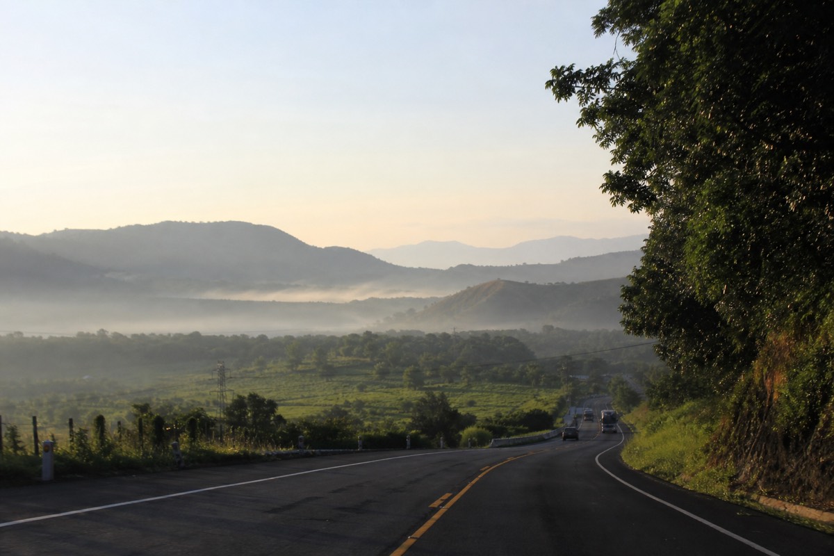
On the guided day, count on roughly 7 to 10 hours door to door: a morning pickup in San Salvador, about 1 to 1.25 hours west, the group ascent forming between 9:30 and 10:00, around 2 hours up and 1.5 down, then lunch on Lake Coatepeque and the drive back. Nothing about it is rushed except the start.
I get asked for a timeline more than anything else, so here is the shape of the day as I would sketch it for a friend. Treat the clock as a planning allowance, not a promise: the operator sets your pickup, and the group moves at the pace of the slowest legs in it.
| Rough clock | What is happening | Notes |
|---|---|---|
| Early morning | Pickup at your San Salvador hotel | Eat first, the summit is hours away |
| Next ~1 to 1.25 h | Drive west toward Cerro Verde | Trailhead access opens from about 7:00 |
| ~9:30 to 10:00 | Group forms at El Tibet, guides assigned | Rent poles for about $2 here, cash |
| Next ~2 h | The climb: vegetation, then open slope, then rock | Roughly 470 m of gain on the way up |
| Around midday | Crater rim, the turquoise lake, paletas | Crater area closes about 13:00 |
| Next ~1.5 h | The descent | Poles earn their $2 on the loose stretch |
| Afternoon | Lunch on the shore of Lake Coatepeque | Included on the guided day |
| Late afternoon to evening | Drive back to San Salvador | 7 to 10 h after pickup |
Two things about that table matter for the wider itinerary. First, the day eats the whole of day two, so do not book an evening activity you care about. Most people get back tired, fed and quiet. Second, the last start at 11:00 is the only hard number in the sequence. Every other line is elastic, and on the guided day the operator owns the elastic parts.
Independent hikers coming from Santa Ana city run a different clock: bus 248 out of La Vencedora around 7:30 to 7:40, roughly 2 hours to the trailhead, the same group window, and a return bus you time yourself. Same summit, same $3 entrance and ~$4 guide, no lake lunch unless you arrange it. The without a guide guide covers that version properly. What both versions share is the middle of the day: two hours of climbing, a rim you cannot swim from, and a slow, rocky hour and a half back down.
How much cash should you carry through the week?
Small US bills, and more of them than you think. The volcano's fees are cash only: $3 park entrance for foreigners, about $4 per person for the group guide, $3 parking, roughly $2 for poles. On the guided day admission and lunch are covered, so your cash goes to poles, paletas and tips. Buses and markets across the route want coins and singles.
El Salvador makes the money side easy in one way, the fees quoted at the volcano are in US dollars, and hard in another, because the small stuff is cash and change can be scarce. I watch hikers arrive at the guide table with a single large note and a hopeful expression every week. Break your bills in the capital before day two.
| Item | Cash needed | Who pays it |
|---|---|---|
| Park entrance | $3 foreigners, $1.50 Salvadorans | DIY hikers; included on the guided day |
| Group guide (mandatory) | ~$4 per person | DIY hikers; handled on the guided day |
| Private guide instead of group | ~$35 to $40 | Optional, DIY only |
| Parking at the trailhead | $3 | Anyone who drove |
| Walking poles | ~$2 rental | Everyone who wants them, cash at El Tibet |
| Bus 248, Santa Ana city to trailhead | ~$0.70 | DIY hikers, each way |
| Whole DIY day from Santa Ana city | ~$17 all-in (one recent traveller's tally) | Entrance, guide, bus, parking, paleta |
The guided day changes the math without changing the habit. Admission is included and so is the lakeside lunch, so the only cash the volcano itself asks of you is for poles, a paleta at the summit, and whatever you tip the guide. Keep a few singles in a pocket you can reach with gloves on, the rim is windier and cooler than anywhere else on the route.
For the rest of the week the pattern holds. Intercity buses, market fruit, coffee in the Ruta de las Flores towns, a beer at El Tunco: all of it moves faster with small denominations. I keep a fuller breakdown of the volcano's own price stack in the tour cost guide, and the wider budget for the trip lives in the El Salvador trip cost guide. Cards work in the capital's hotel districts and at the coast's larger places, but build the week assuming the interesting parts of it run on paper money.
Which months should you build the trip around?
November through April is the dry season and gives the clearest crater, so if the volcano is your priority, aim there. May through October is the green season: lush slopes, afternoon cloud, and a late-morning group ascent that mostly beats it. Both work. Only the margin for a clouded rim changes.
The month question is really a question about the summit view, because everything else on this route, the city, the coffee towns, the surf, works year round with an umbrella. Here is how I would score the two halves of the year against each stop.
| Stop | Dry season, Nov to Apr | Green season, May to Oct |
|---|---|---|
| Santa Ana summit | Clearest crater, best odds of a full turquoise view | Lush trail, afternoon cloud, late-morning ascent usually beats it |
| Lake Coatepeque | Sharp light, warm water | Greener rim, dramatic skies, still swimmable |
| Ruta de las Flores | Dusty roads, festival weekends | Wet-season green, coffee slopes at their fullest |
| El Tunco | Dependable sunsets | Afternoon showers, mornings still good |
| Itinerary advice | Hike on day two, no buffer strictly needed | Hike on day two, keep the seven-day buffer morning |
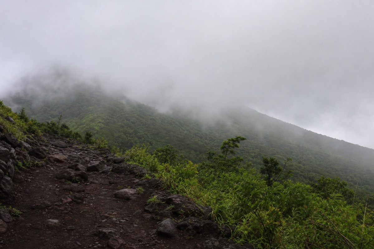
The reason the late-morning ascent matters so much in the green season is timing. Cloud tends to build through the afternoon, and the group is at the rim around midday and off the crater by about 13:00. You are on the descent before most of the weather arrives. It is not a guarantee, I have stood at the rim in July looking at white nothing, but it is the pattern, and it is why I do not tell people to avoid the wet months.
What I do tell them is to keep the buffer if they travel May through October. On a seven-day trip that spare morning is free insurance. On a five-day trip, put the hike on day two and accept that a clouded rim is possible. The best time to hike guide breaks the year down further, and my rainy season hike report shows what a wet-month climb actually looks like from the trail.
What itinerary mistakes does Carlos see every week?
Five recurring ones: putting the coast before the volcano, sleeping at Lake Coatepeque the night before the hike, trying to reach the trailhead by public bus from the capital, booking a late-morning arrival on hike day, and leaving no buffer in the green season. Every one of them is fixed by moving a single night.
I have been on this trail since 2018, and by my own count more than a thousand travellers have walked up it with me. The itinerary errors repeat with almost comic reliability, so I keep a list. None of these are about fitness. They are about where people slept and what they assumed the morning would allow.
| Mistake | What goes wrong | The fix |
|---|---|---|
| Coast first, volcano last | Tired legs, sunburn, one rainy morning deletes the hike | Hike on day two, surf after |
| Lake as the pre-hike base | Taxi around the caldera at dawn, thin margin before 11:00 | Sleep in the capital, give the lake the night after |
| Public bus from San Salvador or El Tunco | No route makes the 11:00 last start | Guided day with pickup, or sleep in Santa Ana city for bus 248 |
| Flying in the morning of the hike | Arrival day and hike day collide | Land on day one, climb on day two |
| No buffer, May to October | A clouded rim with no second chance | Keep the seven-day spare morning |
The coast-first mistake is the one I would push hardest on. El Tunco is where trips relax, and relaxed legs do not climb 470 m of volcanic rock happily. The people who arrive at El Tibet on day six after three surf days move slower, drink more water than they packed, and enjoy the rim less. Flip it and the same people finish the hike inside four hours and spend the beach days feeling like they earned them.
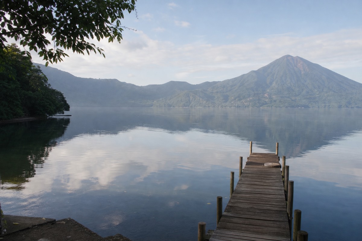
The lake mistake is the sympathetic one. Coatepeque photographs like a promise, and I understand booking it. Just do it after. The one route that solves the lakeshore-to-trailhead morning is your own taxi with margin, and margins are exactly what a holiday morning lacks. On the guided day the operator collects you from a hotel in the capital or the coast, and the whole question disappears.
Who should shorten or change this route?
Anyone the climb itself excludes: the guided day is not wheelchair accessible and is not recommended for travellers with back or heart problems or during pregnancy. Families with mixed energy, and anyone with three days rather than five, should keep the shape but swap the summit for the Cerro Verde forest loop or a lake day.
The route on this page assumes the summit is the point. It is for most people, but not all, and the honest itinerary is the one that bends rather than breaks. Two groups in particular should redraw day two.
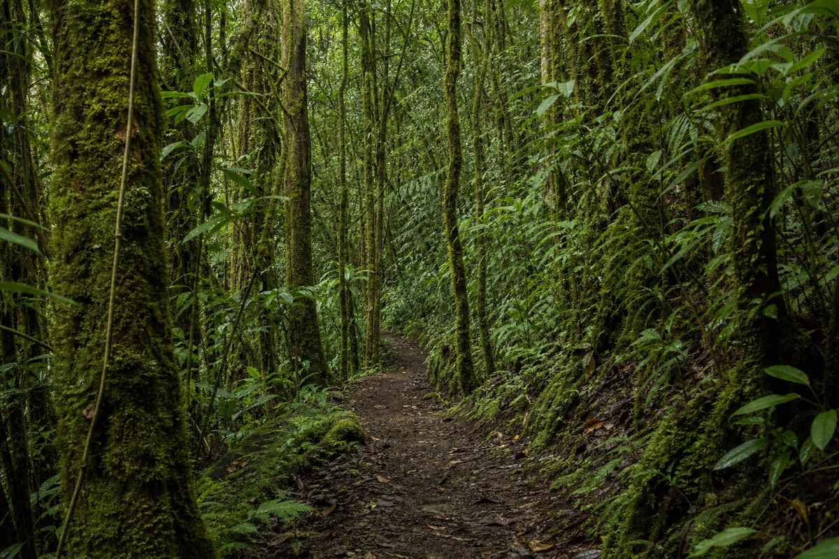
The first is health. The featured departure lists back and heart conditions and pregnancy as reasons not to book, and the terrain explains why: about 470 m of gain, a rocky loose upper third, and a summit that is cooler and windier than the base. Poles help, the group pace helps, but the mountain does not flatten. For these travellers I move day two to Cerro Verde National Park, which sits at about 2,000 m between the three volcanoes and offers shaded forest walking with views across to Izalco's black cone. The easiest volcano guide lays out that ladder honestly.
The second is time. With three days instead of five, keep capital, crater, coast and cut the coffee towns. The volcano day still fits on day two, and you can be at El Tunco by the evening of day three. With ten days, do the opposite: add a second night at Santa Ana city, a full lake day, and let the Ruta de las Flores sprawl. My how many days guide works through the longer and shorter versions.
One thing I would not change for anyone is the position of the hard part. Whether day two is the summit or the forest, do it early. Booking the guided day tour for day two keeps the free-cancellation window on your side, and if a health question or a weather forecast changes your mind, you have not lost anything except a plan on paper.
Where does the volcano day fit best?
Day two. You are rested but not yet sunburned and surfed out, the buffer days still sit ahead of you, and an early success sets the tone. Put the hike late in the trip and one rainy morning can delete the thing you came for.
I have watched this play out from the trail side for years. The hikers who struggle most are the ones who did the coast first: three days of surf, salt and late nights, then a 470 m climb on tired legs. The ones who climb on day two arrive fresh, summit inside the normal 2 hours up and 1.5 down, and spend the rest of the week with the hard part banked.
There is also a booking angle. The featured departure runs with free cancellation up to 24 hours, so reserving it for day two costs you nothing if plans shift. When your dates firm up, book the guided day tour and check live availability and prices on Viator, then build the coast days behind it. The operator holds a 4.9 rating across 869 reviews with a Badge of Excellence, and groups in recent reports run around ten people, small enough that the pace stays sane.
Whichever length you choose, keep the shape: capital, crater, coffee, coast. It is a small country that rewards a simple route, and the volcano gives the whole week its spine.