Cerro Verde National Park in 2026: Fees, Hours, the Three Volcanoes
Cerro Verde National Park is the base for the Santa Ana hike, with cash-only fees, gates from about 7:00, a daily group ascent and three volcanoes.
 Written with Carlos Hernández, Santa Ana Volcano tour guide & hiking specialist
Short answer
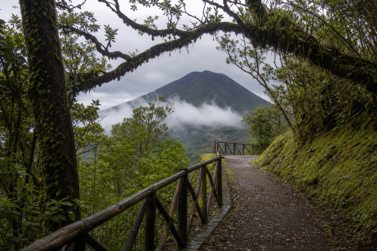
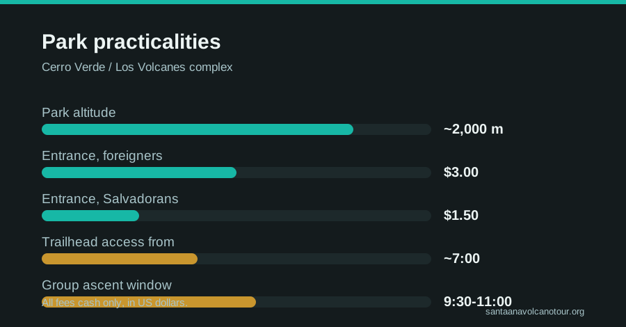
Cerro Verde National Park sits at about 2,000 m between three volcanoes, Santa Ana, Izalco and Cerro Verde itself, and is the base for the Santa Ana hike. Entrance is $3 for foreigners, $1.50 for Salvadorans, cash only. Access runs from about 7:00, and daily guided group ascents leave late morning.
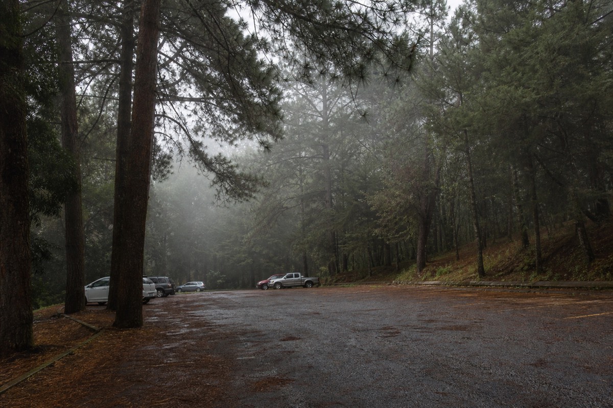
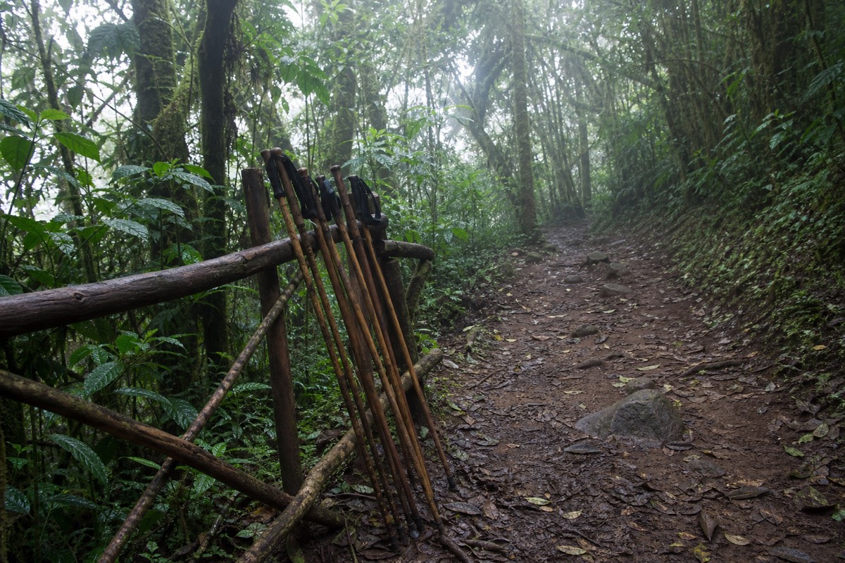
Every hike I have led up Ilamatepec since 2018 has started in the same cool, pine-scented parking lot at Cerro Verde. At around 2,000 m the air already has a bite to it, vendors are setting out poles for rent, and somewhere behind the trees Izalco's black cone is waiting to photobomb your first viewpoint. The park is the doorway to the whole experience, and it runs on rules that surprise people who show up unprepared. Cash-only fees. A fixed climbing window. A guide you cannot decline.
Here is how the park actually works, so none of it costs you the summit.
What exactly is Cerro Verde National Park?
Cerro Verde is the national park sitting at about 2,000 m between three volcanoes: Santa Ana, the country's highest at 2,381 m; Izalco, the black cone; and Cerro Verde itself, the peak the park occupies. Every legal ascent of Santa Ana starts here, inside the park's daily group system.
Think of the park as a saddle with a volcano on each shoulder. You arrive at the Cerro Verde parking area, and from there the trails fan out: the main route to Santa Ana's crater rim, and the separate, steeper route to Izalco. The park is where you pay, where you meet your mandatory local guide, and where the daily ascent group forms.
The setting alone is worth arriving early for. Because you start at about 2,000 m, the Santa Ana hike only needs to gain around 470 m over its 6.9 km round trip, which is the quiet reason a climb up the highest volcano in El Salvador stays in the moderate band. AllTrails rates the route 4.8 stars, and the trail data is public at alltrails.com.
The volcano the park watches over is active. Santa Ana last erupted in October 2005, MARN's SNET network monitors it continuously at snet.gob.sv, and there are currently no advisories or closures. The park system, the mandatory guides and the fixed window all exist inside that reality: this is a managed climb on a living mountain, not a free-range hill walk.
How much does everything cost inside the park?
Budget under $15 and carry it in cash. Park entrance is $3 for foreigners and $1.50 for Salvadorans, the local group guide is about $4 per person, parking is $3, and trekking poles rent for about $2. One independent 2025 report put the whole DIY day near $17, summit ice cream included.
| Item | Price (USD) | Notes |
|---|---|---|
| Park entrance, foreigners | $3 | Cash only |
| Park entrance, Salvadorans | $1.50 | Cash only |
| Local group guide | ~$4 per person | Mandatory, joins the daily group |
| Private local guide | ~$35 to $40 | Optional upgrade on the same rules |
| Parking | $3 | Per vehicle |
| Trekking poles | ~$2 | Rented at the trailhead, widely praised |
The phrase to tattoo on your itinerary is cash only. There is no card machine waiting for you at 2,000 m, and the fees are collected in person. Bring small US dollar bills, add a few extra for a paleta at the summit, and the money side of the day is done. A full cost breakdown, tour versus DIY, lives in what the day costs.
Note what the fees do not include: transport. Getting to the park is the real cost variable, whether that is the $0.70 bus from Santa Ana city or a tour with pickup. On the featured guided day the park admission is included in the price, which removes this entire table from your morning.
What are the park hours, and how does the daily group ascent work?
Trailhead access opens around 7:00, but Santa Ana climbs run on a group system: ascents start around 9:30 to 10:00, the last start is 11:00, and the crater area closes about 13:00. Everyone climbs with a mandatory local guide, and recent reports describe a tourist-police escort with the group.
The schedule is the single most misunderstood thing about the park. Travellers raised on alpine starts show up at dawn expecting to beat the crowds, then sit in the parking lot for two hours. The system is the crowd. One or more groups form late morning, guides distribute themselves through the line, and the whole procession moves up together. Miss the 11:00 last start and your summit is gone for the day, no exceptions, which is why I am blunt with people about transport timing in how to get to the volcano.
The rhythm on the mountain is consistent: about 2 hours up, 30 to 45 minutes at the rim, about 1.5 hours down, 3 to 4 hours all told. The 13:00 crater closure keeps everyone inside daylight and, in the green season, ahead of the afternoon cloud.
Could you slip up alone before the group leaves? No. The guide requirement applies to everyone, local or foreign, fit or not, and I cover why the rule exists and what it is like in practice in hiking without a guide. Short version: the group system is not red tape layered on the hike. It is the hike.
What does a morning at Cerro Verde look like hour by hour?
Access from about 7:00, fees paid in cash on arrival, a wait while the daily group forms between 9:30 and 10:00, the last start at 11:00, about 2 hours to the rim, the crater closing around 13:00, and roughly 1.5 hours back down. Plan to be back at the parking lot by mid-afternoon.
The park does not run like a trailhead you show up at whenever you like. It runs like a small station with one departure. Once you see the day as a timetable, the odd bits, the early gate and the late climb and the hard 11:00 line, all make sense together. Here is the shape, with times given as allowances rather than promises.
| Time (allow) | At the park | Notes |
|---|---|---|
| ~7:00 | Trailhead access opens | Earliest sensible arrival for people who like a margin |
| On arrival | Pay entrance ($3 foreigners, $1.50 Salvadorans), parking $3, guide ~$4 pp | Cash only, small US bills |
| Before the group | Rent poles ~$2, walk to the viewpoint, layer up | Izalco's cone is the view; the air is cool at 2,000 m |
| ~9:30 to 10:00 | Daily group forms, guides sort the line | Be there with water filled |
| 11:00 | Last start | Nobody climbs after this |
| ~2 h | Ascent through forest onto rocky upper trail | Steady pace behind the guide |
| ~30 to 45 min | Crater rim | Photos, the lake, paletas from summit vendors |
| ~13:00 | Crater area closes | Everyone begins the descent |
| ~1.5 h | Descent, loose rock first | Poles out |
| Mid-afternoon | Back in the parking lot | Then the lake, the bus, or the drive home |
Two things stand out when it is written down. First, the gap between the gate opening and the group leaving is real, up to a couple of hours, and it is the most misused time of the day. Use it. Walk to the viewpoint, drink something warm, get your money sorted, look at Izalco. Second, the whole hike sits between 10:00 and 15:00 at the latest, which is why the afternoon is free for Lake Coatepeque on the guided day.
The bus 248 from Santa Ana city, leaving La Vencedora around 7:30 to 7:40 and taking about two hours, drops you at the trailhead in the sweet spot before the group forms. Drivers from San Salvador, at roughly 1 to 1.25 hours, can afford a later breakfast. Nobody, from anywhere, can afford to arrive at 11:15.
How does the daily group actually form, and why is 11:00 so firm?
Hikers gather near the trailhead in the late-morning window, the local guides sort them into one or more lines, a tourist-police escort has been reported with the group, and the procession moves up together. The 11:00 last start exists so everyone is off the crater by about 13:00 and down in daylight, and it does not bend.
I have watched this ritual since 2018 and it still surprises visitors, especially those used to alpine starts. The instinct is to beat the crowd. Here, the crowd is the mechanism. The group system is how the mandatory-guide rule works in practice: rather than one guide per pair of hikers, the guides attach themselves to a late-morning cohort and take it up as a unit. Everyone climbs with a guide because everyone climbs together.
The forming itself is undramatic. People drift toward the start point, guides count and chat, poles get rented at the last minute, someone runs back to the car for a hat. Then the line moves. On the trail the guides distribute themselves front, middle and back, which is what keeps a group of ten or so at a comfortable pace and stops the fastest walkers pulling away on the rocky upper section. Recent reports mention a tourist-police escort travelling with the group as well; on the mountain it reads as reassurance rather than a presence you notice.
The 11:00 line is where I turn blunt with people, and I say this as advice about the mountain rather than about any operator. The window is not a suggestion. It exists so the last group is on the rim before the crater closes around 13:00 and back down with daylight and, in the green months, ahead of the afternoon cloud. Miss it and the day is over, and the guides have no discretion to make an exception for a taxi that ran late.
So the whole planning problem collapses to one sentence: be standing at Cerro Verde, cash in hand, before the group leaves. If you sleep in Santa Ana city the bus 248 does that for you. If you sleep in the capital or on the coast, there is no public route that reliably does, which is the honest reason most travellers from those bases take a pickup. I go into how the line feels from inside in the morning group ascent.
How do you reach the park gate from each base?
By bus from Santa Ana city, by car or tour from everywhere else. The 248 leaves La Vencedora terminal around 7:30 to 7:40 for about $0.70 and takes roughly 2 hours. Driving is about 1 to 1.25 hours from San Salvador and about 2 hours from El Tunco. No public route from the capital or coast reliably makes the window.
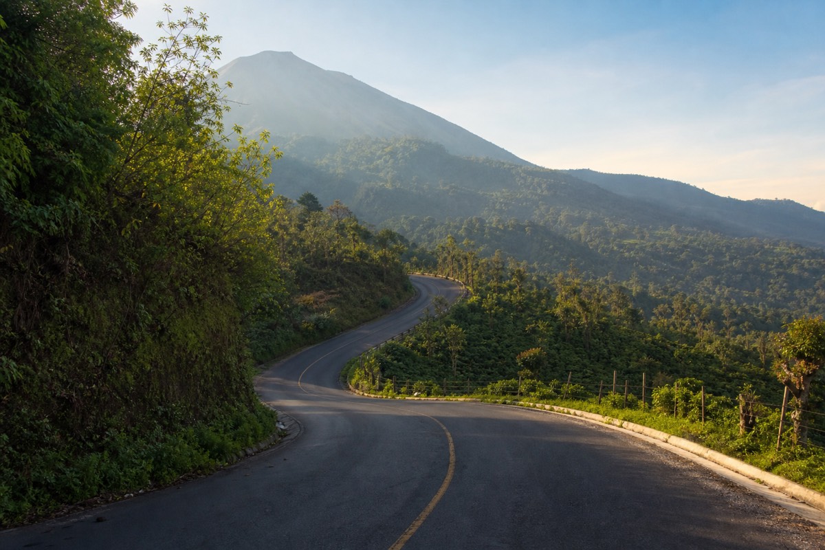
Cerro Verde is easy to reach and easy to reach late, and only one of those matters. The park sits at about 2,000 m up a mountain road, and every route to it has to land you inside the late-morning window. Here is the matrix as it stands.
| Starting from | How | Time and cost | Makes the window? |
|---|---|---|---|
| Santa Ana city | Bus 248 from La Vencedora, ~7:30 to 7:40 | ~2 h, ~$0.70 | Yes, arrives before the group forms |
| San Salvador | Car, driver or guided day with pickup | ~1 to 1.25 h drive | Yes, with pickup or an early drive |
| El Tunco or El Zonte | Car, driver or guided day with pickup | ~2 h drive | Yes with pickup; a long self-drive |
| San Salvador or the coast | Public transport | No workable route hits the window | No |
| On the guided day | Hotel pickup, admission included | Part of a 7 to 10 h day | Yes, that is the design |
The bus is the budget hero of this table and deserves its reputation. It is cheap, it leaves early enough, and it puts you at the trailhead with time to pay, rent poles and stand at the viewpoint before anyone climbs. Its limitation is the return and the lake: from the trailhead onward you are arranging your own transport, and the swim at Coatepeque becomes a separate negotiation.
Driving is straightforward from the capital and longer but fine from the coast; parking is $3, cash. The route detail, including what to expect from the mountain road, is in how to get to the volcano, with base-specific notes in the volcano from San Salvador and the volcano from El Tunco.
The pickup option is the one that removes the table entirely. On the guided day the vehicle collects you at your hotel, park admission is included, and the driver's job is to have you at Cerro Verde before the group forms. For travellers based in San Salvador or on the coast who want the mountain and the lake in one day, that is the version that works.
What should you pack for a day that starts at 2,000 m?
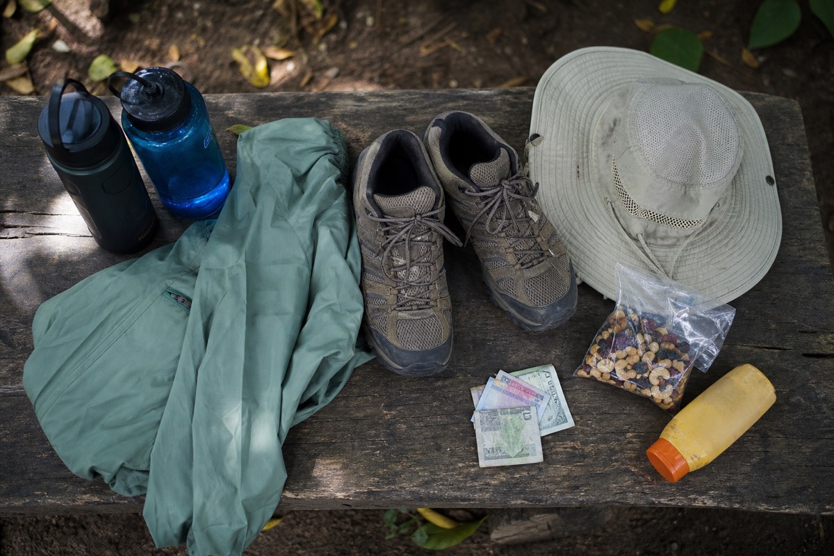
Layers, 2 litres of water, ankle-support shoes, sun cover and small US bills. The park is already cool at 2,000 m and the summit is cooler and windier still, while the climb itself is warm work. Trekking poles rent for about $2 and earn their price on the loose upper section coming down.
The temperature swing is the thing to pack for. You start in a cool pine-shaded parking lot, work up a sweat through the forest, then stand in wind at 2,381 m. Later, if you are on the guided day, you are at a warm lakeshore. One bag has to cover all of it without weighing you down on the climb.
| Item | Why the park day wants it | Planning allowance |
|---|---|---|
| Water | MARN guidance says carry it; the ascent is warm | 2 litres per person |
| Warm or wind layer | Cool at the gate, windy and cooler at the rim | One packable jacket |
| Sturdy shoes | Loose rock near the summit and on the descent | Ankle support recommended by 2025 to 2026 hikers |
| Trekking poles | Praised in reviews, especially descending | Rent at the trailhead, ~$2 |
| Sun protection | Open rocky upper trail, midday summit | Hat, sunscreen, sunglasses |
| Small US bills | Entrance, guide, parking, poles, paletas | Cash only, small denominations |
| Snacks | The hike is 3 to 4 hours | Something light; paletas at the top are the treat |
| Swimsuit and towel | Only if Coatepeque follows | Guided day travellers, pack them |
| Rubbish bag | Pack everything out | MARN's no-litter guidance |
Leave the heavy things behind. This is a moderate 6.9 km round trip with about 470 m of gain, not an expedition, and the most common overpacking error is a bag built for a mountain that would take all day. What punishes people is under-layering rather than under-packing: the parking lot lulls you, the forest warms you, and the rim then reminds you the summit is a different climate from the gate.
The other quiet essential is the cash. Every fee at the park is collected in person, and there is nothing resembling a card machine or ATM up there. Sort the bills the night before. The item-by-item version, with what to leave in the hotel, is in what to bring on the hike, and the honest grading of the trail is in how hard the hike really is.
Who should skip the summit, and is the park still worth it for them?
Anyone the featured day itself screens out: it is not wheelchair accessible and is not recommended for travellers with back problems, heart conditions or during pregnancy. The same self-check applies to any climb here. The park at 2,000 m still rewards a visit for the views, cool air and Izalco's cone, and the lake asks nothing of your knees.
I say this gently but clearly, because the moderate grade tempts people who should sit this one out. Moderate means about 470 m of gain over 6.9 km, a rocky upper section, wind and sun at the top, and roughly 3 to 4 hours on your feet. Most reasonably active people manage it, and one 2025 hiker's line, not super easy but not as difficult as anticipated, is the fair summary. But it is still a real hike on loose rock at altitude, and the group moves as a group.
| Situation | My advice | What the park still gives you |
|---|---|---|
| Wheelchair user or limited mobility | The summit is not accessible; the featured day is explicit about this | Parking-area viewpoints, cool forest air, Izalco's cone across the saddle |
| Back problems, heart conditions, pregnancy | Skip the climb, per the tour's own guidance | The park stop, then Lake Coatepeque with lunch and warm water |
| Nervous about fitness but otherwise well | Climb; rent poles, pace behind the guide, carry water | The full crater lake, at a group pace |
| Travelling with capable teens | Climb together | The best family volcano day in the country |
| Very short on time | The park alone is a fine hour if the window is missed | Views, air, coffee slopes on the road up |
The park is not a consolation prize. It sits at about 2,000 m between three volcanoes, the air has a bite most of the country never feels, and the viewpoint near the parking area hands you Izalco's black pyramid without a single step of climbing. Anyone who wants the volcano day without the volcano can spend an hour there and still have Coatepeque, warm and swimmable, waiting below.
For those who are on the fence about fitness rather than health, the answer is usually to go. Poles, water, a hat, and the guide's pace carry most people to the rim. If you want an outside read before deciding, is the volcano worth it weighs the reward against the effort honestly, and the country's other options are in the easiest volcano to hike in El Salvador.
Which of the three volcanoes do you actually climb?
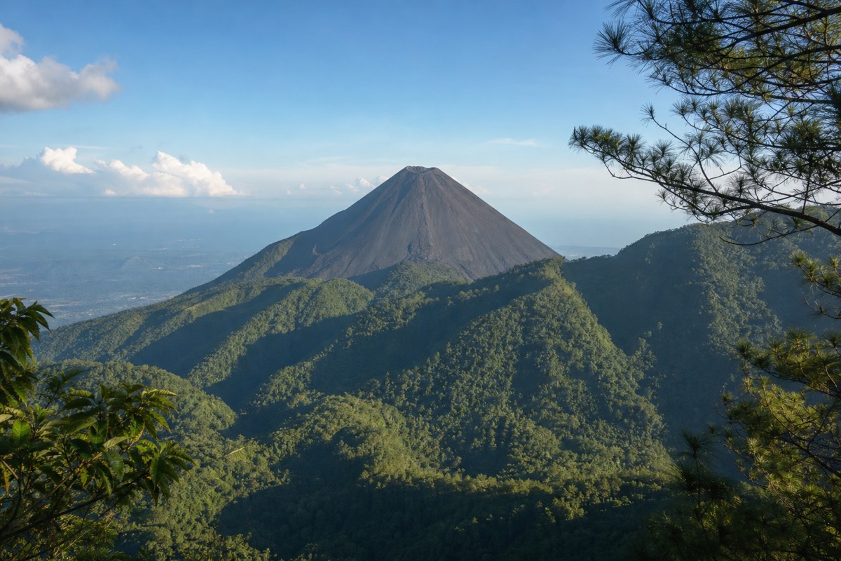
For almost everyone, Santa Ana. It is the highest at 2,381 m, the trail is moderate, and the turquoise crater lake is the region's signature reward. Izalco is a separate, steeper climb up a bare black cone. Cerro Verde is the forested base you park on rather than a summit prize.
| Santa Ana (Ilamatepec) | Izalco | Cerro Verde | |
|---|---|---|---|
| Role in the park | The main event | The steep side quest | The base at ~2,000 m |
| Summit | 2,381 m, highest in El Salvador | Bare black volcanic cone | The park's own forested peak |
| Character | Moderate, rocky near the top | Notably steeper, separate trail | Parking, fees, trailheads, viewpoints |
| Reward | Turquoise sulfuric crater lake | The "Lighthouse of the Pacific" cone itself | Views of both neighbours |
| On the featured tour | Yes, guided with admission included | No | Yes, as the starting point |
Izalco deserves its legend. Sailors called it the Lighthouse of the Pacific, and its black pyramid is the most dramatic single shape you will see all day. But as a climb it is a different, harder proposition, and I put the full comparison in Izalco or Santa Ana.
If you want the park with none of its admin, this is where the guided day earns its keep: pickup from San Salvador, El Tunco or El Zonte, park admission included, the group window handled, then lunch at Lake Coatepeque after the descent. When the plan firms up, book the guided day tour and check live availability and prices on Viator. It carries 4.9 stars across 869 reviews, groups cap at 20 and usually run near 10, and cancellation is free to 24 hours.
What practical details trip people up at Cerro Verde?
Three things, over and over: arriving without cash, arriving after the 11:00 last start, and underdressing for a summit that is cooler and windier than the trailhead. Solve those, carry 2 litres of water and decent shoes, and the park is one of the easiest-run protected areas in Central America.
| Practicality | The reality at the park |
|---|---|
| Payments | Cash only, small USD bills for fees, guide, parking, poles, paletas |
| Getting there by bus | Route 248 from La Vencedora terminal, Santa Ana city, ~7:30 to 7:40, ~$0.70, ~2 h |
| Getting there by car | ~1 to 1.25 h from San Salvador, ~2 h from El Tunco |
| Water | Carry 2 litres per person, per MARN guidance |
| Footwear | Sturdy shoes with ankle support; the upper trail is loose rock |
| Weather | Summit noticeably cooler and windier than the parking lot |
| Litter | Pack everything out, the no-litter rule is enforced culture here |
My last piece of advice is about attitude, not logistics. Cerro Verde rewards people who treat it as part of the day rather than a gate to get through. Arrive with time to spare, drink something warm in the cool air, walk to the viewpoint and let Izalco's cone do its thing. The mountain you came to climb is on the schedule. The park is the part you get to enjoy unhurried.