The Easiest Volcano to Hike in El Salvador
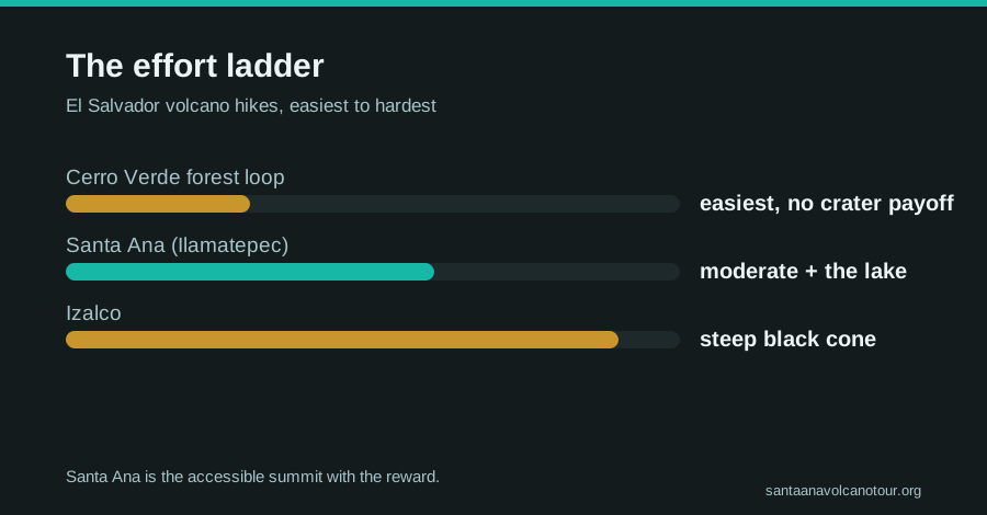
Santa Ana is the accessible moderate summit with a crater payoff, Cerro Verde is easier but viewless at the top, Izalco is harder. The honest ladder.
 Written with Carlos Hernández, Santa Ana Volcano tour guide & hiking specialist
Short answer
For a real summit with a real reward, Santa Ana is the easiest volcano hike in El Salvador, a moderate 6.9 km round trip with about 470 m of gain and a turquoise crater lake at the top. Cerro Verde's forest loop is physically easier but has no crater payoff. Izalco is distinctly harder.
Every week someone at the trailhead tells me they picked Ilamatepec because the internet called it easy. Then the rocky last stretch starts and they revise their vocabulary. So let me answer the question the way I answer it in person, with the whole ladder in view: three volcanoes stand together in this corner of the country, they range from a stroll to a slog, and the right answer depends on whether you want an easy walk or an easy summit. Those are different things.
What is the easiest volcano to hike in El Salvador?
Depends what you count as a hike. The easiest walk is Cerro Verde's forest loop, gentle trails around an extinct, overgrown crater with no summit payoff. The easiest true summit, climb up, crater view, climb down, is Santa Ana: moderate, 3 to 4 hours total, and open to any reasonably fit walker.
| Rung | Volcano | Character | Payoff at the top |
|---|---|---|---|
| Easiest | Cerro Verde | Flat, shaded forest loop at ~2,000 m | Viewpoints, no crater |
| Moderate | Santa Ana (Ilamatepec) | 6.9 km round trip, ~470 m gain, rocky finish | Turquoise crater lake, four-country-scale views |
| Hardest of the three | Izalco | Separate, steeper climb up a bare young cone | The classic black summit, earned |
This trio shares one park. Cerro Verde National Park sits at about 2,000 m in the saddle between the three, which is why you can stand on its viewpoints and study both neighbors before committing to either. The extinct one you walk around, the sleeping giant you climb for the lake, and the young black cone, the one sailors once called the Lighthouse of the Pacific, you save for a fitter day.
My bias is on record: if you have one morning and working legs, climb Santa Ana. AllTrails rates the route 4.8 stars and files it as moderate, and the full hike difficulty guide breaks down exactly where the effort lands.
How hard is Santa Ana really?
Genuinely moderate, not secretly brutal and not a stroll. Count on about 2 hours up and 1.5 down over 6.9 km, with roughly 470 m of climbing to the 2,381 m summit. The upper third turns rocky and loose, which is where most people feel it. Recent hikers put it well: not super easy, not as difficult as anticipated.
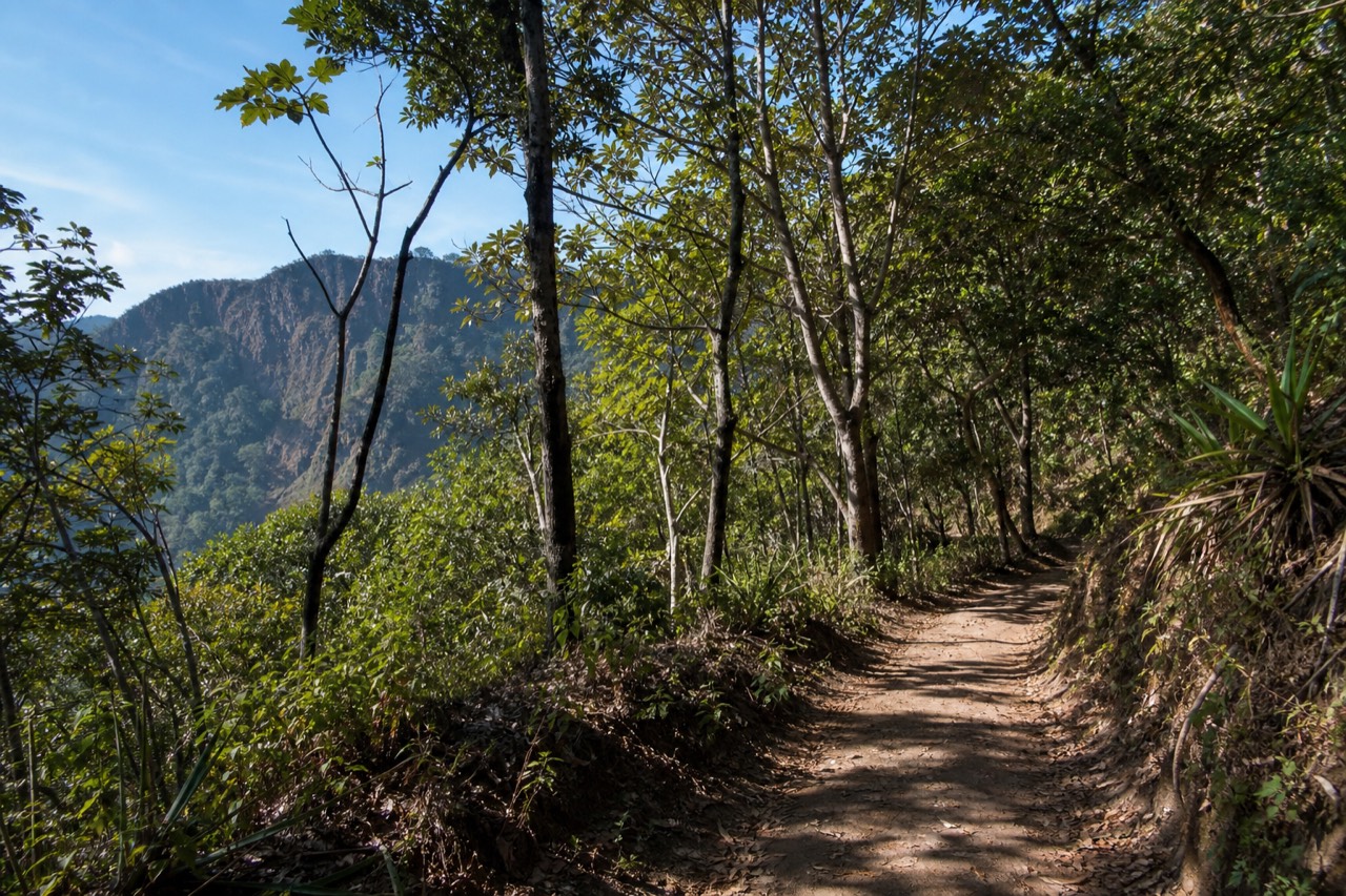
The trail has three moods. The lower stretch moves through vegetation on decent footing, the middle opens up and steepens politely, and the final push crosses volcanic rock where ankles earn their keep. Sturdy shoes matter more than fitness here, and the wooden poles rented at the trailhead for about $2 get praised in review after review, mostly for the way down.
Structure helps too, in both directions. A local guide is mandatory for everyone, and the daily group ascent leaves between about 9:30 and 10:00 with a last start at 11:00, so you climb on a schedule with support rather than alone. The pace runs to the group, which most find comfortable, and there are paletas sold at the summit, a fact I consider load-bearing for morale.
Two honest caveats. The summit is cooler and windier than the base, bring a layer and 2 L of water. And the climb is not for everyone: the featured guided version excludes travelers with back or heart problems and pregnant travelers, and it is not wheelchair accessible, which tracks with the terrain. What you get for the effort is the country's highest volcano and its strangest color, the sulfuric, acidic lake in the crater, no swimming, just staring.
Is Cerro Verde actually easier, and is it enough?
Easier, yes, by a wide margin: shaded, mostly level forest trails around a long-extinct crater, walkable in normal shoes by nearly anyone. Enough, only if you want forest and viewpoints rather than a summit. There is no crater lake, no climb, and no top-of-the-world moment.
Cerro Verde is what a volcano becomes with enough time. Its crater has grown over completely, cloud forest covers the slopes, and the park's paths wander through orchids and birdsong at a barely noticeable grade. For travelers with small children, older knees, or a genuine dislike of uphill, it is the honest recommendation, and the viewpoints toward Izalco give you drama without sweat.
But manage expectations. The loop is a walk in a beautiful park, not an ascent. You finish where you started, pleasantly, having summited nothing, and the postcard views are of other volcanoes. Plenty of visitors pair it with a Santa Ana climb across two days, forest one day, crater the next. The Cerro Verde park guide covers trails, access and how the pairing works.
| Volcano | Effort | Reward | Verdict |
|---|---|---|---|
| Cerro Verde | Minimal, flat shaded loop | Forest, birdlife, views of the other two | Lovely walk, zero summit |
| Santa Ana | Moderate, 3 to 4 h, rocky finish | Turquoise crater lake, highest point in the country | Best effort-to-reward ratio |
| Izalco | High, steep bare slopes | The iconic black cone, bragging rights | Earned, not given |
How much harder is Izalco?
Distinctly harder. Izalco is the young, bare, black cone you study from Santa Ana's trail, and climbing it means a separate, steeper hike on loose volcanic slopes with little shade. Fit hikers love it. Nobody has ever called it the easy option.
Izalco is the youngest of the trio and looks it, a near-perfect cone of dark volcanic rock with barely a plant on it. It erupted so persistently through the 1800s and 1900s that sailors steered by its glow, hence the Lighthouse of the Pacific name. Eruptions built it steep, and steep is how it hikes: what you gain, you gain directly, and the descent on loose material asks as much attention as the climb.
The comparison with Santa Ana is a chapter of its own, and I keep a full Izalco vs Santa Ana guide for people torn between them. The short version: Izalco rewards hikers who want to feel a climb, Santa Ana rewards everyone else, and the view of Izalco from Santa Ana's trail is so good that many people decide the black cone is best appreciated from across the valley, at eye level, with a paleta.
Whichever peak tempts you, the ground rules are the same across the park: guides, managed access, and a volcano that is monitored daily. Santa Ana last erupted in October 2005 and MARN's SNET service watches it continuously, with no current advisories or closures. Activity status is a fact you check, not a difficulty factor you fear.
Where on the Santa Ana trail does the effort actually land?
In the top third. The lower stretch is vegetated and forgiving, the middle opens out and steepens politely, and the final push crosses loose volcanic rock where ankles and poles earn their keep. Allow roughly the first hour of the 2 hour climb for the easy ground and the second for the rock, then 1.5 hours down.
"Easy" is a word about averages, and averages hide the part that hurts. Santa Ana's 6.9 km round trip and roughly 470 m of gain describe a moderate hike, but the effort is not spread evenly across it. Here is how I brief a group at El Tibet before we move.
| Trail section | Footing | What it feels like | Planning allowance |
|---|---|---|---|
| Lower stretch | Vegetation, decent path | A warm-up, chatting pace | Part of the first hour up |
| Middle stretch | Open slope, steeper | Steady climbing, first views back to Cerro Verde | Rest of the first hour |
| Upper third | Loose volcanic rock | Careful foot placement, most people feel it here | Roughly the second hour up |
| Crater rim | Rock, wind, cooler air | Standing still, staring at turquoise | Until about 13:00 when the crater area closes |
| Descent | Same rock, then path | Poles matter most here | About 1.5 h |
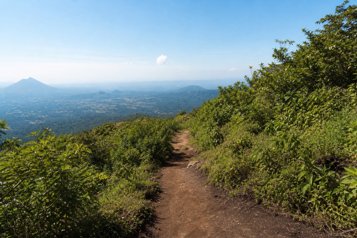
The pacing point matters because most people spend their energy in the wrong place. They charge the lower stretch because it is pleasant, arrive at the rock already breathing hard, and then discover that loose footing is slower and more tiring than any gradient. The group pace, set by the mandatory local guide, protects against this better than solo enthusiasm does.
The descent deserves its own respect. On the way up, loose rock is a nuisance. On the way down it is where the ankle-turns happen, and the reviews that praise the ~$2 rental poles are nearly always talking about this stretch. AllTrails files the route as moderate at 4.8 stars, and I would add one word to that: moderate, top-heavy. Know where the effort sits and the whole climb feels easier than its reputation.
How does the 11:00 last start shape an easy day?
Completely. The trailhead is reachable from about 7:00, the daily group forms between roughly 9:30 and 10:00, nobody starts after 11:00, and the crater area closes around 13:00. Arrive inside that window and the mountain is organized for you: guides, a group pace, and a schedule that puts you on the rim before afternoon cloud.
The window is the reason Santa Ana counts as easy at all. Compare the alternative: an unmanaged volcano where you pick your own start, find your own route and judge your own weather. Here, the structure does that work. The cost is rigidity, the reward is a climb that almost anyone can complete without route-finding.
| Clock | What is happening at El Tibet | Why it matters for an easy day |
|---|---|---|
| ~7:00 | Trailhead access begins | Arriving early costs nothing but a cool wait |
| ~9:30 to 10:00 | Group ascent forms, guides assigned | The pace is set for the group, not the fastest walker |
| 11:00 | Last start, no exceptions | Miss it and there is no afternoon climb |
| Around midday | Groups reach the crater rim | Ahead of most green-season cloud |
| ~13:00 | Crater area closes | The descent starts with daylight and energy to spare |
The bottleneck for independent hikers is getting there. Bus 248 leaves La Vencedora terminal in Santa Ana city around 7:30 to 7:40, costs about $0.70 and takes roughly 2 hours, which lands you inside the window with room to rent poles. From San Salvador or the coast there is no public route that beats 11:00, which is why the guided day, with hotel pickup and about 1 to 1.25 hours of driving from the capital, exists. Neither is harder than the other. They are just different ways of solving the same clock. The getting there guide has both.
What the window buys you is a rim at midday. In the dry months, November through April, that means the clearest crater views of the year. In the green season, May through October, it means you are usually down before the afternoon cloud settles. An easy volcano is partly one that has been timed for you, and this one has.
What gear makes Santa Ana feel easy?
Shoes with ankle support, the ~$2 rental poles, 2 L of water, a warm layer for a summit that is cooler and windier than the base, sun protection, and small US bills. That is the whole list. Nothing technical, nothing you cannot buy in Santa Ana city or San Salvador the day before, and every item pulls its weight on the rocky top third.
The gear audit for this hike is short, which is part of why it earns its easy reputation. What surprises people is which items matter most. Nobody regrets the layer. Everyone who skipped ankle support wishes they had not.
| Item | Why it earns its place | Skip it and… |
|---|---|---|
| Shoes with ankle support | The upper third and the descent are loose rock | The descent becomes slow and nervous |
| Poles, ~$2 at the trailhead | Balance on the rock, knees on the way down | Reviews say this is the regret |
| 2 L of water | 3 to 4 hours, tropical sun, MARN says carry it | You borrow from the group |
| Warm layer | The 2,381 m rim is windier and cooler than El Tibet | You leave the crater early, shivering |
| Sun protection | Open middle stretch, little shade | Sunburn on the way down |
| Small US bills | Poles, paletas, tips, all cash | Fumbling at the guide table while the group forms |
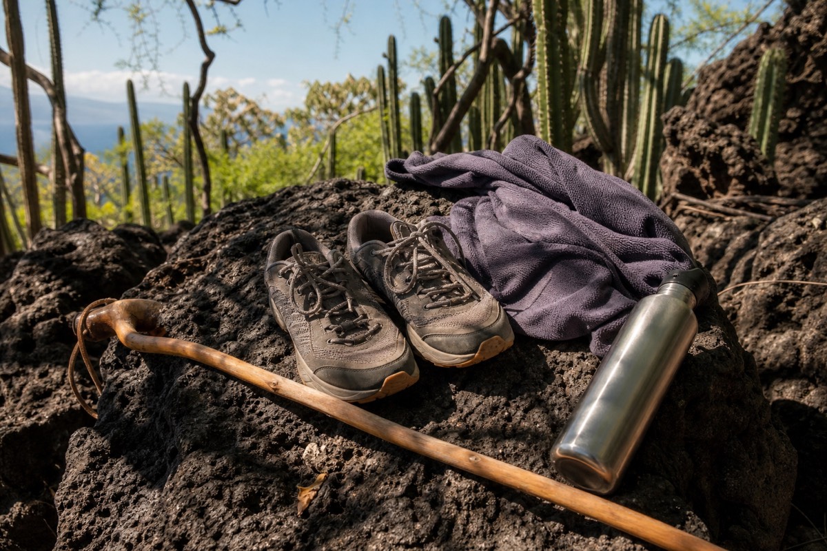
The water line is the one I would underline. MARN's guidance for the volcano is plain about it, the ascent is not to be improvised, carry water, take your litter back down. Two liters is what I hand people as a rule of thumb, and on a hot dry-season morning most of it goes.
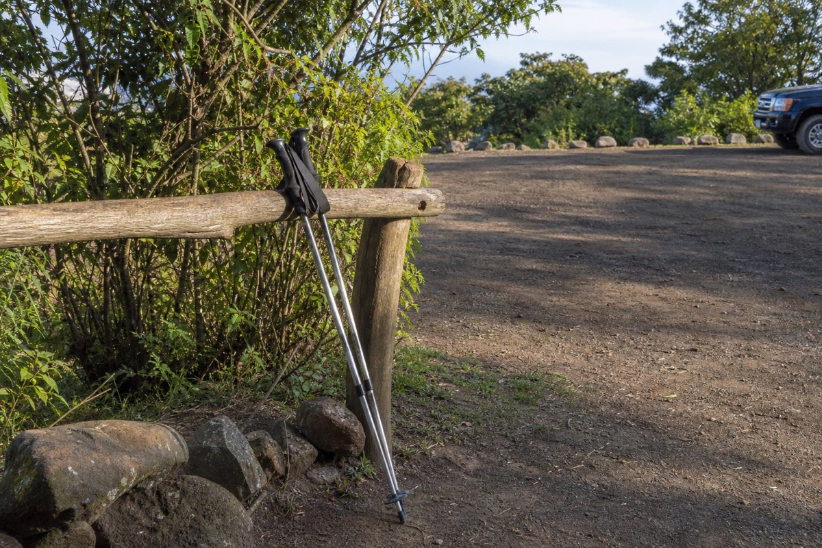
Poles are the cheap miracle. For about $2 you rent a wooden pole at El Tibet, and the number of reviews that single it out as the best decision of the day is not a coincidence. On the climb it steadies you on the loose stretch. On the descent it saves knees and ankles, and the descent is where "easy" volcanoes catch people. My what to bring guide goes item by item, including what to leave behind, but the table above is the honest core of it.
Who should skip Santa Ana, and what should they do instead?
The guided day is not wheelchair accessible and is not recommended for travellers with back or heart problems or during pregnancy, and the terrain backs that up. Small children and anyone who dislikes uphill are borderline. For all of them, Cerro Verde's forest loop and a Lake Coatepeque afternoon give the volcano day without the volcano.
Calling Santa Ana the easiest summit is not the same as calling it easy for everyone. Roughly 470 m of gain, a loose rocky upper third and a windy rim at 2,381 m are real, and the featured guided version lists back and heart conditions and pregnancy as reasons not to book. I would rather send someone to the forest with a clear conscience than watch them turn back on the rock.
| Profile | Santa Ana verdict | Better plan |
|---|---|---|
| Wheelchair users, limited mobility | Not accessible | Cerro Verde viewpoints, Coatepeque lakeshore |
| Back or heart conditions, pregnancy | Not recommended on the guided day | Cerro Verde forest loop |
| Small children | Borderline, depends on the child | Cerro Verde, or Coatepeque for swimming |
| Reasonably fit adults, unsure | Yes, moderate, 3 to 4 h | Rent poles, climb with the group |
| Fit hikers wanting a challenge | Yes, but consider the neighbor | Izalco, separate and steeper |
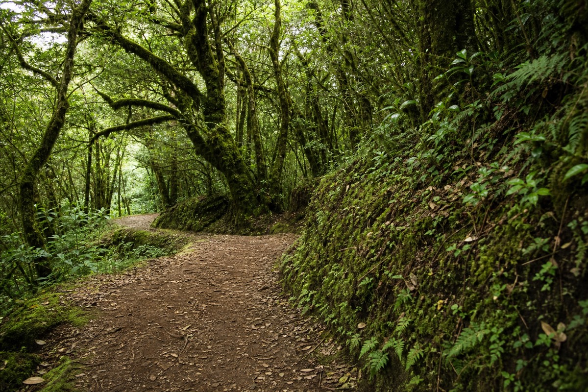
Cerro Verde is the honest alternative and I do not say that as a consolation. The park sits at about 2,000 m in the saddle between the three volcanoes, the extinct crater has grown over completely, and its shaded paths move at a barely noticeable grade past viewpoints toward Izalco's black cone. For a family with a grandparent and a toddler it is the better day, full stop. The Cerro Verde park guide covers the trails and how the park pairs with a summit day for the fitter members of a group.
Then there is the water. The volcano's crater lake is sulfuric, acidic and off limits, but Lake Coatepeque next door is a warm, swimmable caldera nearly 10 km across, and on the guided day it is where everyone eats lunch. Anyone who skips the climb can still have the lake, and honestly, some of the people who do climb wish they had spent longer there. The Lake Coatepeque guide covers it.
What trips up "easy hike" people most, in Carlos's experience?
Six things: the wrong shoes, too little water, spending all their energy on the pleasant lower trail, treating the descent as the easy part, arriving after 11:00, and expecting the rim to feel like the base. None of these are about fitness. All of them are about respect for a mountain that reads as gentle from the car park.
By my own count, more than a thousand travellers have walked up Ilamatepec with me since 2018, and the people who struggle are rarely the unfit ones. They are the ones who read the word easy, packed accordingly, and met the top third with a surprised face. This is the list I would hand to anyone who chose Santa Ana because it was supposed to be the soft option.
The shoe mistake comes first because it is the most common. Trainers with no ankle support are fine for two-thirds of the trail and a liability on the last third and the whole way down. The reviews that describe the hike as not super easy but not as difficult as anticipated are, I think, mostly describing footing rather than gradient. Ankle support and a ~$2 pole change the experience more than any amount of training would.
Water and pacing come next and they are linked. People who drink too little climb too fast, and people who climb the lower stretch fast arrive at the rock already tired. The group pace exists to stop this. Trust it, even if the guide seems slow.
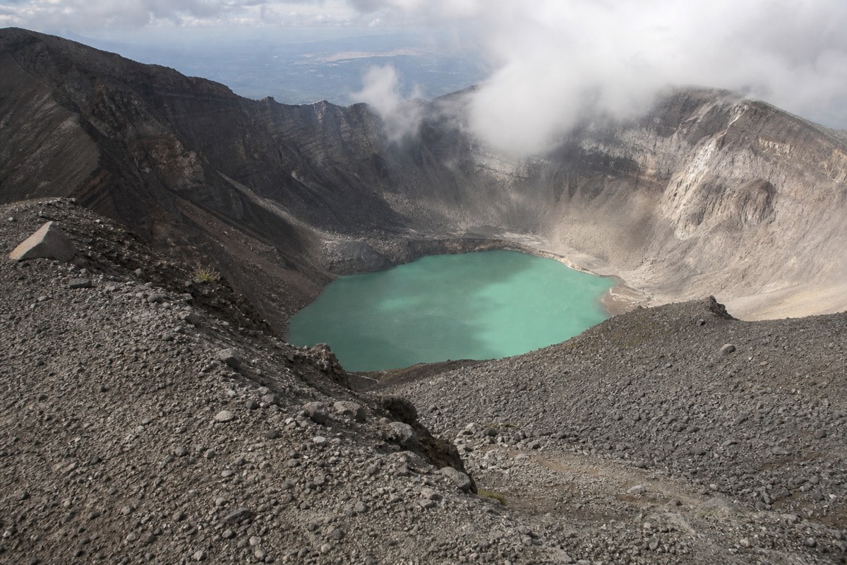
The descent and the rim are the two the mountain teaches for me. Down feels like it should be free and is where the ankle-turns happen on loose rock, so poles stay in hand until the path smooths out. And the rim is a different climate from El Tibet, cooler, windier, exposed. The people in T-shirts leave it early. The people with a layer sit down, buy a paleta and stare at the lake for as long as the ~13:00 closing allows. If you want the full difficulty picture before you commit, the hike difficulty guide breaks it down, and the first-time mistakes post is the longer version of this list. For anyone who would rather have the logistics handled entirely, the guided day tour puts you at the trailhead inside the window with admission covered, which removes the arriving-late mistake before you make it.
Which volcano should a first-timer pick?
Santa Ana, and it is not close. It is the accessible moderate: a real summit inside four hours, a crater lake payoff neither neighbor offers, mandatory guides and a daily group that remove the route-finding, and a version of the day with pickup, admission and lunch already handled.
The practical case seals it. Access is managed and cheap, $3 entrance for foreigners, about $4 for the group guide, all cash, and the logistics come in two clean flavors. Independent hikers ride bus 248 from Santa Ana city, about $0.70 and 2 hours to the trailhead, for a roughly $17 all-in day. Everyone starting from San Salvador or the beach takes the packaged route: book the guided day tour and check live availability and prices on Viator, which folds hotel pickup, the guided climb with admission included, and an afternoon lunch at Lake Coatepeque into one 7 to 10 hour day, rated 4.9 across 869 reviews.
| Practical question | Cerro Verde | Santa Ana | Izalco |
|---|---|---|---|
| Guide required | Park setting, guided options | Yes, mandatory, ~$4 group | Yes, guided |
| Time on trail | 1 to 2 h easy walking | 3 to 4 h | Longer, steeper day |
| Start constraint | Park hours | Group ascent, last start 11:00 | Guided departures |
| Best for | Non-hikers, families | Nearly everyone | Fit, experienced hikers |
Easy is relative on a volcano. Pick Cerro Verde if you want a walk, Izalco if you want a fight, and Santa Ana if you want what most people actually came for: a summit you can reach, and a crater you will not forget.