Is Santa Ana Volcano Worth It?
An honest verdict on the Santa Ana volcano hike, what the turquoise crater delivers, who loves the day, who should skip it, and when it disappoints.
 Written with Carlos Hernández, Santa Ana Volcano tour guide & hiking specialist
Short answer
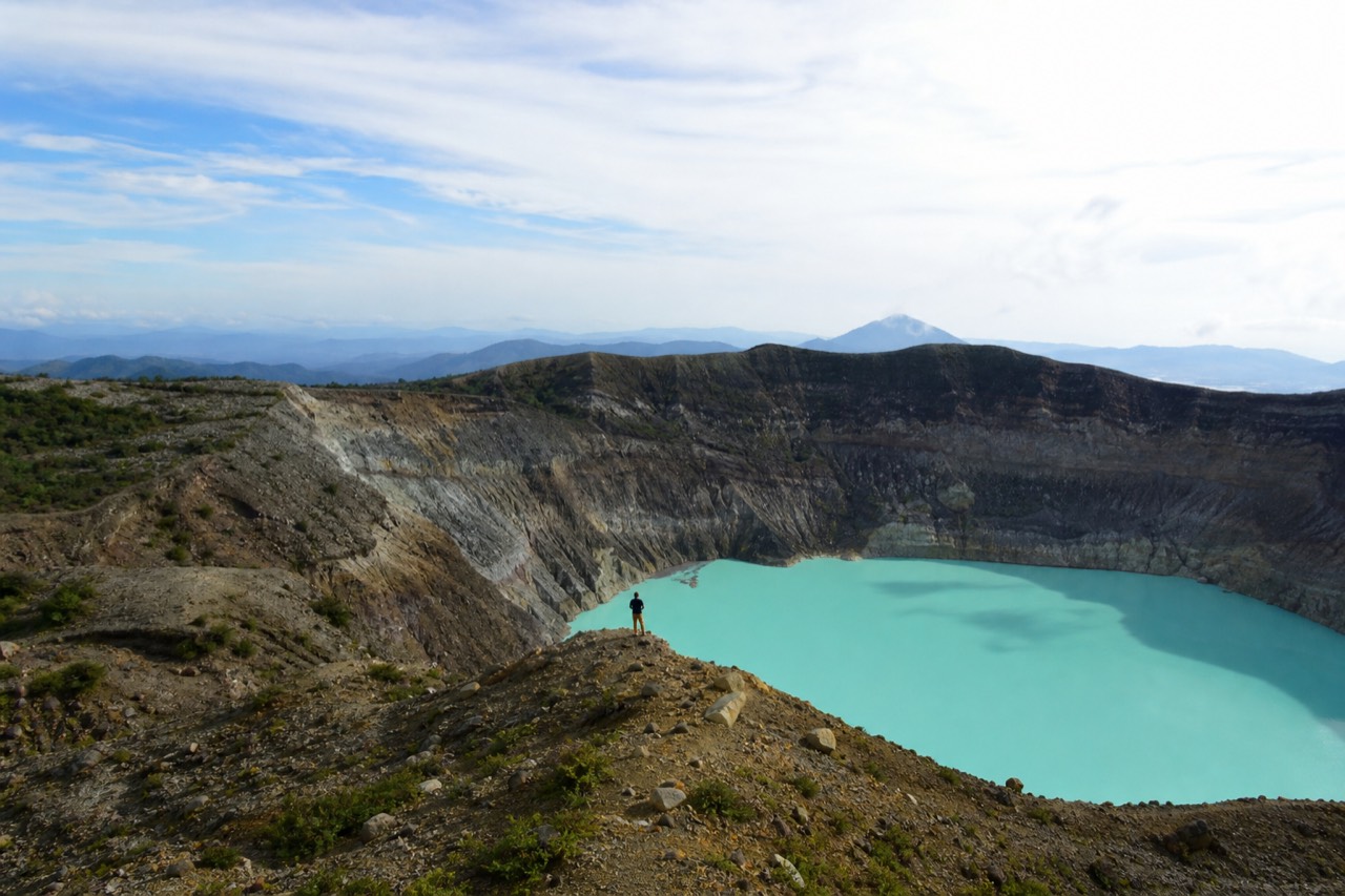
For most travelers, yes. Santa Ana is El Salvador's highest volcano at 2,381 m, the summit holds a steaming turquoise crater lake, and the climb is moderate, about 3 to 4 hours round trip. The honest cons are strong sun, a fixed late-morning start window, and occasional cloud over the crater.
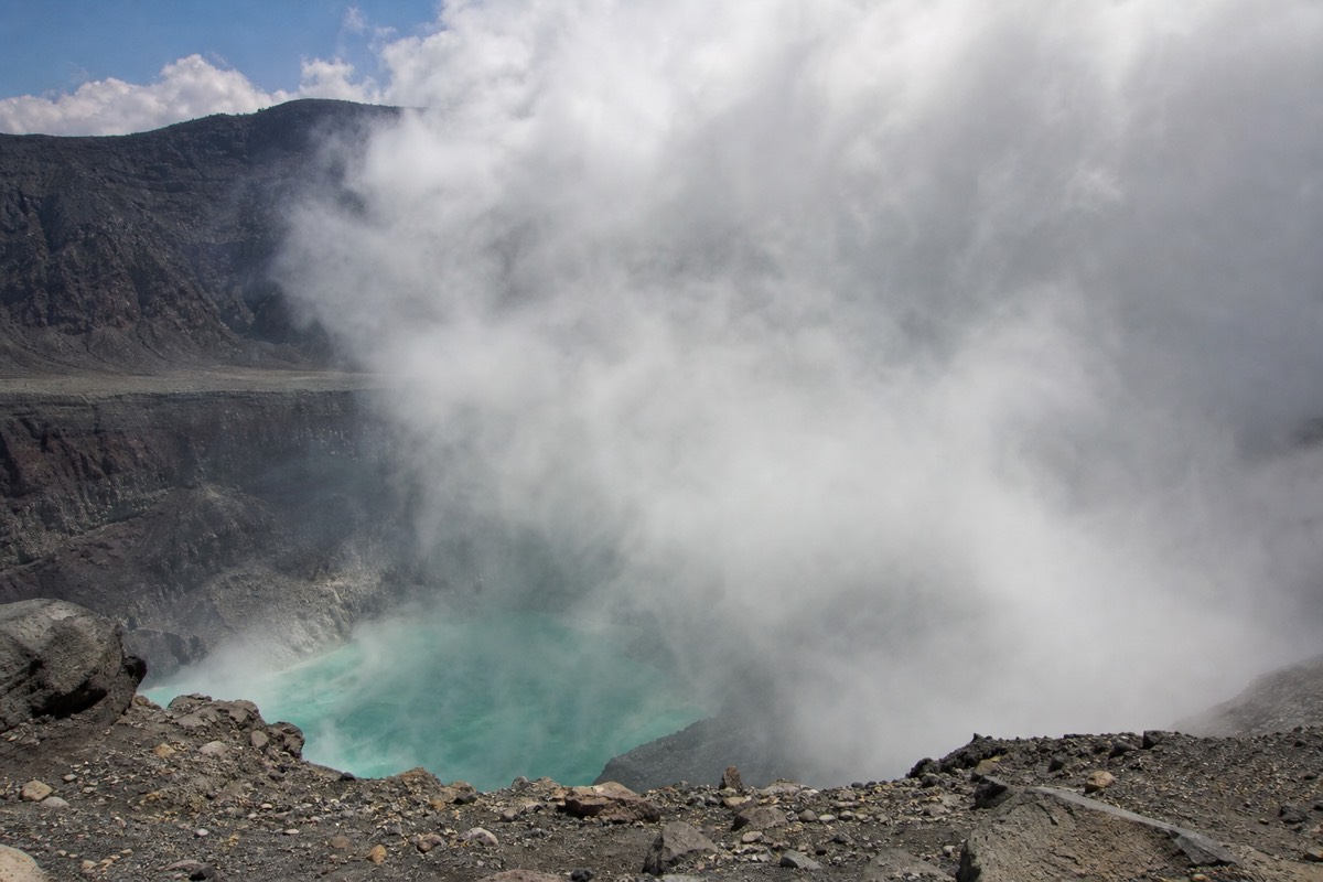
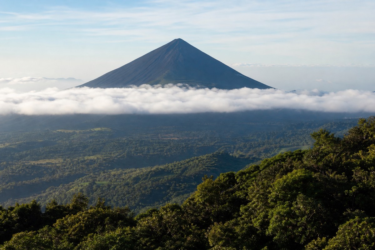
People ask me one question more than any other, sometimes over coffee in Santa Ana, sometimes by message before they even land: is the volcano really worth a whole day? I have walked that trail season after season since 2018, and the rim still stops me mid-sentence. Steam drifting off water the color of glass cleaner, and the black cone of Izalco standing off to the side. But you deserve the honest answer, not the postcard one, so here it is with the cons included.
Is Santa Ana Volcano worth it?
Yes, for most travelers. Santa Ana is the highest volcano in El Salvador at 2,381 m, the summit crater holds a turquoise, sulfuric lake you will not see anywhere else in the country, and the effort is moderate: 6.9 km round trip, about 470 m of gain, done in 3 to 4 hours.
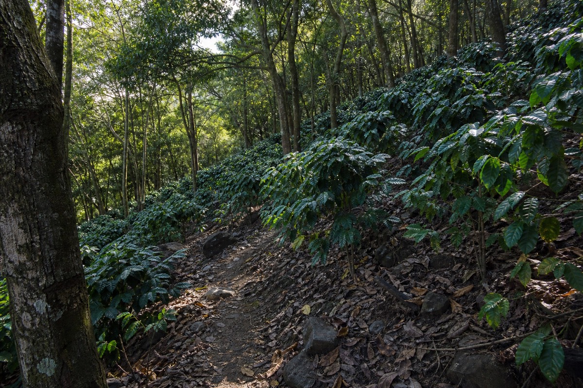
The numbers back the feeling. The trail carries a 4.8 rating on AllTrails, and the guided day that pairs the climb with Lake Coatepeque sits at 4.9 across 869 Viator reviews with a Badge of Excellence. Recent hikers describe it as "not super easy but not as difficult as anticipated," which matches what I see on the trail: people of ordinary fitness reach the rim, catch their breath, and forget they were tired.
What makes it worth a full day rather than a quick stop is the range packed into one climb. You start in shaded farmland, cross old lava, and finish on a bare rocky crest with the crater below you and, on clear mornings, Lake Coatepeque glinting to the east. There is even a man selling paletas at the summit, and I have never seen anyone regret buying one. If you want the trail broken down step by step before you commit, my full walkthrough of the climb itself covers every stage.
What do you actually get for the effort?
A moderate half-day of walking buys you the summit of the country's highest volcano, a live steaming crater lake, views across to Izalco and Cerro Verde, and, on the guided day, a lakeside lunch at Coatepeque afterwards. The effort-to-reward ratio is one of the best I know in Central America.
Here is the exchange rate, stage by stage.
| Stage | Effort | What you get back |
|---|---|---|
| Trailhead to forest edge | Easy walking, gentle grade | Shade, birdsong, coffee-country views |
| Mid-mountain switchbacks | Steady climbing, the sweaty part | Izalco's black cone appearing beside you |
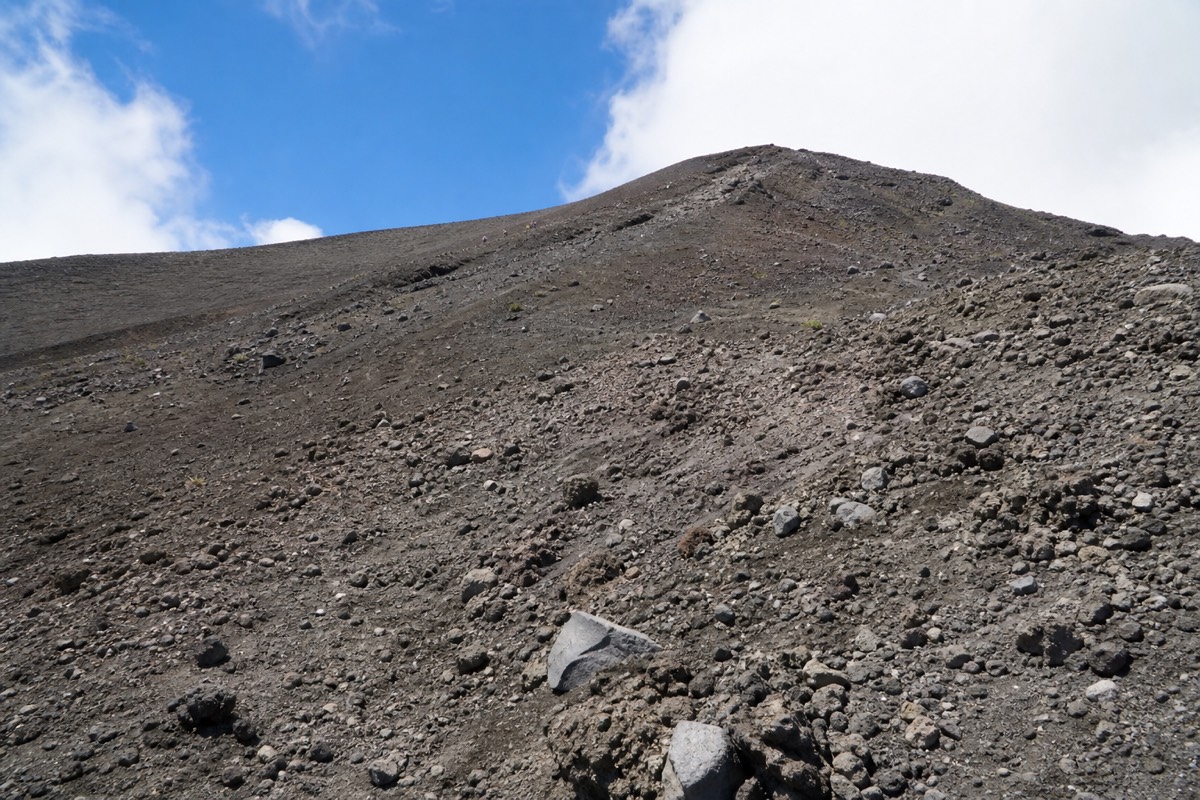
| Rocky summit push | Loose volcanic rock, hands-out scrambly moments | The rim, arriving all at once |
| Crater rim | Standing still, wind in your face | The turquoise lake steaming 2,381 m up |
| Descent | Knees and ankles working, poles help | Paletas, and lunch at Coatepeque on the guided day |
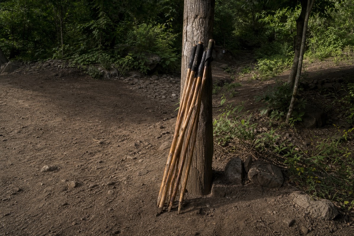
Total moving time runs about 2 hours up and 1.5 down. The gain of roughly 470 m is real but honest: no false summits, no brutal sustained steepness. Poles rent for about $2 at the trailhead and reviewers keep praising them, especially for the rocky top section on the way down.
Who gets the most out of it, and who should skip it?
Anyone of ordinary fitness who can walk uphill for two hours will enjoy Santa Ana. It suits first-time volcano hikers, photographers, and travelers short on time. Skip it if you have back or heart problems, are pregnant, need wheelchair access, or refuse to walk on loose rock.
My honest scorecard, from watching hundreds of groups reach the rim:
| Traveler type | Worth it? | Why |
|---|---|---|
| First-time volcano hiker | Absolutely | Moderate trail, mandatory local guide, huge payoff |
| Keen hiker chasing a challenge | Yes, with a caveat | Rewarding but short; pair it with steeper Izalco |
| Photographer | Yes | Crater lake, Izalco cone, Coatepeque views in one frame |
| Traveler with limited mobility | No | Not wheelchair accessible, rocky upper trail |
| Back or heart conditions, pregnancy | No | The operator excludes these for good reason |
| Family with walking-fit kids | Usually yes | The fixed group pace keeps everyone together |
The guide requirement removes the biggest risk for beginners. Every hiker joins the daily group ascent with a mandatory local guide, so nobody route-finds alone, and the pace is set for the whole group rather than the fastest person.
When does Santa Ana disappoint?
Three things let people down: cloud sitting on the crater, the strong sun on the exposed upper trail, and the rigid schedule, with the last group start at 11:00 and the crater area closing around 13:00. All three are manageable if you pick your season and come prepared.
I will not pretend every day is a postcard. In the green season, May through October, afternoon cloud builds fast, though the late-morning ascent window mostly beats it. December through April brings the clearest water and the longest views.
| Disappointment | When it happens | How to avoid it |
|---|---|---|
| Crater hidden in cloud | Green-season afternoons mostly | Hike Nov to Apr, or trust the late-morning window |
| Sunburn and dehydration | Any clear day on the open upper trail | 2 L of water, hat, sunscreen, no exceptions |
| Missing the start window | Arriving after 11:00 | Book transport that plans around the fixed schedule |
| Sore ankles on the rocks | The descent, mostly | Real shoes with ankle support, rent poles for $2 |
The schedule trips up more independent travelers than the weather does. The group ascent starts around 9:30 to 10:00, and there is no workable public transport from San Salvador or El Tunco that reliably hits that window. Full timing detail is in my guide to the best months and hours for the climb.
What does a worth-it day actually look like, hour by hour?
A good Santa Ana day is front-loaded. You are moving by 7:00 to 8:00 wherever you start, at the trailhead area before the group forms around 9:30 to 10:00, on the rim close to noon, off the crater before it closes around 13:00, and eating lunch by Lake Coatepeque or back in town by mid-afternoon.
The schedule is the part people underestimate, so here is a worked example built on the fixed pieces: the group ascent window, the 11:00 last start, the roughly 2 hours up and 1.5 down, and the drive times from each base.
| Time | From San Salvador on the guided day | From Santa Ana city by bus 248 |
|---|---|---|
| 7:00 to 7:40 | Hotel pickup, coffee in the van | Bus leaves La Vencedora terminal, about $0.70 |
| 8:30 to 9:30 | Arrive at the park after roughly 1 to 1.25 h of driving | Still on the bus; allow around 2 h to El Tibet |
| 9:30 to 10:00 | Group forms, guide briefing, poles for about $2 | Same group, same guide, same briefing |
| 10:00 to 12:00 | The climb: forest, switchbacks, rocky push | Same trail, same pace |
| Around 12:00 | Rim, crater, photos, a paleta | Rim, crater, photos, a paleta |
| 12:00 to 13:30 | Descent, crater area clears around 13:00 | Descent, then wait for the afternoon bus back |
| Afternoon | Lakeside lunch at Coatepeque, drive back | Roughly 2 h back to Santa Ana city |
Two things jump out. First, both versions climb together, because everyone joins the same daily ascent with a mandatory local guide. Second, the guided version has slack built in: the van reaches the park with time to spare, and the day ends at a lake instead of a bus stop. Missing the 11:00 cutoff is the one failure that cannot be repaired, and it is far easier to miss on a self-drive from the coast than on a scheduled pickup.
If you want the whole clock laid out for one specific start point, my guides to doing the climb from San Salvador and from El Tunco show where the minutes go.
How much does a worth-it day cost in cash?
Very little on the mountain itself. Park entrance is $3 for foreigners, the group guide fee runs about $4 per person, parking is $3, and poles rent for around $2, all cash in US dollars. One traveler reported a full DIY day from Santa Ana city at roughly $17. The guided day folds admission and lunch into one booking.
The mountain is one of the cheapest big experiences in Central America, and the cash math is simple enough to do on the bus.
| Item | Cash cost | Notes |
|---|---|---|
| Park entrance, foreigner | $3 | Salvadorans pay $1.50; cash only |
| Local group guide | About $4 per person | Mandatory; private guides run roughly $35 to $40 |
| Parking | $3 | Only if you drive |
| Trekking poles | About $2 | Rented at the trailhead, worth it for the descent |
| Bus 248, each way | About $0.70 | Santa Ana city to the trailhead area |
| Summit paleta | Small change | The sale nobody regrets |
| Reported DIY total | Roughly $17 | One traveler's April 2025 report, all-in from Santa Ana city |
The fees are collected in cash and there is no card reader on a volcano, so bring small bills. Where the value shifts is transport. From Santa Ana city the bus is nearly free. From San Salvador, El Tunco, or El Zonte there is no public route that meets the group window, which means a hire car, a taxi, or the guided day, and at that point the admission and the Coatepeque lunch already sitting inside the tour price change the comparison. I break the full comparison down in my guide to what the volcano day costs; the short version is that the mountain is cheap and the logistics are what you pay for.
Which months tilt the verdict, and which make it a gamble?
November through April is the safest bet: dry air, the clearest turquoise, the longest views to Izalco and Coatepeque. May through October is greener and lusher, with afternoon cloud that the late-morning ascent mostly beats. No month is a write-off, but the dry season is where "worth it" becomes near-certain.
I get asked for the single best month, and I resist, because the two seasons trade different things. Here is how I would score them as planning guidance, not a forecast.
| Period | Crater clarity | Trail greenery | Cloud risk on the rim | My planning note |
|---|---|---|---|---|
| November to January | Best of the year | Fading from the rains | Low | Book the earliest pickup you can, and pack a layer for the wind |
| February to April | Excellent | Dry, dusty on the upper trail | Low, sun is the issue | Hat, sunscreen, water; the crater is at its most vivid |
| May to July | Good in the late morning | Bright green everywhere | Builds after midday | Trust the ascent window; it clears the crater before the cloud arrives |
| August to October | Variable | Peak lush | Highest of the year | Still worth it; treat a clear rim as a bonus, not a promise |
The mechanism behind the table is simple. The group ascent starts around 9:30 to 10:00 and puts you on the rim before the afternoon build-up, which is why even green-season hikers usually get their photo. The summit is cooler and windier than the base in every month, so the layer is not optional. If you have flexibility, my full breakdown of the best time to hike goes month by month.
What mistakes make people say it was not worth it?
In my experience since 2018, the unhappy hikers made one of five errors: they arrived after 11:00 and were turned away, they brought too little water, they wore the wrong shoes for the loose upper rock, they expected to swim in the crater, or they came in a green-season afternoon and met the cloud. Every one is avoidable.
I keep an informal tally of why a client's day went wrong, and it almost never involves the mountain itself.
| Mistake I see weekly | What it costs | The fix |
|---|---|---|
| Arriving after the 11:00 last start | The whole climb, no exceptions | Plan transport around the window, or take a pickup that does |
| Half a liter of water for a four-hour hike | Headache, cramps, a miserable descent | Carry a real supply; the trail is exposed above the forest |
| Fashion trainers on the rocky top section | Rolled ankles on the way down | Shoes with ankle support, plus poles for about $2 |
| Expecting to swim at the summit | Disappointment at the rim | The crater lake is acidic and prohibited; Coatepeque is the swimming lake |
| Skipping breakfast because of an early pickup | Running out of energy on the switchbacks | Eat, and carry something for the rim |
The 11:00 cutoff deserves the emphasis it gets. There is no negotiating with it, and the people who reach the gate at 11:20 after a rushed drive from the coast are the only genuinely heartbroken visitors I meet. Guides Josue, Gaby, and Diego, all praised by name in recent reviews of the guided day, run their groups on the same clock. I collected the rest of the pattern in a post on first-time mistakes on the volcano, and it is worth ten minutes before you go.
Is it still worth it if the crater is hidden?
Mostly yes. Even with the lake in cloud you climb El Salvador's highest volcano, walk from coffee farmland through cloud forest to bare rock, watch Izalco's black cone appear beside you, and on the guided day finish with lunch at Lake Coatepeque. The crater is the headline, not the whole show.
I will not oversell a cloudy rim; nobody wants to stand at 2,381 m looking into grey. But the mountain has more than one payoff, and it helps to know them before you decide whether a green-season date is worth the risk.
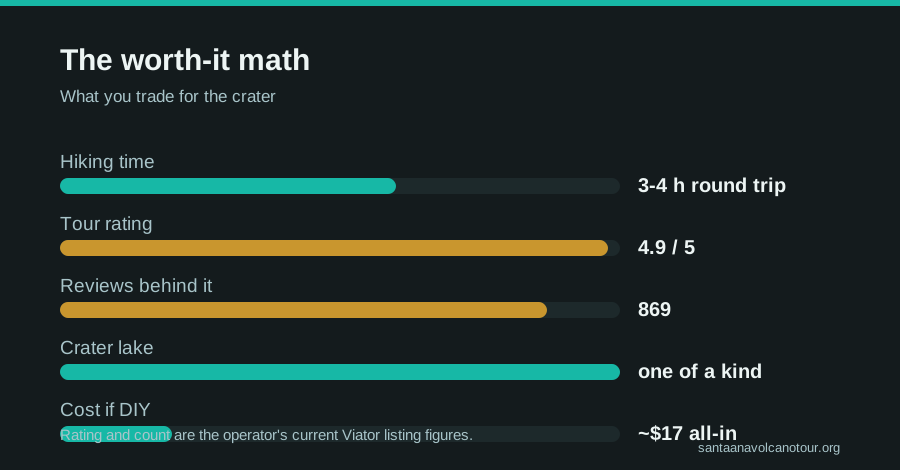
The lower trail is a full landscape change in under 7 km. You start among coffee plants under shade trees, climb through forest, cross old lava, and end on a wind-scoured crest. Izalco, the "Lighthouse of the Pacific," reveals itself as you gain height and is often below the cloud when the summit is not. Lake Coatepeque, the caldera lake roughly 10 km across, sits to the east and frequently stays visible even when the crater does not. And cloud on Santa Ana tends to move rather than sit; groups that wait ten minutes at the rim often get their window.
Then there is the rest of the day. On the guided day you descend to a lakeside lunch at Coatepeque, where reviewers this year mention jet-ski rental and a swim, none of which depends on the summit weather. If the forecast is grim and you can shift by a day, the free cancellation to 24 hours on the guided day tour is exactly the lever to pull. If you cannot shift, go anyway. In all my seasons I have had very few clients wish they had stayed in bed.
Is the guided day worth it compared with doing it yourself?
If you are based in Santa Ana city, the DIY bus day is cheap and doable. From San Salvador, El Tunco, or El Zonte, the guided day wins: hotel pickup, admission included, the timing handled for you, plus a lakeside lunch at Coatepeque, all rated 4.9 across 869 reviews.
The DIY version is real and I respect it. Bus 248 leaves La Vencedora terminal in Santa Ana around 7:30, costs about $0.70, and takes roughly two hours to the trailhead. One traveler reported an all-in day of about $17 including entrance, guide fee, parking, and a paleta at the top. But that math only works from Santa Ana city, and you still carry the risk of missing the 11:00 cutoff.
From anywhere else, the logistics eat the savings. That is why, for most itineraries, I tell people to book the guided day tour and check live availability and prices on Viator, because it folds the drive, the admission, the group timing, and the Coatepeque lunch into one door-to-door day with free cancellation up to 24 hours. Groups stay small, capped at 20 and usually running around 10.
How do you tilt the odds toward a great day?
Come between November and April for the clearest crater, carry 2 L of water and real sun protection, wear shoes with ankle support, and build your transport plan around the fixed late-morning ascent. Do that and Santa Ana almost never disappoints.
One last honest note. The summit is cooler and windier than the base, the lake is sulfuric and strictly off-limits for swimming, and the whole crater area empties by early afternoon. None of that diminishes the day; it just rewards the people who show up ready. Pack right using my what to bring checklist, pick your season, and the odds are firmly on your side. The official tourism board's page on Ilamatepec calls it one of the country's signature experiences, and after all these years on the trail, I have no argument with that.