How Hard Is the Hike, Really?
An honest difficulty guide to the Santa Ana volcano hike: real trail stats, how it compares with hikes you know, and what to expect at every fitness level.
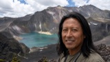 Written with Carlos Hernández, Santa Ana Volcano tour guide & hiking specialist
Short answer
The Santa Ana volcano hike is genuinely moderate: 6.9 km round trip, about 470 m of gain, roughly 2 hours up at a guided group pace. The only technical part is loose rock near the rim. Most people of average fitness finish comfortably; reviewers keep saying it was easier than they feared.
The question I get more than any other, on the trail and in my inbox, is some version of "will I make it?" I have watched teenagers sprint the climb and I have watched their parents grind it out twenty minutes behind them, and by my own count over a thousand travellers have asked me this since 2018. Almost all of them made the rim. So let me answer it properly, without the vague "moderate" label doing all the work.
How hard is the Santa Ana volcano hike?
Moderate, and honestly rated for once: 6.9 km round trip, about 470 m of elevation gain to the 2,381 m summit, around 2 hours up and 1.5 down. The grade stays reasonable until a rocky final stretch. A recent reviewer put it well: not super easy, but not as difficult as anticipated.
The full picture sits in the numbers. The route holds a 4.8 star rating on AllTrails with difficulty logged as moderate, and the guided groups move at a deliberately humane pace with breaks built in. You climb with the day's group and a mandatory local guide, so nobody is racing you. The two honest challenges are the loose volcanic rock in the last section and the sun once the forest cover ends. Neither requires training. Both punish flip-flops.
Altitude, the thing people fear most, barely registers here. The summit sits at 2,381 m, below the elevations where altitude sickness typically becomes a concern, and you sleep far lower the night before. You may breathe harder near the top. You will not be counting your fingers.
How does it compare with hikes you might already know?
Think of it as a solid half-day mountain walk, well above a paved tourist lookout, well below anything requiring a headlamp and a base camp. If you have done any popular day hike with a few hundred meters of climbing, Santa Ana will feel familiar.
| Hike | How it compares | The verdict |
|---|---|---|
| Santa Ana (Ilamatepec) | 6.9 km round trip, ~470 m gain, 3 to 4 hours | The baseline: moderate, guided, one rocky stretch |
| A short urban crater walk (Diamond Head type) | Far shorter, a fraction of the climbing | Santa Ana is a real step up from lookout hikes |
| Angels Landing, Zion (minus the chains) | Similar order of distance and gain | If that climb felt fine, this one will too |
| Overnight volcano treks (Acatenango type) | Multiples of the gain, camping near 4,000 m | A different sport; Santa Ana is one comfortable morning |
| Izalco, next door | Shorter but steeper, on loose black scoria | Noticeably tougher on the legs than Santa Ana |
The comparisons are about feel rather than decimal-point matching, but they hold up. Izalco is the one people underestimate: that beautiful black cone you photograph from the Santa Ana trail is a harder, scree-filled climb, which is why most first-timers pick Ilamatepec.
How hard is it at your fitness level?
Regular walkers finish with energy to spare. Sedentary but healthy hikers finish slower and sore, and still finish. The trail only becomes a bad idea if you have heart, back or knee trouble, or if you are pregnant, which is also where the tour operator draws its own line.
| Your fitness level | Expected experience | Time up |
|---|---|---|
| Hikes or runs regularly | Comfortable, breaks feel optional | Under the standard 2 hours |
| Walks often, no training | Steady effort, breathing hard on the rocky part | ~2 hours with the group |
| Mostly sedentary, healthy | Hard but achievable, legs sore next day | Rear of the group, still inside the window |
| Heart, back or serious knee issues | Not recommended | The featured tour excludes these conditions |
| Pregnant travellers | Excluded by the operator | Save it for another trip |
Two practical notes on that table. First, the group pace is the great equalizer: the guide sets a rhythm the slowest comfortable hiker can hold, and the ascent window has slack built into it. Second, the restrictions are not lawyer decoration. The descent loads knees and lower backs on loose rock for a solid hour, and there is no vehicle access to the rim. The featured guided day is also not wheelchair accessible for the same reason.
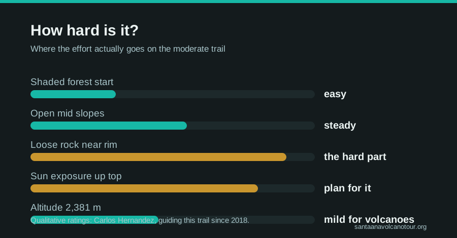
What actually makes it hard?
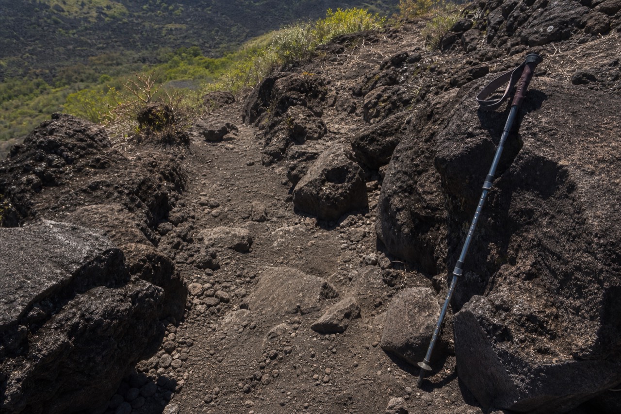
Not the distance and not the altitude. The difficulty concentrates in three things: loose rock underfoot near the summit, full sun exposure on the upper half, and wind at the rim. Each one has a cheap, boring fix you can arrange before you take a single step.
| Challenge | How bad is it | The fix |
|---|---|---|
| Loose volcanic rock near the top | The main event, slow going both ways | Real shoes with grip, ~$2 rental poles |
| Sun exposure above the treeline | Draining by late morning | Sunscreen, hat, 2 L of water |
| Wind and chill at the rim | Surprising after a sweaty climb | One packable layer |
| The fixed pace of a group ascent | Mildly annoying for fast hikers | Accept it, enjoy the views |
| Early logistics to make the window | The real filter for most visitors | Organized transport or a very early bus |
Notice what is missing from that table: anything you can train for. Preparation for Santa Ana is a packing problem, not a gym problem, and I keep the full list in what to bring for the climb. MARN, which monitors the volcano, keeps its own advice short: do not improvise the ascent, carry water, leave no litter.
The season shifts the difficulty more than people expect. Dry-season mornings from November to April are hot and clear; green-season hikes from May to October trade heat for humidity and afternoon cloud, which the late-morning group start mostly beats. Timing strategy has its own page in the best time to hike.
Who should skip this hike, honestly?
Anyone with heart trouble, serious back or knee problems, or a pregnancy should sit this one out; those are the operator's own exclusions on the featured day and they match what the descent does to a body. Wheelchair users cannot reach the rim, there is no vehicle access. Everyone else, including nervous non-hikers, is usually fine.
I would rather lose you as a reader than have you learn this at the rocky section. The Santa Ana hike is moderate, and moderate is honest, but the word hides one specific load: about 470 m of descent on loose volcanic rock with tired legs. That hour is what the exclusions protect. It is not the altitude, which peaks at 2,381 m, and it is not the distance.
| Situation | My honest call | Why |
|---|---|---|
| Heart condition | Skip it | Sustained uphill effort with no quick way down |
| Serious back or knee issues | Skip it, or talk to your doctor first | The 1.5 hour descent on loose rock loads both hard |
| Pregnant | Skip it this trip; the operator excludes it | Same descent, plus a remote trailhead |
| Wheelchair user | Not possible | No vehicle access to the rim; the featured day is not accessible |
| Nervous but healthy | Go, at the back of the group | The pace is set for the slowest comfortable hiker |
| Fit but scared of heights | Go; the rim is wide and managed | Guides keep everyone inside the safe section |
| Very young children | Ask yourself about 3 to 4 hours of walking | The window and pace are fixed; there is no shortcut down |
The last row is a judgment call, so let me be careful with it. I have seen families do this well, and I have seen a small child carried the last stretch by a parent who did not enjoy it. The mountain does not care about ages; it cares about whether someone can walk uphill for two hours and downhill for one and a half, on rock, at a group pace, without an exit route. If that describes your child, come. If it does not, Cerro Verde park has gentler trails, and the guided day itself will still put the rest of the family on the rim.
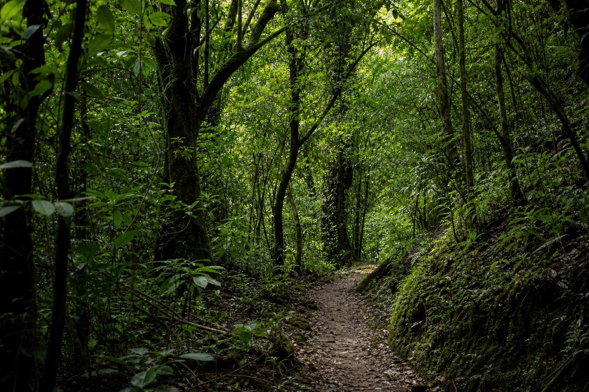
Is going down harder than going up?
Different, not harder, and for many people yes. The climb costs lungs and about 2 hours; the descent costs knees and balance for about 1.5 hours, most of it on the same loose rock you struggled up. Poles rented at the trailhead for around $2 and shoes with real grip flip the descent from scary to routine.
Everybody trains for the way up. Almost nobody thinks about the way down, and yet the descent is where I see the slips, the sore knees the next day, and the quiet swearing. The physics is simple. On the climb, loose rock steals a little of each step. On the descent, it steals your braking, and you are already tired.
| Direction | Time (allow) | What hurts | What helps |
|---|---|---|---|
| Up | ~2 hours | Lungs and calves, sun on the upper half | Slow steady pace, water early, breaks at the views |
| Down | ~1.5 hours | Knees, ankles, concentration on loose rock | Poles, short steps, ankle support, no hurry |
| The rocky stretch, both ways | The slowest part of each direction | Footing more than fitness | Grip soles, poles, following the guide's line |
Poles matter more than any other purchase and cost about $2. Reviewers from the last two seasons keep saying the same thing, and having watched the difference on the loose section for years I agree: they turn a knee-jarring skid into a controlled walk. Ankle support helps too, and recent hikers mention it specifically. If your knees already complain on stairs, this descent is the reason to think twice, and it is exactly the load the operator's exclusions on the featured day are pointing at. The step-by-step of the loose-rock section, up and down, is in the full trail walkthrough.
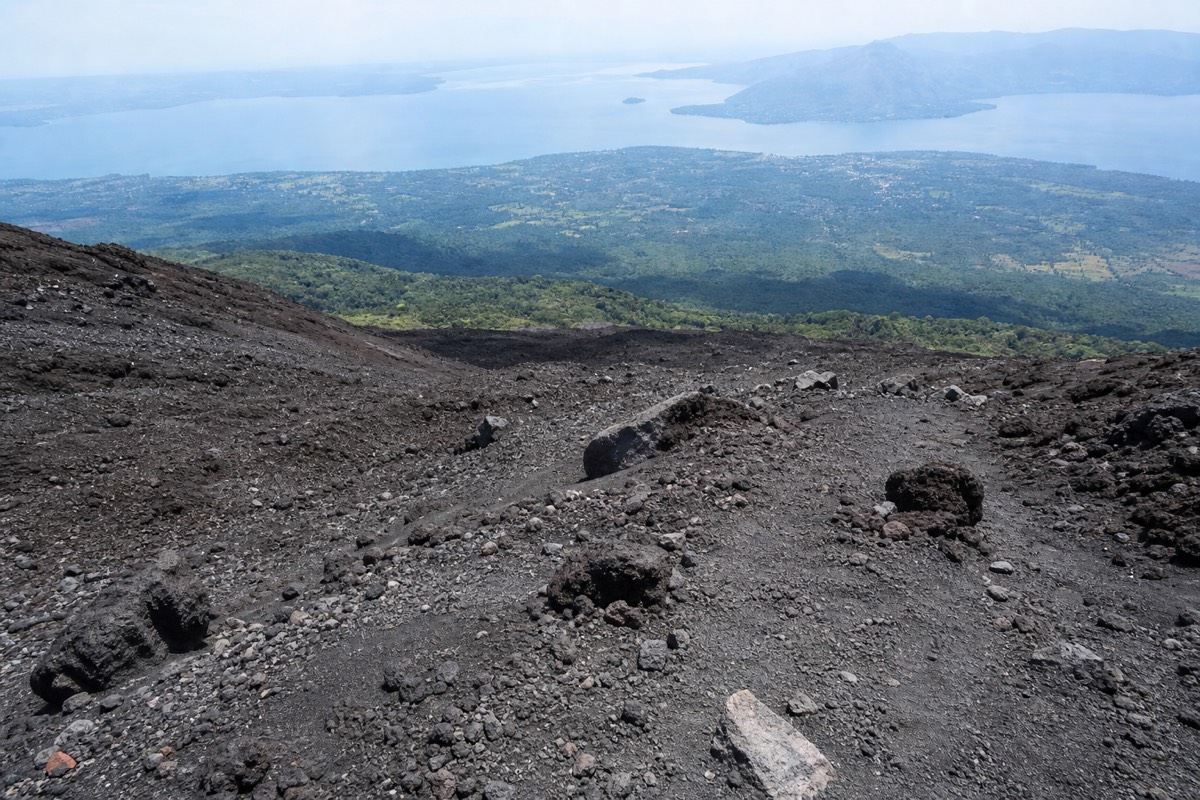
How does the ascent window change the difficulty?
It removes the option of going slow whenever you like. Groups start between about 9:30 and 11:00, the crater area closes around 13:00, so a late start compresses your rim time rather than extending the day. The pace itself stays humane; the pressure is on the morning logistics, not your legs.
The window is the part of this hike that outsiders never factor into "how hard is it". You cannot begin at dawn to beat the heat, and you cannot start at two in the afternoon because you slept in. Every ascent runs with a mandatory local guide, and the guides move the day's visitors up together, so the difficulty has a clock attached to it.
| Your start | Time you reach the rim (allow) | Rim time before the ~13:00 close | Effect on effort |
|---|---|---|---|
| ~9:30 to 10:00 | ~11:30 to 12:00 | Roughly an hour | Relaxed pace, long breaks possible |
| ~10:30 | ~12:30 | About half an hour | Fine, slightly brisker |
| 11:00, the last start | ~13:00 | Little to none | The guide will keep you moving; no dawdling |
The lesson from that grid is that the earliest group is the easiest group, not because the trail changes but because you can afford to stop. This is also where the guided day earns its keep for anyone worried about effort: the transport is built to land you at the trailhead for the early start, so the whole climb happens with slack in it. From Santa Ana city, bus 248 at around 7:30 to 7:40 does the same job for about $0.70; from San Salvador or El Tunco there is no public option that fits, which is a difficulty of a different kind, and the routes are compared in getting to the volcano.
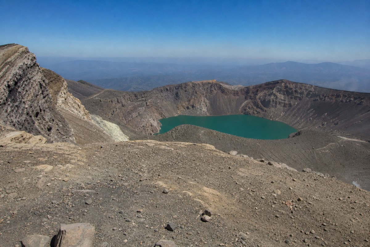
What pacing do I actually recommend?
Slower than you want for the first hour, steady through the open middle, then deliberately careful on the rocky push. Drink at every stop, not just when thirsty. Budget around 2 hours up including breaks; the guide sets the group rhythm and the slowest comfortable hiker is the right speed. Racing buys you nothing but a shorter time on the rim.
This is the pacing plan I give nervous hikers, and it is planning advice from a guide who has walked this trail since 2018, not a rule from any operator. The point is to arrive at the rim with something left, because the rim is the reason you came.
| Stretch | Pace I suggest | Where to stop |
|---|---|---|
| Lower forest, first ~30 minutes | Easier than feels natural | Once, briefly, to settle your breathing |
| Forest climb, next ~30 to 35 minutes | Steady, conversational | At the top of the trees, water |
| Open slopes with Izalco views, ~25 to 30 minutes | Steady, hat on, sun cream on | The Izalco viewpoint, everyone stops here |
| Rocky summit push, ~30 to 35 minutes | Slow, poles out, short steps | Whenever the guide pauses; the wind picks up |
| Rim | Stand still and look | Layer on first, then photos |
The trick people miss is that the lower forest is a trap. It rolls more than it climbs, the shade is lovely, and fresh legs want to charge. Charging there costs you on the rocky section an hour later, where the loose rock asks for concentration you have already spent. Walk the forest as if you were saving something, because you are.
Breathing hard near the top is normal, not a sign that altitude is getting you; the summit at 2,381 m sits below the elevations where that usually becomes a concern. If a stop feels wanted, take it, look back at Coatepeque, and let the group compress around you. I have never once seen a guide leave a hiker behind for pausing.
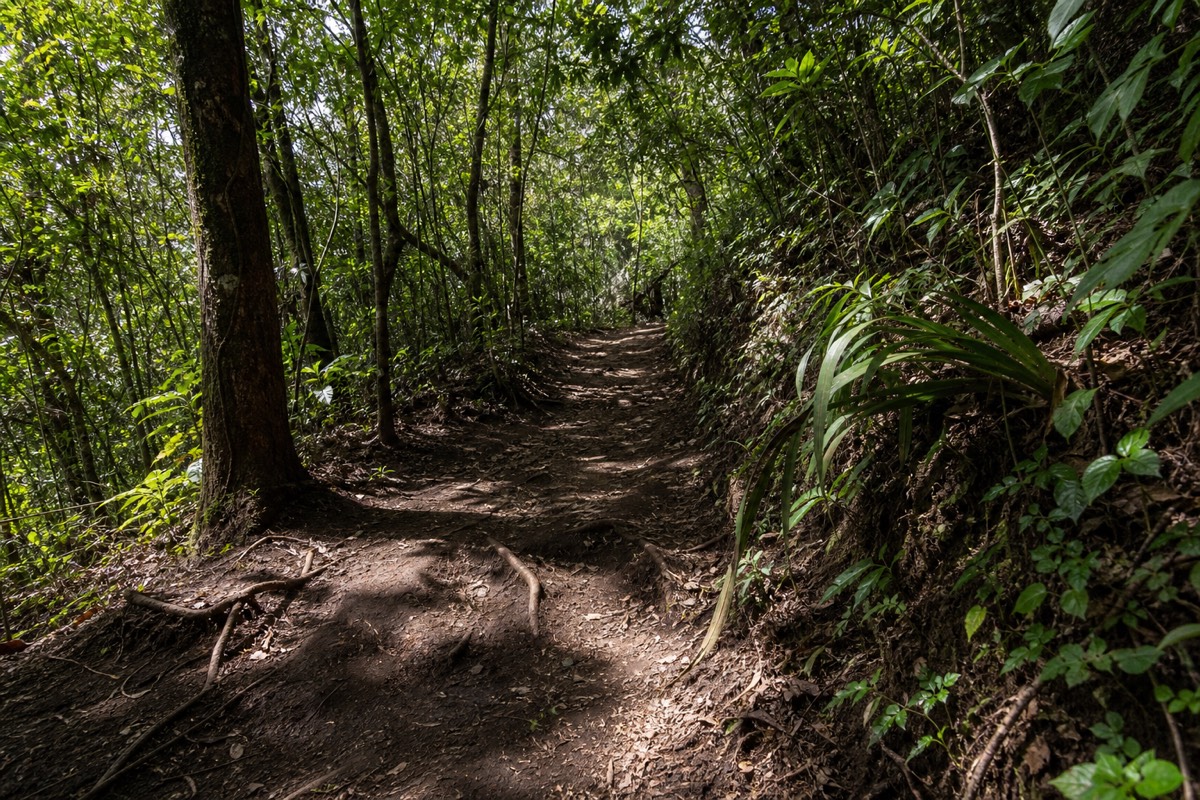
How much does the season change the effort?
Same trail, different tax. Dry season, November through April, taxes you with sun on the open upper half and asks for the full 2 liters of water. Green season, May through October, trades heat for humidity, softer footing under the trees and afternoon cloud, which the late-morning group start mostly beats. Neither season makes the climb harder in a way training would fix.
I get asked whether the rainy months make the hike "too hard", and the answer is that they change what tires you, not how tired you get. Heat is a slow tax; humidity is a sticky one. In the dry months the payoff is the clearest crater of the year, so the trade is worth it, and I tell people to be in the first group so the open sections are behind them before the sun peaks. In the green months the forest is dense and cool and the light is softer, the loose rock is the same loose rock, and the cloud that can hide the lake usually arrives after the ascent has already put you on the rim.
In the dry months the main tax is sun and heat above the treeline, the footing is firm with the usual loose rock near the top, and being in the early group means the open half is behind you in gentler light. In the green months the tax is humidity and the occasional muddy patch under the trees, the rock up high is exactly the same rock, and the late-morning start mostly beats the afternoon cloud. At the rim, in any month, the tax is wind and a real chill after a sweaty climb, on loose rock with managed access; reach it before the ~13:00 close and it is calm enough to enjoy.
The rim wind deserves a line of its own because it surprises everyone. You climb sweating and arrive shivering; one packable layer fixes it in every month of the year. Season-by-season timing, and the argument for the dry months if crater color is your entire goal, is laid out in the best time to hike, and the honest green-season experience is written up in the rainy season hike report.

Does the guided day actually make it easier?
Physically, the mountain is the mountain. What the guided day removes is every difficulty around the climb: the pre-dawn logistics, the ascent window stress, the admission line, and the post-hike collapse. It scores 4.9 across 869 Viator reviews, with recent groups reporting around 10 people.
The hardest part of Santa Ana for most foreign visitors is not on the trail at all. It is getting to a remote trailhead by 11:00 from San Salvador or the surf towns, with cash, on the right morning. Reviewers on the featured day consistently praise the same things: small groups, guides like Josue, Gaby and Diego who read the group's pace well, and the moment the hike ends and someone else drives you to lunch at Lake Coatepeque. If your worry is the effort itself, that support matters more than any training plan, so book the guided day tour and check live availability and prices on Viator with free cancellation up to 24 hours before, in case your legs talk you out of it. They will not.
My final word, the one I give nervous hikers at the trailhead: the mountain meets you where you are. The full step-by-step trail walkthrough shows exactly where the effort lands, and none of it lands all at once. Go slow, drink early, and let the crater do the showing off. The official tourism board calls Ilamatepec one of the country's signature climbs at elsalvador.travel, and it earns that standing precisely because ordinary people summit it every single morning.