Five Mistakes I Watch First-Timers Make on Ilamatepec Every Week
The mistakes first-timers make on the Santa Ana hike week after week, no cash at the gate, late arrival, beach shoes, one small water bottle, the wrong lake.
 By Carlos Hernández, Santa Ana Volcano tour guide & hiking specialist
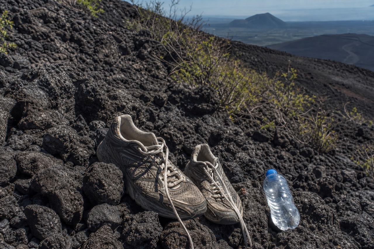
Every Saturday I stand near the trailhead and watch the same five movies play out. A couple digging through pockets for cash that is not there. A taxi rolling in at 11:20 to a closed climb. Somebody in white canvas sneakers eyeing the volcanic rock. I have guided this trail since 2018, more than a thousand travellers by my own count, and the mistakes barely change from week to week. The good news is that all five are cheap to fix and none of them require fitness, gear budgets or luck. They require about four minutes of reading, which is what this is.
Why does nobody bring enough cash to the gate?
Because nothing at the volcano takes cards. Every fee is cash, in US dollars, ideally small bills: $3 park entrance for foreigners ($1.50 for Salvadorans), about $4 per person for the mandatory group guide, $3 for parking, $2 if you want to rent poles. Arrive with at least $15 to $20 per person and the whole gate ritual takes two minutes.
The volcano sits a long way from the nearest ATM, and I have watched people negotiate, plead, and in one memorable case try to pay the guide fee in Guatemalan quetzales. It never works. The fee stack is small, one independent trip report last year put an entire do-it-yourself day at roughly $17 including the paletas at the summit, but it is rigid.
| Cash item | Amount (USD) |
|---|---|
| Park entrance, foreigners | $3 |
| Park entrance, Salvadorans | $1.50 |
| Local group guide | ~$4 per person |
| Parking | $3 |
| Pole rental (optional, worth it) | ~$2 |
| Summit paletas and snacks | a few dollars |
| Private guide instead of group (optional) | ~$35 to $40 |
Bring more than the minimum. Summit ice cream after two hours of climbing is one of this country's great small pleasures, and running out of small bills at 2,381 m is not.
What happens if you arrive after 11:00?
You do not climb. The daily guided ascent starts around 9:30 to 10:00, the last permitted start is 11:00, and the crater area closes at about 13:00. There is no afternoon session, no exception for having driven two hours, and no unguided option at any hour, because a local guide is mandatory for everyone.
This is the mistake that produces actual tears, because it usually ends a plan that took half a day of travel. The trailhead opens around 7:00, and the arithmetic backwards from 11:00 is unforgiving. Driving takes about an hour to an hour and a quarter from San Salvador and around two hours from El Tunco. The public option, bus 248 from La Vencedora terminal in Santa Ana city, leaves about 7:30 to 7:40, costs roughly $0.70, and takes two hours to the El Tibet trailhead, which lands you comfortably inside the window. From San Salvador or El Tunco there is no workable public route that hits the window at all; I walk through every option in how to get to the volcano.
| Guardrail | Time |
|---|---|
| Trailhead access opens | ~7:00 |
| Bus 248 leaves Santa Ana city | ~7:30 to 7:40 |
| Daily group ascent starts | ~9:30 to 10:00 |
| Last permitted start | 11:00 |
| Crater area closes | ~13:00 |
| Afternoon climbing | Does not exist |
Build in a buffer. Flat tyres, slow breakfasts and wrong turns all happen, and the mountain does not wait.
The simplest fix for both the cash problem and the timing problem is to let someone else own the logistics. The day trip I point most first-timers toward leaves San Salvador early, covers El Tunco and El Zonte pickups, includes admission, and is timed around the window by people who do it daily; you can book the guided day tour and check live availability and prices on Viator, where it holds 4.9 stars across 869 reviews with a Badge of Excellence and free cancellation up to 24 hours. To be clear, I do not lead that departure; I just watch its groups arrive on time, every time, while independent travellers sprint from the parking lot.
Why do beach shoes fail on this trail?
Because the upper third of the trail is loose, sharp volcanic rock, and flip-flops, slides and flat canvas sneakers give you no grip and no ankle support on it. Reviewers keep calling the trail "not super easy but not as difficult as anticipated", and footwear is usually the difference between those two readings.
El Salvador is a surf country, so half my walk-ups arrive dressed for El Tunco. The first two thirds of the trail forgive that. The final stretch to the rim does not; it is rubble that rolls underfoot, and coming down it is harder than going up. The trail is 6.9 km round trip with about 470 m of gain, rated moderate on AllTrails, and closed-toe shoes with real tread plus the $2 rental poles turn it into a steady three-to-four-hour outing instead of an ankle lottery. My full gear list, which is short, is in what to bring.
How much water is actually enough?
Two litres per person. That is MARN's own guidance for this climb, not a guide's upsell. The single 600 ml bottle I see in most first-timers' hands runs out before the rim on a trail with no shade for long stretches, sustained gain, and a summit that sells paletas but not hydration you can count on.
Heat is sneaky here. The base feels mild, the summit at 2,381 m is cooler and windier, and people read that as "I will not sweat much". Then comes an hour and a half of climbing in open sun. Dehydration on the descent is the version I see most: wobbly legs on exactly the loose rock where you need them steady.
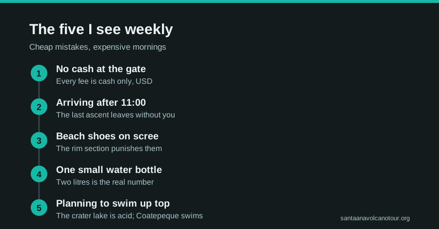
Which lake can you actually swim in?
Not the one on top. The crater lake is sulfuric, acidic and strictly off limits; swimming in it is both impossible and prohibited, and rim access is managed. The swimming water is Lake Coatepeque, the huge caldera lake about 10 km across that you see from the trail, where people swim, eat lakeside lunches and even rent jet skis.
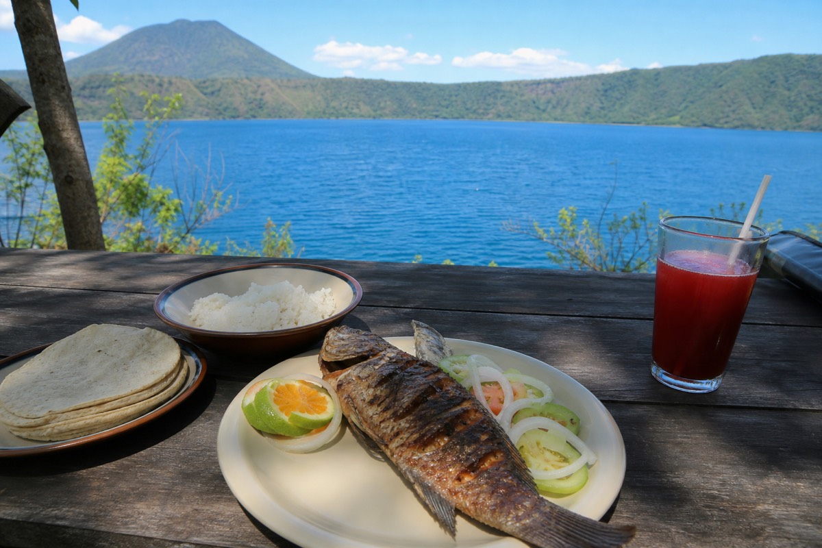
At least once a month somebody asks me, halfway up, whether they should have brought a towel for the crater. I love the optimism. The turquoise up top is chemistry, not Caribbean, and the managed rim keeps everyone at a respectful distance from water that would ruin your day and your skin. Coatepeque, glittering below the trail to the east, is the real prize for swimmers, and it is where the guided day finishes with a cooked lunch by the water. The swimmable one gets its own deep dive in the Lake Coatepeque guide.
| Mistake | Consequence | Fix |
|---|---|---|
| No cash at the gate | Turned away over $10 in fees | Carry $15 to $20 pp in small USD bills |
| Arriving after 11:00 | No climb that day, full stop | Leave with a buffer; bus 248 by 7:40 or drive early |
| Beach footwear | Slips and rolled ankles on loose rock | Closed shoes with tread, $2 poles |
| One small water bottle | Dry by the rim, shaky descent | 2 L per person, per MARN guidance |
| Planning to swim in the crater | Disappointment; it is acidic and prohibited | Swim in Lake Coatepeque after the hike |
What does the cash math look like for two people doing the day themselves?
For a couple driving in, budget about $17 a head in small US bills, roughly what one independent trip report totalled for a full do-it-yourself day, and round up to $20 each. The fixed stack is $3 entrance, about $4 for the group guide, $3 parking split between you, $2 poles apiece if you rent, and a few dollars of paletas at the summit.
Let me do the arithmetic the way I tell people at the gate to do it the night before, because "about $17" is easier to trust when you can see where it comes from.
| Item | Per person | For two |
|---|---|---|
| Park entrance (foreigners) | $3 | $6 |
| Group guide | ~$4 | ~$8 |
| Parking, one car | $3 shared | $3 |
| Poles (optional, I recommend them) | ~$2 | ~$4 |
| Paletas and snacks at the summit | a few dollars | a few dollars |
| Bus 248 instead of driving, from Santa Ana city | ~$0.70 each way | ~$1.40 each way |
| Sensible cash to carry | $20 | $40 |
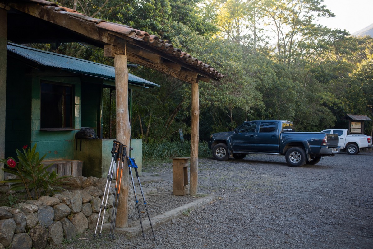
Notice the shape of that column. Nothing on it is expensive, and every line of it is rigid: the entrance and the guide fee are not negotiable, the parking attendant does not take cards, and the pole vendor is not running a tab. What breaks people is not the total. It is arriving with one large note and finding nobody who can change it early in the morning. Small bills, ideally ones and fives, and coins for the bus if you take it.
The comparison that surprises visitors is how the do-it-yourself total sits next to a guided day. The featured tour includes admission and the lakeside lunch, so those lines vanish from your pocket, and you still want a little cash for poles and ice cream. I lay the two columns side by side in the tour cost guide and, for the whole trip rather than one morning, in what El Salvador costs.
What is the sixth mistake, the one that happens on the way down?
Treating the descent as the easy half. The upper third of the trail is loose volcanic rock, and going down it tired, dehydrated and in a hurry is where I see the slips, the rolled ankles and the shaky legs. Poles, a slower pace than feels natural, and water saved for the descent fix almost all of it.
This is my own addition to the list, credited to nothing more scientific than eight years of standing at the bottom of that rocky stretch and watching people arrive at it. The rim is a high: the lake, the wind, the paleta, the photos. Then the guides call the descent, everyone turns round, and the same rubble that was tiring on the way up becomes slippery on the way down, because gravity is now pushing you into every loose stone rather than holding you back from it.
Three patterns repeat. The first is speed. People see the trailhead far below, feel the pull of lunch, and start half-jogging on ground that rewards short, flat, deliberate steps. The second is empty bottles. Whoever drank their single 600 ml on the way up is now walking the trickiest section with nothing, and dehydration shows up as exactly the shakiness you do not want on rolling rock. The third is the poles folded up at the top of the rocky section and carried because "it is downhill now". Keep them out. The $2 rental earns its money on the descent, not the ascent.
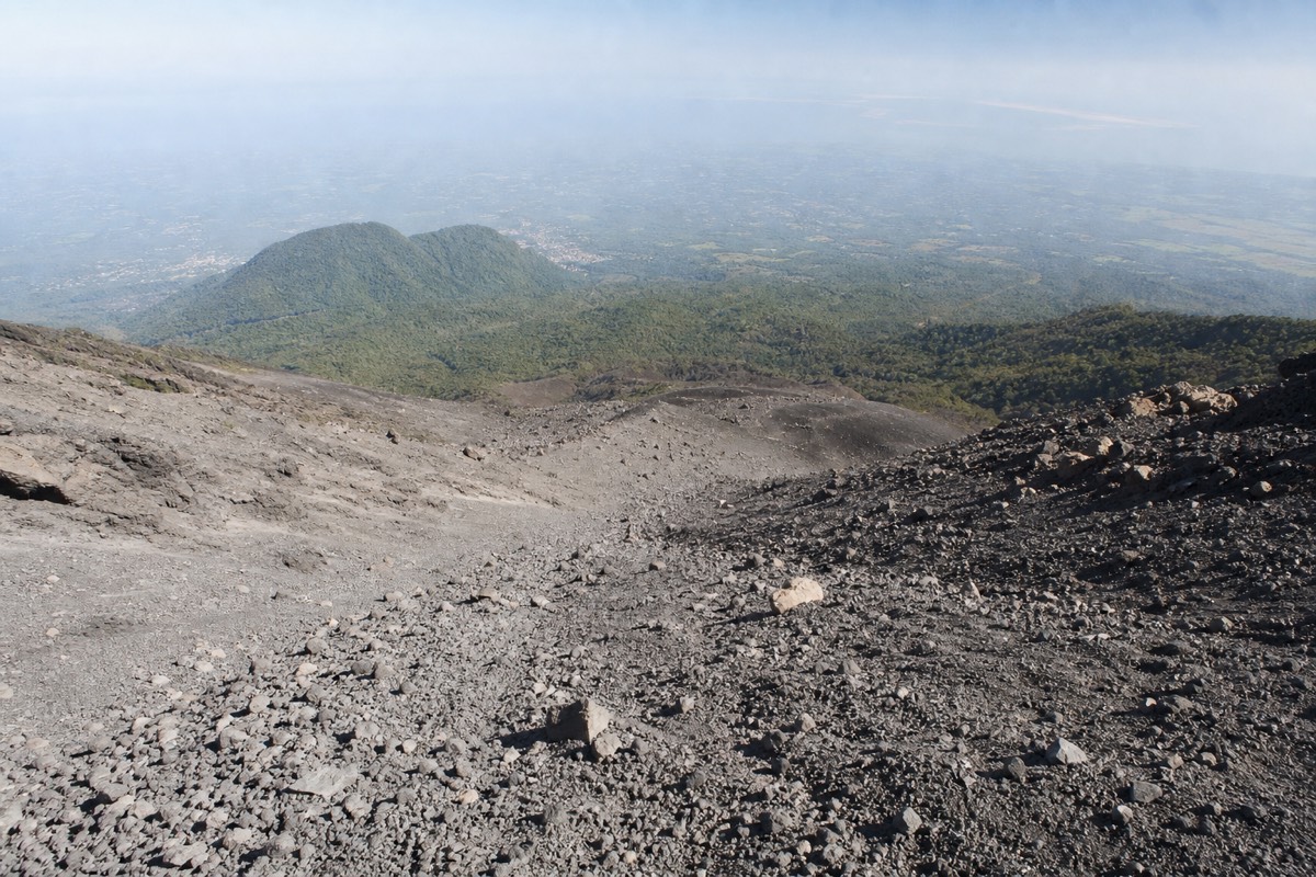
None of this makes the trail dangerous; it is rated moderate, and the daily group brings down every kind of walker in about an hour and a half. It just means the mountain asks for the same attention leaving as arriving. If you want to know how the whole route feels in the legs before you commit, how difficult the hike really is walks through it section by section, and for the sweeter side of the summit stop, paletas at the summit is the reward you are descending from.
Which mistakes disappear if you book the guided day, and which stay yours?
Booking the guided day removes the two logistics mistakes outright: admission is included, so the gate cash problem shrinks to poles and ice cream, and pickup from San Salvador, El Tunco or El Zonte is timed around the 11:00 cutoff by people who run it daily. Footwear, water and knowing which lake to swim in remain your job.
I say this to first-timers with no stake in it, since I do not lead that departure. It is simply true that most of the sad scenes I described at the top of this post involve independent travellers rather than tour groups, because a tour absorbs the two mistakes that need local knowledge and leaves you the ones that only need common sense.
| Mistake | Doing it yourself | On the guided day |
|---|---|---|
| No cash at the gate | Your problem: $3 entrance, ~$4 guide, $3 parking, all cash | Admission included; carry a little cash for poles and paletas |
| Arriving after 11:00 | Your problem: drive from San Salvador ~1 to 1.25 h, El Tunco ~2 h, plus buffer | Pickup timed by the operator; the window is their daily routine |
| Beach shoes | Yours | Still yours: closed shoes with tread |
| One small water bottle | Yours | Still yours: 2 litres per person, per MARN |
| Swimming in the wrong lake | Yours to figure out | Solved by the itinerary: lunch is at Coatepeque |
| The descent (mistake six) | Yours | Still yours, though a guide sets the pace |
Look at the right-hand column and you can see why I point most international first-timers that way. Half the lines still say "yours", so nobody is selling you a shortcut past the actual hike; the trail is the same 6.9 km and the summit is the same 2,381 m. What changes is that the fragile parts of the morning, the cash and the clock, are handled by a company that does them every day, in a group capped at 20 that recent reviews say runs closer to 10. If that trade appeals, the guided day tour is the one I mean, and the tour versus doing it yourself sets the two columns out in full.
What do the people who get it right all have in common?
They treat the volcano as a morning with rules rather than a stroll with views. Cash counted the night before, transport that lands well before 11:00, real shoes, two litres each, and swimwear saved for Coatepeque. Do those five things and this becomes one of the easiest great hikes in Central America.
None of this is meant to make Ilamatepec sound fierce. The country around it is having a moment, the US State Department's advisory sits at its most relaxed level, and the trail itself is a moderate, well-trodden three to four hours that grandmothers and eight-year-olds finish weekly. The mistakes above are not dangers so much as ways to waste a beautiful day. Fix them in advance, and the mountain gives you everything: the climb, the crater, the turquoise shock of the lake, and an ice cream at 2,381 m that tastes better than any dessert at sea level.