Three Volcanoes From One Park: Santa Ana, Izalco and Cerro Verde
Santa Ana's summit, Izalco's black cone and Cerro Verde's cloud forest share one park. What you can honestly fit into a single day there, and what you cannot.
 By Carlos Hernández, Santa Ana Volcano tour guide & hiking specialist
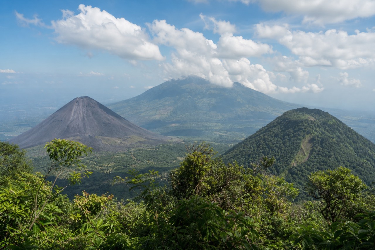
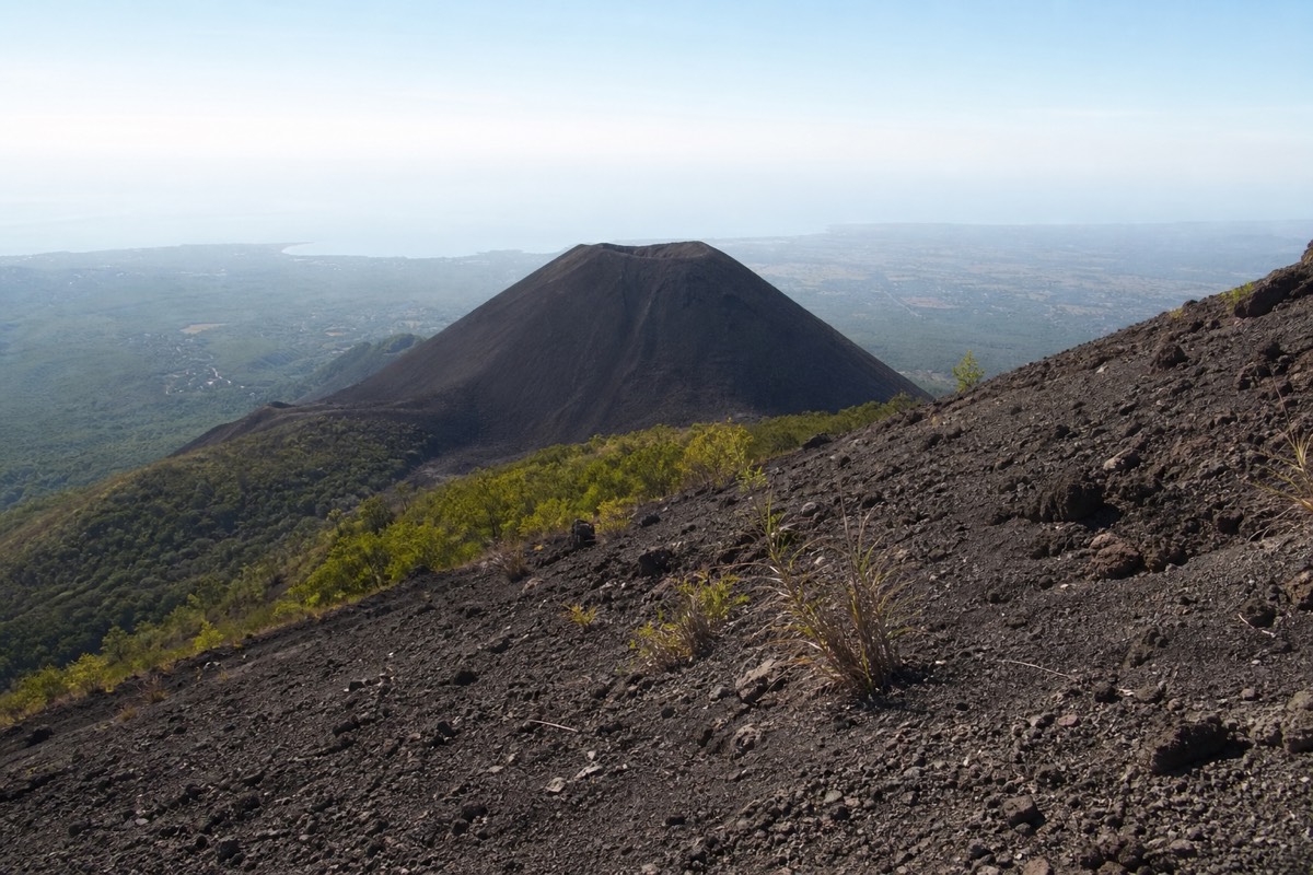
There is a bend about halfway up the Santa Ana trail where the trees step aside and Izalco appears: a near-perfect black cone, bare as poured charcoal, sitting below you like a scale model of what a volcano should be. Every group I have led since 2018 stops there. Cameras out, jaws slightly open, and then the question I have heard a thousand times, more or less word for word: can we do that one too, today?
I love the ambition. This post is the long, honest answer, because Cerro Verde National Park really does hold three volcanoes within sight of each other, and what you can do with them in one day is both more and less than people expect.
What exactly are the three volcanoes of Cerro Verde?
Santa Ana (Ilamatepec), El Salvador's highest volcano at 2,381 m, active with a turquoise crater lake; Izalco, the young black cone once called the Lighthouse of the Pacific, a separate and steeper climb; and Cerro Verde itself, an old, extinct, forest-covered volcano whose slopes hold the national park at about 2,000 m.
They are three ages of volcano standing in one frame. Santa Ana is the working giant, monitored daily by MARN's network, last eruption October 2005, currently free of any advisories or closures. Izalco is the dramatic teenager, so relentlessly active through its history that sailors steered by its glow, hence the lighthouse nickname, though today it stands quiet and black. Cerro Verde is the elder, worn down to a green dome of cloud forest where the park's visitor facilities sit. The full origin story of the mountain I guide is in our Santa Ana facts guide, and the two rivals get a proper head-to-head in Izalco vs Santa Ana.
| Santa Ana (Ilamatepec) | Izalco | Cerro Verde | |
|---|---|---|---|
| Character | Active stratovolcano, crater lake | Young black cinder cone | Extinct, forest-covered |
| Height | 2,381 m, highest in the country | Lower, dramatically steep profile | Park sits at ~2,000 m |
| Summit hike | 6.9 km round trip, ~470 m gain, moderate | Separate, steeper climb | Gentle forest trails |
| What is on top | Turquoise sulfuric lake | Bare volcanic rock | Cloud forest, viewpoints |
| Guide | Mandatory, daily group ascent | Guided, separate arrangement | Easy independent walking |
Can you summit all three volcanoes in one day?
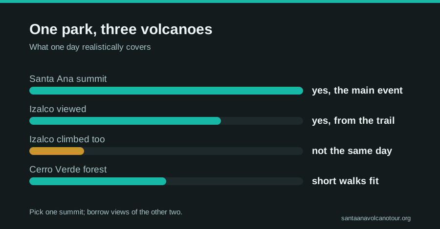
Realistically, no. Santa Ana's climb is locked to one daily window, last start 11:00 with the crater closing around 13:00, and it uses three to four hours by itself. Izalco is a separate, steeper guided climb that cannot be stacked after it. One summit, one cone admired from above, one forest walked: that is the honest full house.
The bottleneck is not fitness, it is scheduling. The Santa Ana window exists because the mountain is managed as an organized daily ascent with mandatory local guides, and by the time you are back at the trailhead in the early afternoon, the day's climbing on the massif is done. Izalco demands its own morning and, frankly, its own legs; the cone is loose and steep in a way that makes Santa Ana feel like a boulevard. People who try to write both into one itinerary end up doing Santa Ana properly and staring at Izalco wistfully, which, for what it is worth, is exactly what the halfway viewpoint is for. If your trip has room, give the trio two days and stay nearby; I sketch that version in our El Salvador volcano itinerary.
What does a realistic one-day plan look like?
Climb Santa Ana inside the daily window, collect Izalco from the trail viewpoints, and spend whatever remains on Cerro Verde's forest paths or, better, down at Lake Coatepeque. That sequence fits inside the park's own clock: arrive by 9:30, summit by midday, down by early afternoon, swimming or forest by three.
| Plan | What you get | Verdict |
|---|---|---|
| Santa Ana summit + Izalco views + Coatepeque lunch | The highest crater, the cone from above, a swimmable caldera | The classic; works every time |
| Santa Ana summit + Cerro Verde forest walk | Summit plus easy cloud-forest cooldown | Works if you have wheels waiting |
| Santa Ana + Izalco, both summits | Two big climbs against one clock | Does not fit the window; split over two days |
| Izalco only | The steep black cone | A fine second day, not a first |
Notice what the winning plans share: Santa Ana first, always, because its window is the least flexible thing in the park. This is also precisely the shape of the guided day I send most visitors on, and there is a reason it books out. Hotel pickup from San Salvador (El Tunco and El Zonte covered), admission included, a certified bilingual guide up the volcano, and then lunch cooked by the shore of Coatepeque with the whole day's geology laid out across the water. If that is the day you want, book the guided day tour and check live availability and prices on Viator; it carries 4.9 stars across 869 reviews with a Badge of Excellence, runs small groups capped at 20 with recent reviews reporting about 10, and cancels free up to 24 hours. I do not lead those departures, but their route is the same arithmetic I have just walked you through, solved daily.
How should you budget your legs across the day?
Spend them almost entirely on Santa Ana. The summit round trip is about two hours up and an hour and a half down over rocky ground, and it is the only part of the day that demands real effort. Everything after it, forest paths or a lakeside table, is recovery disguised as sightseeing.
| Segment | Effort | Time |
|---|---|---|
| Santa Ana ascent | The day's real work, steady climbing, rocky top third | ~2 h |
| Crater rim | Easy walking, big wind, photos and paletas | Until ~13:00 close |
| Santa Ana descent | Knees and concentration on loose rock | ~1.5 h |
| Cerro Verde forest paths | Gentle strolling at ~2,000 m | As long as you like |
| Lake Coatepeque | Lunch, swimming, optional jet ski | The reward |
Two details from eight years of watching legs fail and succeed. First, the descent is where tiredness shows; rent the $2 poles at the trailhead and thank me at the bottom. Second, altitude is mild here by Andes standards but real: the park sits around 2,000 m and the summit at 2,381 m is noticeably cooler and windier than the coast you may have woken up on. The trail data on AllTrails rates the whole thing moderate at 4.8 stars, which matches what I see weekly: strong walkers find it comfortable, occasional walkers find it satisfying, and almost everyone finds it worth it.
How do you get to Cerro Verde park, and where does each volcano start?
Everything begins at the park, which sits at about 2,000 m between the three volcanoes. By car it is roughly 1 to 1.25 hours from San Salvador and about 2 hours from El Tunco; by public transport, bus 248 from La Vencedora terminal in Santa Ana city leaves around 7:30 to 7:40, costs about $0.70 and takes about 2 hours to the El Tibet trailhead. Parking is $3, cash.
The park is the hinge of the whole day, so it pays to understand how the pieces sit before you arrive. Santa Ana's climb starts from the El Tibet trailhead, where the daily group gathers and the fees are paid: $3 entrance for foreigners, about $4 for the mandatory group guide, $3 to park. Cerro Verde's forest paths and viewpoints are the gentle part at park level. Izalco is its own guided climb, arranged separately, and I will not put numbers on it here because they are not in my verified notes; the honest comparison of the two peaks lives in Izalco vs Santa Ana.
| From | How | Leave by | Travel time | Cash on arrival |
|---|---|---|---|---|
| Santa Ana city | Bus 248 from La Vencedora, ~$0.70 | ~7:30 to 7:40 | ~2 h to El Tibet | $3 entrance, ~$4 guide |
| San Salvador | Drive, or the guided day's hotel pickup | ~8:00 by car | ~1 to 1.25 h | $3 parking if you drive |
| El Tunco / El Zonte | Drive, or the guided day's pickup | ~7:30 by car | ~2 h | $3 parking if you drive |
| San Salvador or the coast | Public transport | Not workable | Misses the 11:00 last start | n/a |
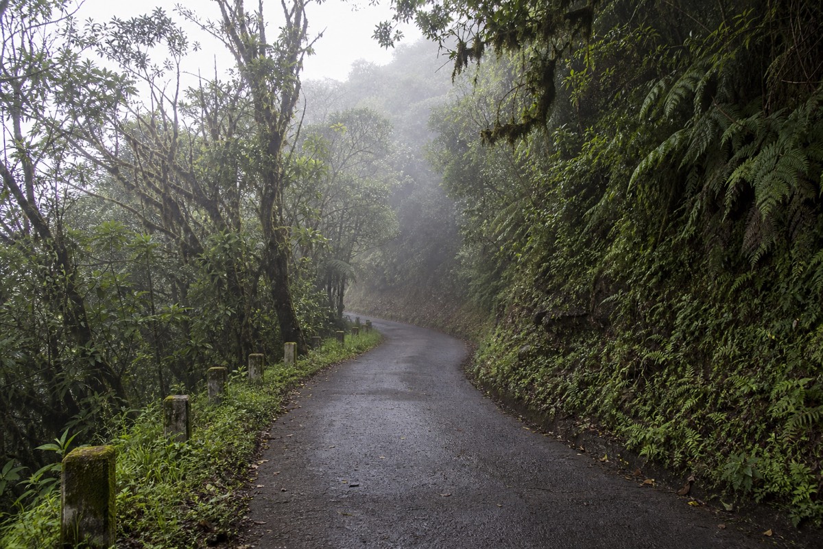
The final approach is slow mountain road on every route, and this is where the timing gets tight; the Santa Ana group forms around 9:30 to 10:00 and 11:00 is the last start, full stop. The bus from Santa Ana city is the only public option that lands inside the window, and it drops you into a trailhead that smells of coffee and sunscreen with time to rent poles at about $2. Drivers should pad their estimate. If you would rather have the drive, the fees and the clock handled, the guided day tour collects you at your hotel and delivers you into the group on time. Route-by-route detail, including the bus, is in how to get to the volcano, and the park itself, its forest and its facilities, has its own guide.
Where on the trail do Izalco and Coatepeque appear, and when should you stop for photos?
Izalco appears from the Santa Ana trail roughly halfway up, at the bend where the trees open and the black cone sits below you; Lake Coatepeque shows to the east as you gain height and is fully laid out from the crater rim. Stop for Izalco at the bend, and save Coatepeque for the top, where you get the lake and the crater in one turn.
This is guide's judgment, not survey data, but it is the judgment of someone who has watched a thousand travellers raise their cameras on this trail and knows where the good frames are. The lower stretch is forest and open slope, pleasant, not photogenic. Then comes the bend, and Izalco: a bare cone, dark as poured charcoal, so perfectly shaped that people ask whether it is real. That is your first stop, and the group takes it as one, so use it. Shoot wide to get the cone against the lowlands, then shoot tight on its flanks, because the texture of that black rock is what makes the photo.
Coatepeque is subtler. It reveals itself piece by piece as you climb, a sheet of blue between ridges to the east, and it is easy to keep stopping for it and arrive at the rocky upper section already tired. Resist. The whole caldera, about 10 km across, opens from the summit rim, and from there you can turn a slow circle: the sulfuric turquoise of the crater at your feet, Coatepeque's deep blue to the east, Izalco's cone to the south, and on a clear dry-season day the Pacific beyond. That single turn is the best geology lesson in the country, and it is why I tell people to walk the middle of the trail with the camera put away.
The rim is windy and cooler than anywhere below, and access to the edge is managed by the guides, so photograph from where they put you and do not chase a lower angle. What you see from that rim, and why the crater lake looks the way it does, is the subject of the crater lake guide, and the swimmable blue lake below gets the Coatepeque guide.
What should be in your bag for a day that touches all three?
Pack for the summit and the day sorts itself: 2 litres of water per person, closed shoes with tread and ankle support, a windproof layer for a rim that is cooler and windier than the base, small US bills for the $3 entrance, ~$4 guide, $3 parking and $2 poles, and swimwear plus a towel for Coatepeque afterwards.
The bag for a three-volcano day is really the bag for the Santa Ana climb with a swim tucked into it, because Santa Ana is the only part that makes physical demands. This is how I audit what people bring, item by item, against where the day takes them.
| Item | Santa Ana climb | Cerro Verde forest | Lake Coatepeque | Note |
|---|---|---|---|---|
| Water, 2 L per person | Essential | Nice to have | Refill at lunch | MARN's own baseline for the climb |
| Closed shoes with tread | Essential, loose upper rock | Fine in anything sturdy | Sandals are fine here | Ankle support is the reviewers' consistent tip |
| Windproof layer | Essential on the rim | Useful in cloud forest | Off | Summit is cooler and windier than the base |
| Small US bills | $3 entrance, ~$4 guide, $3 parking, ~$2 poles | Covered by park entry | Lunch is included on the guided day | Cash only, everywhere |
| Rental poles | Worth the $2, especially descending | Not needed | Not needed | Praised in review after review |
| Sun protection | Open sun on the upper trail | Shade | Full sun on the water | Hat and sunscreen |
| Swimwear and towel | Dead weight | Dead weight | The whole point | Crater lake swimming is impossible and prohibited |
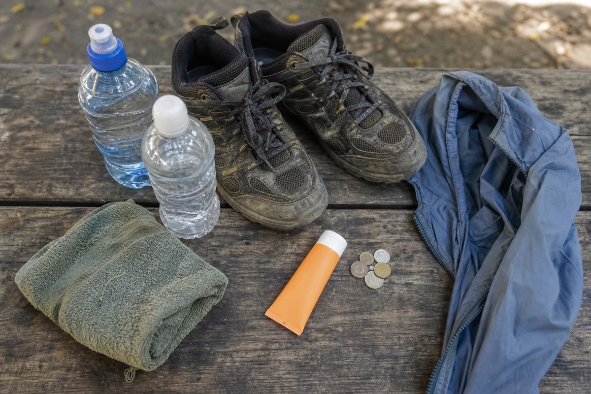
The mistakes I see are always at the two ends of that table. People arrive with the swim gear and forget the water; or they arrive dressed for a mountain and forget that the day ends beside a lake where you can rent a jet ski. Pack both halves. The one item people argue with me about is the layer, because the coast was hot at breakfast, and then they meet the wind on the rim at 2,381 m. Bring it. The full, short packing list is in what to bring for the hike, and if you are planning more than one park day, how many days in El Salvador helps you spread the volcanoes out.
Which volcano should a first-timer actually choose?
Santa Ana, without hesitation. It is the highest, the most alive, the only one with a turquoise crater lake, and the one whose daily guided ascent makes it the safest and simplest to do well. Izalco rewards a return trip; Cerro Verde rewards whatever minutes you have left.
I say this as someone who loves all three. Izalco's black pyramid is the best-looking volcano in the country, and the old forest on Cerro Verde has a hushed, dripping magic on cloudy afternoons. But views are an economy, and Santa Ana pays in every currency at once: the climb, the lake, the Pacific, Coatepeque, and Izalco itself, seen from above at the angle it was born to be photographed from. Start there. The other two will still be standing, and one day is enough to fall for the whole park.