Ilamatepec: Facts, Height and Geology
The reference page for Santa Ana volcano: what Ilamatepec means, the 2,381 m height, its stratovolcano geology, the 2005 eruption and the coffee country around it.
 Written with Carlos Hernández, Santa Ana Volcano tour guide & hiking specialist
Short answer
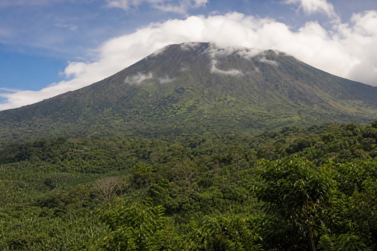
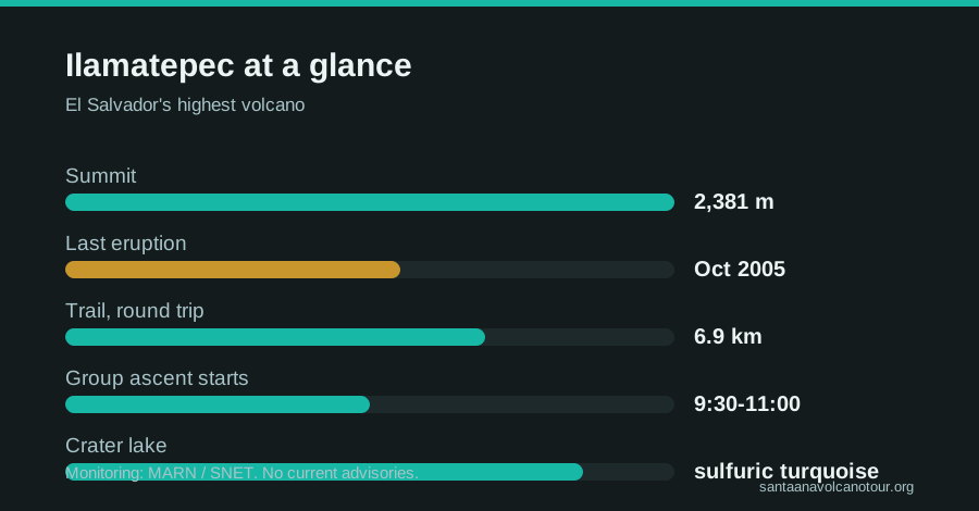
Santa Ana volcano, locally Ilamatepec, is El Salvador's highest volcano at 2,381 m. It is an active, monitored stratovolcano in the Apaneca-Ilamatepec range, ringed by coffee country, with a turquoise acidic crater lake at the summit. Its last eruption came in October 2005; there are no current advisories.
Guests ask me the same three questions on the drive out, almost in the same order: how tall is it, will it erupt on us, and what does Ilamatepec even mean? I have answered them on the trail since 2018, usually while pointing at the mountain itself, which is the best visual aid a guide could ask for. This page is the sit-down version: every verified fact about the volcano in one place, so you can arrive already knowing what you are climbing.
What does Ilamatepec actually mean?
Ilamatepec is the volcano's older, local name, from Nahuatl, and it is commonly translated as "old woman mountain" or "mother mountain". Santa Ana is the colonial-era name, borrowed from the nearby city. Locals use both, and on the trail you will hear Ilamatepec said with a certain respect.
Names carry history here. The Nahuat-speaking Pipil peoples lived under this volcano long before any Spanish map labeled it Santa Ana, and their name stuck to the mountain the way the newer one never quite has. There is something fitting in the translation, too: an old woman who has been here longer than everyone, mostly quiet, occasionally furious. I unpack the story and the way locals talk about her in why locals call it Ilamatepec, which is worth reading before you hear a guide use the name mid-climb.
For the practical traveller, the takeaway is simple. Santa Ana volcano, Volcán de Santa Ana and Ilamatepec are one mountain. Signage, park staff and the official tourism board at elsalvador.travel move between the names freely, so you should too.
How tall is Santa Ana volcano and where does it sit?
The summit stands at 2,381 m (about 7,812 ft), which makes it the highest volcano in El Salvador. It anchors the Apaneca-Ilamatepec range in the west of the country, above the city of Santa Ana, with Cerro Verde national park sitting at about 2,000 m on its flank.
| Key stat | Figure |
|---|---|
| Summit elevation | 2,381 m |
| Rank | Highest volcano in El Salvador |
| Type | Stratovolcano |
| Range | Apaneca-Ilamatepec |
| Last eruption | October 2005 |
| Current status | Active, monitored, no advisories |
| Crater lake | Turquoise, sulfuric, acidic |
| Hike to the rim | 6.9 km round trip, ~470 m gain |
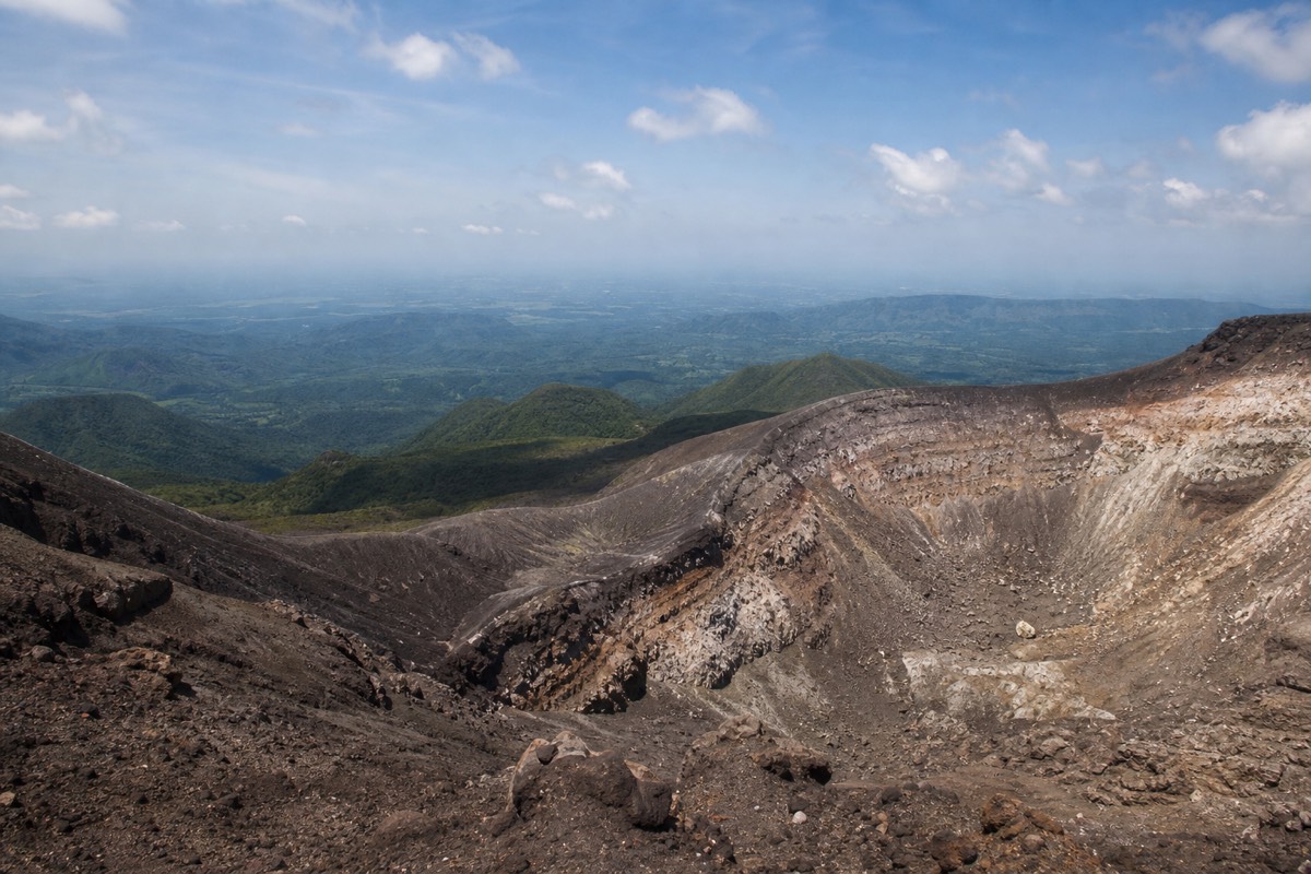
Height numbers can feel abstract, so here is the ground truth. The hike does not start at sea level; the trailhead area sits high on the mountain already, which is why the climb gains about 470 m rather than the full 2,381. From the rim on a clear day you look down on Lake Coatepeque, across to the cone of Izalco, and out toward the Pacific. The step-by-step trail walkthrough covers exactly how those 470 m feel underfoot.
What kind of volcano is it, geologically?
Santa Ana is a stratovolcano: a steep cone built from layered eruptions of lava, ash and rock over a long life. It is active and continuously monitored by MARN through the SNET network, and its summit crater holds a hot, acidic, startlingly turquoise lake that you can view from the rim but never touch.
Stratovolcanoes are the classic volcano shape, the one children draw, and they earn it through repetition: eruption, layer, quiet, eruption, another layer. Santa Ana's summit is actually a nest of craters from different eras, with the youngest holding the lake. The water gets its color from dissolved sulfur compounds and minerals, and its chemistry is the reason swimming is both impossible and prohibited. Steam drifting off the crater is normal and monitored, not a warning sign.
The word active deserves precision, because it scares people unnecessarily. Active means the volcano has erupted in recent history and remains capable, not that eruption is imminent. MARN publishes its monitoring through SNET, and as of now there are no advisories or closures on the mountain. The rim is managed, guides are mandatory, and the daily ascent system exists precisely so that access can be adjusted instantly if the monitoring picture changes. I go deeper on what monitoring looks like day to day in is the volcano active.
When did it last erupt?
The most recent eruption came in October 2005, an explosive event that threw ash and rock over the surrounding slopes. Before that, 1904 marks the other major eruption of the modern record. Two eruptions in over a century is the rhythm of a patient volcano, watched closely in between.
| Year | Event |
|---|---|
| 1904 | Major eruption of the early modern record |
| October 2005 | Most recent eruption; ash and rock over nearby slopes |
| 2005 to present | Quiet, under continuous SNET monitoring |
| Today | No current advisories or closures |
The 2005 eruption is the one your guide will talk about at the rim, because its evidence is still visible in the crater. It reshaped the summit area and reminded the region that Ilamatepec's quiet is a pause, not a retirement. The response since then is the system you hike under today: monitoring stations, a managed rim, mandatory local guides, and a fixed ascent window. MARN's standing guidance says the climb is not to be improvised, and after 2005, nobody local argues.
What that century-scale rhythm means for you as a visitor is honest reassurance. You are climbing a live mountain with professionals watching its vital signs, under rules built from real events rather than theater. That combination, real volcano plus real oversight, is exactly what makes the hike feel like an adventure instead of a liability form.
Why is this coffee country?
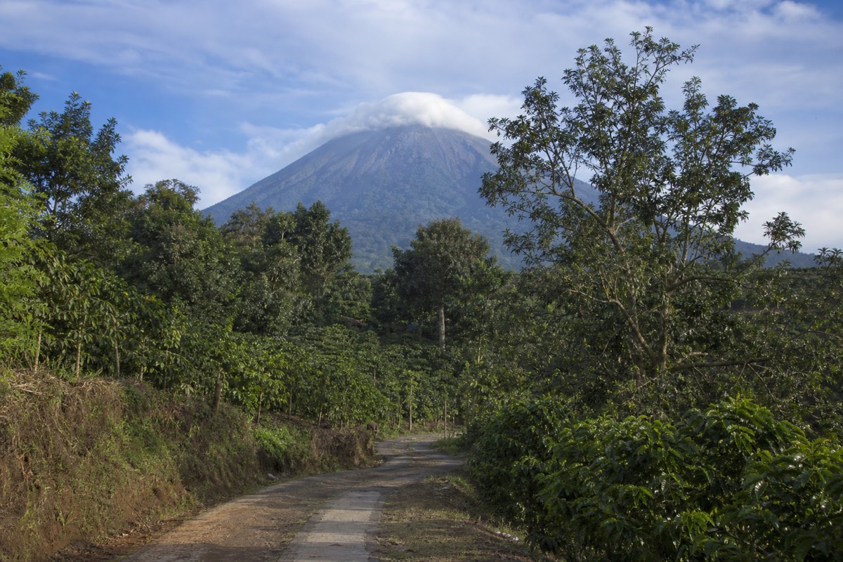
Volcanic soil. The slopes of the Apaneca-Ilamatepec range grow some of El Salvador's best coffee because old ash weathers into rich, mineral-heavy ground, and the altitude adds the cool nights that quality beans need. The drive to the trailhead runs through working coffee farms almost the whole way.
It is one of the quiet trades volcanoes make with the people who live on them. The same eruptions that layer a stratovolcano also blanket the countryside in ash, and given time, that ash becomes farmland. Combine soil like that with elevations climbing past 1,000 m and you get a coffee belt, which is exactly what wraps around Santa Ana, Cerro Verde and the towns of the famous flower route to the west.
For a hiker this is scenery with a plot. Watch the windows on the way up: lowland fields give way to shaded coffee rows, then to cloud forest inside the park, then to the bare volcanic rock of the upper trail. You cross the whole trade in ninety minutes of driving and two hours of walking.
How is the volcano monitored, and what does "no advisories" mean?
MARN, El Salvador's environment ministry, watches Ilamatepec continuously through the SNET monitoring network and publishes its status. "No current advisories or closures" means the monitoring shows nothing that would restrict access today, and the managed ascent runs as normal. Active describes the volcano's history and capacity, not tomorrow's forecast.
Guests hear "active" and "monitored" in the same sentence and quietly assume the second word is there to soften the first. It is the other way round. Because the mountain erupted in October 2005 and remains capable, it is watched, and because it is watched, ordinary people can walk to its rim under a fixed set of rules. The public face of that watching is SNET, where MARN posts its volcanic monitoring, and the standing guidance is short enough to memorize: the ascent is not to be improvised, carry water, leave no litter.
The words matter, so here is how I translate them for hikers. Active: has erupted in recent history and could again; Santa Ana qualifies through 2005. Monitored: instruments and people are watching its vital signs, and the results are published rather than kept in a drawer. Advisory: a published warning that changes what visitors may do; there is none right now. Closure: access restricted; also none right now. Steam over the crater lake sits in none of those categories, it is the normal breathing of a hot, acidic lake and something guides point out rather than flinch at.
What you should actually do with this is small. Check the SNET page before you travel if it eases your mind, then trust the system on the day: mandatory local guides, a managed rim, an ascent window that starts around 9:30 to 10:00 and closes the crater area near 13:00. Those rules were built after real events, not for theater. The fuller answer to the eruption question, including how the 2005 event fits the record, is in is Santa Ana volcano active.
What is the crater lake, chemically and visually?
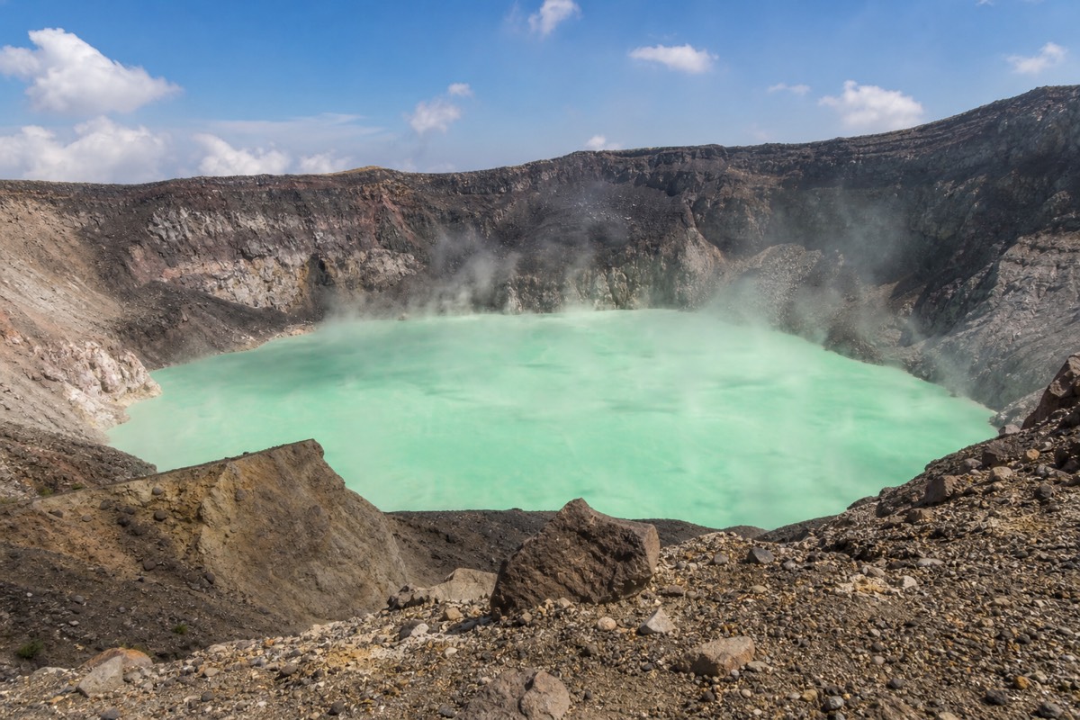
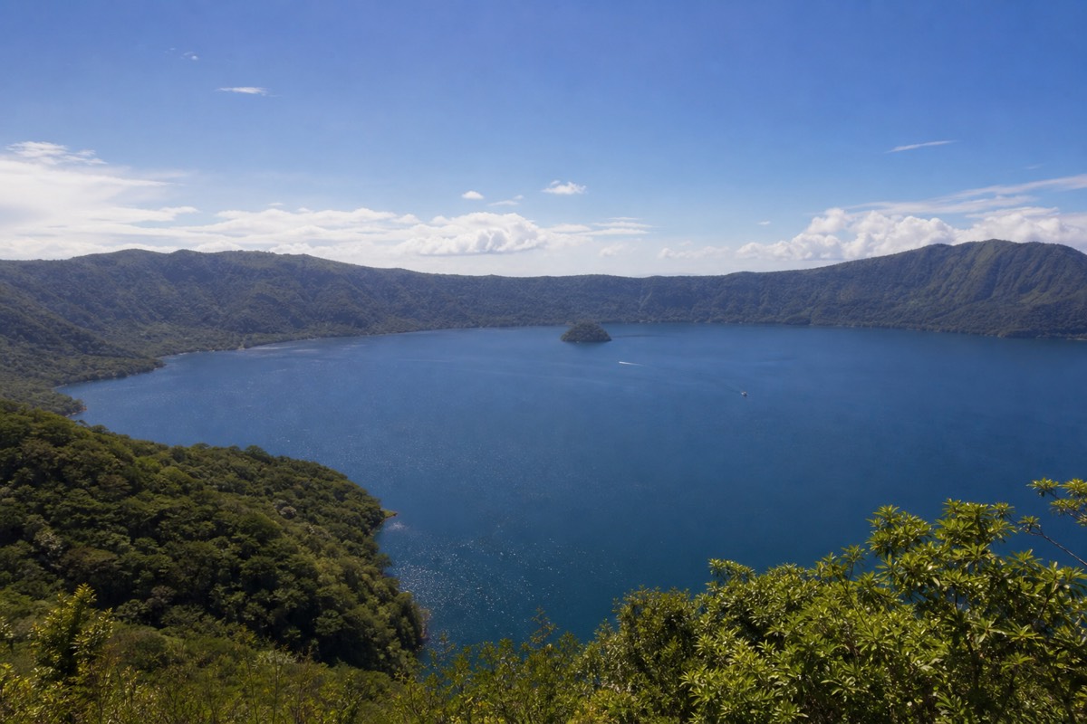
A hot, sulfuric, acidic lake sitting in the youngest of the summit's nested craters, colored a milky turquoise by dissolved sulfur compounds and minerals. It steams, it changes shade with the light and the season, and it is both impossible and prohibited to swim in. The lake you swim in is Coatepeque, a caldera lake roughly 10 km across, down the mountain.
Two lakes, one day, and people mix them up constantly, so this table exists mainly to stop that. One is the reason you climb; the other is where you cool off afterwards.
| Santa Ana crater lake | Lake Coatepeque | |
|---|---|---|
| Where | Inside the summit crater at 2,381 m | A caldera east of the volcano, well below the trailhead |
| What it is | Hot, sulfuric, acidic crater water | A large caldera lake, roughly 10 km across |
| Color | Milky turquoise, shifting with light and season | Deep blue |
| Swimming | Impossible and prohibited | Yes; jet-ski rental reported in 2026 reviews |
| How you see it | From the managed rim, with a guide | From the shore, on the guided day over lunch |
| Origin | The youngest crater of an active stratovolcano | A far older, far larger eruption that left the caldera |
The turquoise gets asked about at the rim more than anything else. The short version: sulfur compounds and minerals dissolved in hot water scatter light in that particular blue-green, and because the mix and the light both move, the exact shade on your visit will not quite match anyone's photos. The longer version, and why the color drifts, is in why the crater lake color changes. The acidity is why rim access is managed and why guides keep everyone inside the safe section: this is a lake to look at from above, and the looking is spectacular. Coatepeque, by contrast, is a swimming lake, and on the featured day it is where lunch is served on the shore after the descent. Both get their own pages: the crater lake guide and Lake Coatepeque.
What do the numbers look like in feet and miles?
The summit is 2,381 m, about 7,812 ft. The hike gains roughly 470 m, around 1,540 ft, over 6.9 km, or 4.3 mi, round trip. Cerro Verde park sits near 2,000 m, about 6,560 ft, and Coatepeque spans roughly 10 km, a little over 6 mi. Same mountain, translated for anyone who thinks in imperial.
Half my guests count in feet and I have learned to carry both sets of numbers in my head, because "two thousand three hundred and eighty-one meters" produces polite nods and "seven thousand eight hundred feet" produces a raised eyebrow. Here is the reference page's reference table.
| Measure | Metric | Imperial (rounded) |
|---|---|---|
| Summit elevation | 2,381 m | ~7,812 ft |
| Elevation gain on the hike | ~470 m | ~1,540 ft |
| Round-trip distance | 6.9 km | 4.3 mi |
| Cerro Verde park elevation | ~2,000 m | ~6,560 ft |
| Lake Coatepeque width | ~10 km across | ~6 mi across |
| Time up / down | ~2 h / ~1.5 h | Same clock everywhere |
The conversions are arithmetic on the verified figures, nothing more, and the rounding is deliberate. What they show is the shape of the day: a summit that sounds alpine, reached by a climb that is really a long hill. You start high because Cerro Verde park already sits near 2,000 m between the three volcanoes, so the trail asks for about 1,540 ft of gain rather than the full height, and that is why the hike rates moderate rather than heroic. If you know how a 1,500 ft climb over a couple of miles feels at home, you know most of what your legs need to know here; the rest is the loose rock near the top, which no unit converts. For the comparison with hikes you may already have done, see how hard the hike really is.
Where does the volcano sit on the map, and how far is it from the cities?
Ilamatepec rises in western El Salvador above the city of Santa Ana, with Cerro Verde national park at about 2,000 m on its flank and Lake Coatepeque in a caldera to its east. Driving, allow 1 to 1.25 hours from San Salvador and about 2 hours from El Tunco. From Santa Ana city, bus 248 takes roughly 2 hours to the trailhead.
The geography is simple once you picture three cones and a lake. Santa Ana, Izalco and Cerro Verde stand in a cluster; the park sits between them; the big blue sheet of Coatepeque lies off to the east where an older, vaster eruption collapsed the ground. Everything a visitor needs is inside that small circle. What varies is where you wake up.
| Starting point | Getting to the trailhead | Notes |
|---|---|---|
| Santa Ana city | Bus 248 from La Vencedora, ~7:30 to 7:40, ~$0.70, ~2 hours | The only public route that fits the ascent window |
| San Salvador | Drive, ~1 to 1.25 hours | No workable public option for the window; the guided day picks up here |
| El Tunco / El Zonte | Drive, ~2 hours | Same story; pickup covered on the guided day |
| Cerro Verde park | You are already there, ~2,000 m | Gate area, entrance $3, parking $3 |
| Lake Coatepeque | Short drive from the volcano | Lunch stop on the guided day; the swimming lake |
Notice the pattern in that table. From Santa Ana city the mountain is a cheap bus ride; from anywhere else it is a driving question, because the group ascent starts between about 9:30 and 11:00 and public transport from the capital or the coast simply does not land you there in time. That single fact explains most of the tour bookings I see, and it is worth understanding before you plan a night in San Salvador expecting to wing it. Route by route detail lives in how to get to the volcano, and if you are choosing where to sleep beforehand, where to stay in Santa Ana makes the case for the city itself.
What do visitors most often get wrong about the facts?
That the crater lake is swimmable, that "active" means about to erupt, that you can climb whenever you like, that altitude will be a problem, and that Izalco is the same hike. All five are wrong, and each one changes how you plan the day. The corrected version fits in one table.
I have been correcting the same misconceptions on the trail since 2018, and by my own count over a thousand travellers have carried at least one of them up the mountain. Here is the list, offered as a guide's field notes rather than anyone's official position.
| What people believe | What is actually true |
|---|---|
| "We can swim in the crater lake" | It is sulfuric and acidic; swimming is impossible and prohibited. Coatepeque is the swim |
| "Active means it could go any minute" | Active means it erupted in recent history, October 2005, and is monitored; there are no current advisories |
| "We'll start hiking whenever we arrive" | Ascents run with a mandatory guide in a window from about 9:30 to 11:00; the crater area closes near 13:00 |
| "2,381 m, we'll get altitude sickness" | The summit sits below the elevations where that usually becomes a concern; breathing harder near the top is normal |
| "Izalco is just the next hill over" | It is a separate, steeper climb on loose black scoria; most first-timers pick Santa Ana |
| "It's a hard hike" | Moderate: 6.9 km round trip, ~470 m gain, ~2 hours up; the loose rock near the rim is the only technical part |
| "There's no rush, it's a small country" | Small, yes; but from San Salvador there is no public route that hits the window |
The swimming one is the most persistent and the most important, because it is a safety fact dressed as a disappointment. The lake at the top is beautiful precisely because of what makes it dangerous, and the managed rim exists so you can enjoy the first without testing the second. The Izalco confusion runs a close second, and it matters for planning: the black cone you photograph across the valley is a different mountain with a different trail, and the choice between them has its own page in Izalco vs Santa Ana. Everything else on the list resolves the same way, by planning around the mountain's rules rather than around a picture of it.
What are the three Cerro Verde volcanoes?
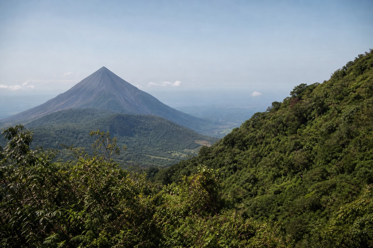
Cerro Verde national park sits at about 2,000 m between three volcanoes with three personalities: Santa Ana, the tallest and the one you hike to a crater lake; Izalco, the young black cone once called the Lighthouse of the Pacific; and Cerro Verde itself, an old, extinct, forest-covered peak that hosts the park.
| Volcano | Character | For hikers |
|---|---|---|
| Santa Ana (Ilamatepec) | 2,381 m, active, turquoise crater lake | The signature climb: moderate, guided, 3 to 4 hours |
| Izalco | Bare black cone, famously bright eruptions for nearly two centuries until 1958 | A separate, steeper, tougher hike |
| Cerro Verde | Extinct, cloaked in cloud forest | Easy park trails and the classic viewpoints |
Izalco is the drama of the trio. Sailors reportedly used its near-constant eruptions as a beacon, which is how a mountain earned the nickname Lighthouse of the Pacific, and its black, plantless cone still looks brand new from the Santa Ana trail. Most travellers photograph it rather than climb it, and choosing between the two ascents is its own decision with its own guide on this site.
If you want the facts on this page under your boots rather than on your screen, the practical version is a single day: book the guided day tour and check live availability and prices on Viator, and you get the summit of the country's highest volcano, admission included, followed by lunch beside Coatepeque, the giant caldera lake that an older, vaster eruption left behind. The day holds 4.9 stars across 869 reviews, which is a statistic this reference page is happy to include.
The old woman of the west has a name in a language older than the country, a lake no one may touch, and a century of patience between tempers. Facts are fine things. Standing on them at 2,381 m is better.