Is Santa Ana Volcano Still Active?
Santa Ana (Ilamatepec) is an active, monitored stratovolcano. Last eruption October 2005, no current advisories, and what active really means for hikers.
 Written with Carlos Hernández, Santa Ana Volcano tour guide & hiking specialist
Short answer
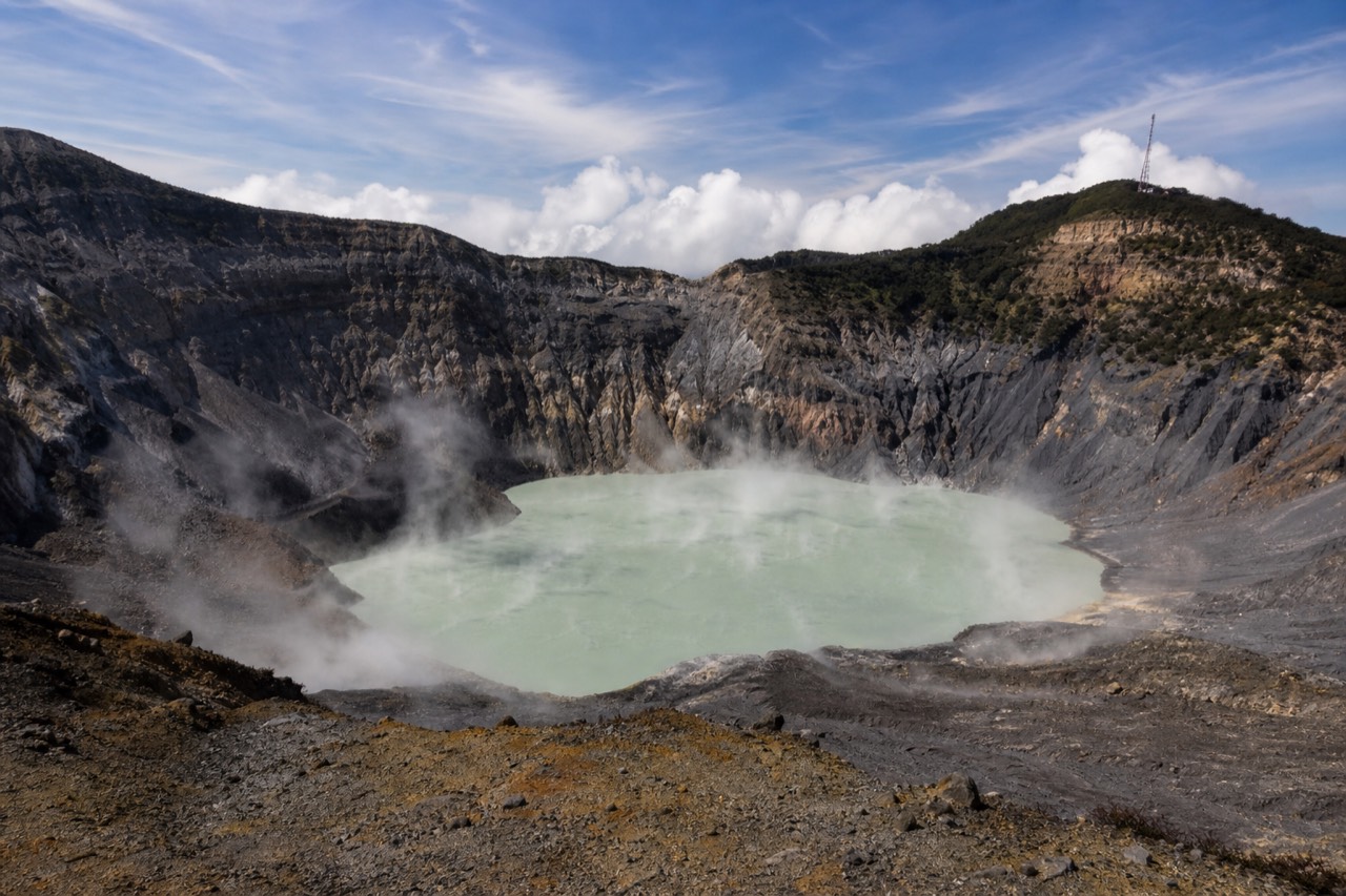
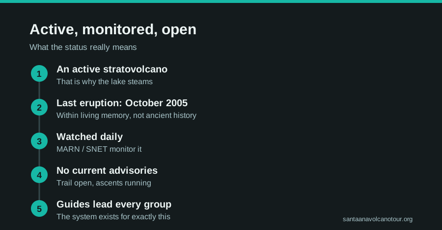
Yes. Santa Ana, called Ilamatepec locally, is an active stratovolcano and El Salvador's highest. Its last eruption was in October 2005. MARN's SNET network monitors it daily, and there are no current advisories or closures. Active means watched, not erupting. The summit trail is open, with a local guide mandatory for every hiker.
The first thing clients notice at the rim is the smell, that faint sulfur edge riding the wind, and the second is the steam lifting off the turquoise lake below. Then someone always asks the question, half joking and half not: wait, is this thing still active? I have answered it on the summit more times than I can count since 2018, so let me answer it properly here, with the monitoring facts rather than folklore.
Is Santa Ana Volcano still active?
Yes. Santa Ana is an active stratovolcano, the highest volcano in El Salvador at 2,381 m. It last erupted in October 2005 and has been quiet since, under daily monitoring by MARN's SNET network. There are no current advisories or closures, and the summit trail remains open to guided groups.
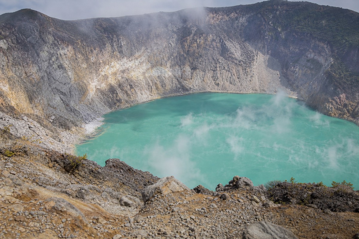
Active is a geological classification, not a warning light. A volcano is called active when it has erupted in recent history and retains a working magmatic system, and Santa Ana shows its status openly: the crater lake is sulfuric and acidic, it steams, and the water holds that unnatural turquoise that makes everyone reach for a camera. Swimming in it is both impossible and prohibited, and rim access is managed for the same reason.
None of that has stopped the mountain becoming the most climbed summit in the country. The daily group ascent runs on a fixed schedule, every hiker goes up with a mandatory local guide, and the crater area clears by early afternoon. If you are weighing the climb itself, my guide to the hike covers the trail stage by stage, and the crater lake guide explains why that water looks the way it does.
When did Santa Ana last erupt?
October 2005. That eruption is the most recent in the volcano's recorded history, and in the two decades since, Santa Ana has stayed quiet under continuous instrumental monitoring. No eruptive activity has closed the trail in the current period, and no advisories are in force as of the latest checks.
Two decades of quiet is meaningful, but the 2005 date is exactly why the monitoring system exists in its current form. A volcano that erupted within living memory gets instruments, protocols, and a public reporting channel, and Santa Ana has all three. That is a better situation for hikers than a "dormant" peak nobody bothers to watch.
Here is the status picture in one grid.
| Status item | Current state |
|---|---|
| Classification | Active stratovolcano |
| Last eruption | October 2005 |
| Current advisories or closures | None |
| Monitoring body | MARN, through the SNET network |
| Trail status | Open, daily guided group ascent |
| Guide requirement | Mandatory for all hikers, no exceptions |
| Crater access | Rim only, managed; lake strictly off-limits |
The official record sits with SNET, El Salvador's environmental monitoring service, which publishes volcanic observations for the public. If anything changed, that is where it would appear first.
Who monitors the volcano, and what do they watch?
MARN, El Salvador's environment ministry, monitors Santa Ana daily through its SNET network. Instruments and observers track seismic activity, gas emissions, and changes at the crater lake. MARN also publishes hiker guidance: the ascent is "not to be improvised," carry water, and leave no litter.
Monitoring an active volcano is mostly patient, unglamorous data work, and that is reassuring rather than alarming.
| What is monitored | Who watches it | Why it matters to you |
|---|---|---|
| Seismic activity | SNET instruments | Tremors precede eruptions long before the surface changes |
| Gas emissions | MARN monitoring | Rising sulfur output signals a system waking up |
| Crater lake behavior | MARN and SNET observation | Temperature and color shifts are early indicators |
| Surface changes at the crater | Ongoing observation | Deformation shows pressure building below |
| Public advisories | MARN via SNET | The official channel that would close the trail |
The practical takeaway: you do not need to interpret any of this yourself. The system's whole job is to convert instrument data into a simple public answer, open or closed, and right now the answer is open.
How does the volcano's activity shape the daily hiking rules?
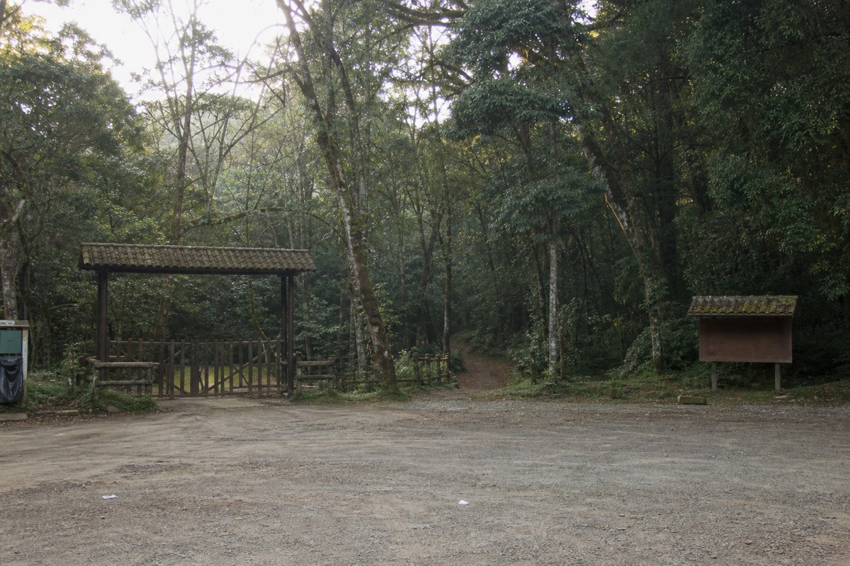
Directly. Because Ilamatepec is active and monitored, access is organized rather than open: the trailhead area opens around 7:00, the daily group ascent forms around 9:30 to 10:00, the last start is 11:00, and the crater area closes around 13:00. A local guide is mandatory for every hiker, with no exceptions.
The clock is the visible face of the monitoring system. Every rule that feels bureaucratic at the gate exists so that, on any given day, the authorities know how many people are on the upper mountain, who is leading them, and roughly when they will be down.
| Time | What happens | Why it is fixed |
|---|---|---|
| About 7:00 | Trailhead area becomes accessible | Staff and guides in place before the first groups arrive |
| 9:30 to 10:00 | The daily group ascent forms and starts | One organized wave, easier to escort and to count |
| 11:00 | Last start, no later departures | Everyone must be down before the crater closes |
| Around 12:00 | Groups reach the rim | About 2 h up at group pace |
| Around 13:00 | Crater area closes | The upper mountain empties before afternoon weather |
| Early afternoon | Descent complete, roughly 1.5 h down | Guides confirm their groups are off the mountain |
MARN's public guidance sums up the spirit of it: the ascent is "not to be improvised," carry water, leave no litter. That is the environment ministry talking, and the wording is deliberate. On an active volcano the difference between a well-run day and a bad one is whether people improvise. The mandatory guide, the group window, and the early close are the anti-improvisation measures, and they have made this the most climbed summit in the country. My write-up of the morning group ascent describes what that wave feels like from inside it.
What do you actually see of the active complex from the trail?
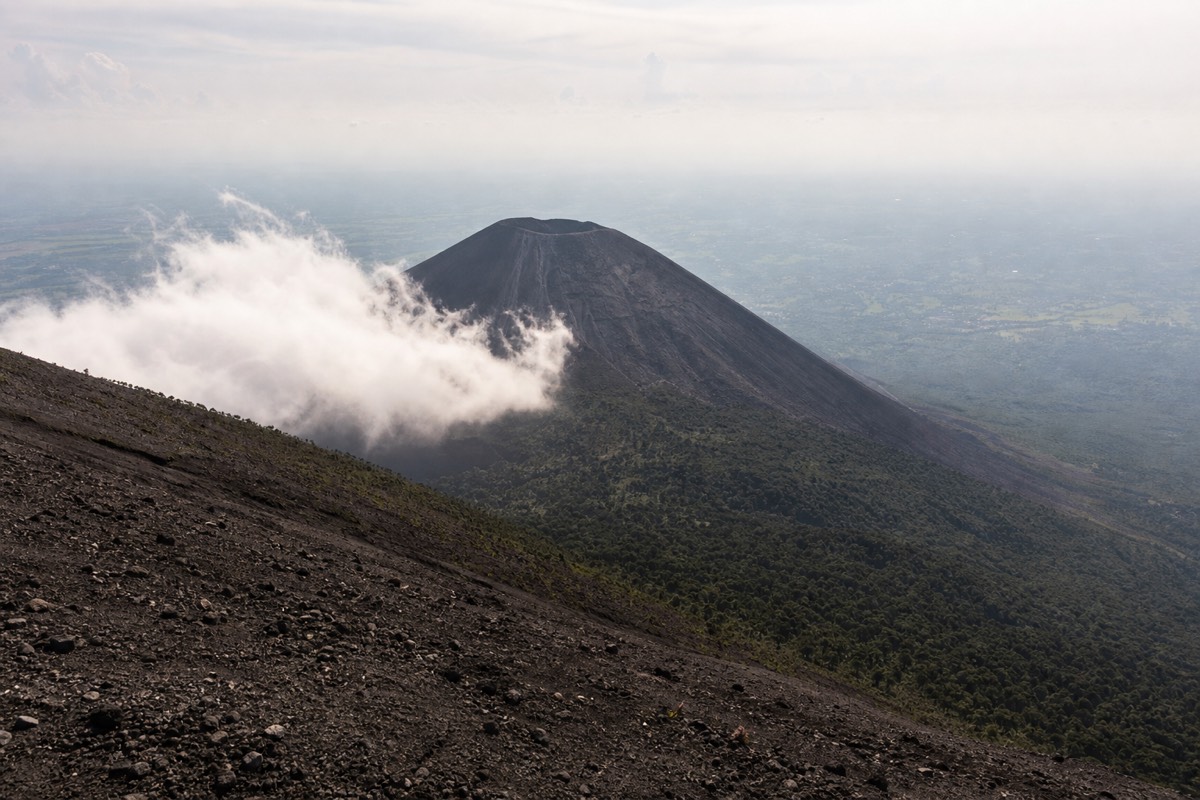
Three volcanoes and one caldera. Santa Ana's own steaming crater is the destination, Izalco's young black cone stands to the south, forested Cerro Verde holds the national park at about 2,000 m between them, and Lake Coatepeque, a caldera roughly 10 km across, spreads out to the east. The whole area is one volcanic system.
People imagine an active volcano as one lonely peak. Ilamatepec is the tallest member of a cluster, and the trail is the best classroom in the country for reading it.
| What you see | Where it appears on the hike | What it tells you |
|---|---|---|
| Coffee under shade trees | The lower trail | Volcanic soil grows the region's most valuable crop |
| Old lava and bare rock | Mid-mountain and above the tree line | Earlier activity, weathered into the path you walk on |
| Izalco's black cone | Emerging beside you as you gain height | The "Lighthouse of the Pacific," a younger, steeper neighbor with its own separate hike |
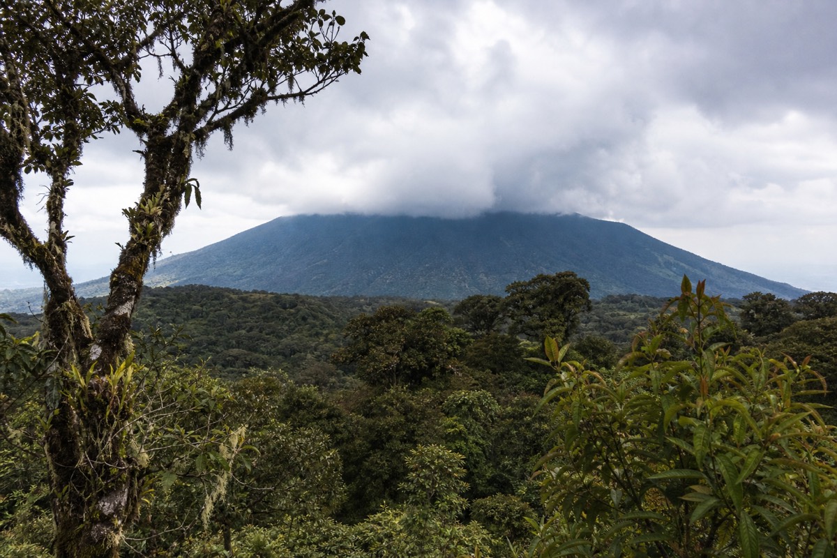
| Cerro Verde's forest | Below and behind you | The park at about 2,000 m, the older, greener member of the group |
| Lake Coatepeque | To the east from the upper trail and rim | A caldera lake about 10 km across; the swimming lake, not the crater |
| The crater lake | The rim, arriving all at once | Sulfuric, acidic, steaming: the live part of the mountain |
Izalco is the neighbor that gets the most questions. Its cone is dark, bare, and shaped like a child's drawing of a volcano, and its nickname, the "Lighthouse of the Pacific," tells you it was once far from quiet. It is climbed separately, on a steeper trail, and it is not part of the Santa Ana ascent. Cerro Verde is the gentle one, forested and cool, with the park infrastructure sitting on it. My side-by-side of Izalco versus Santa Ana and my guide to Cerro Verde National Park go into each in turn.
Why does the crater steam, and is the sulfur smell a warning?
The crater lake is sulfuric and acidic, and the steam and faint sulfur smell are its normal state, not a sign of trouble. On a monitored volcano the people who would notice a change are watching instruments, not sniffing the air. Your job at the rim is to stay on the managed edge and out of the lake.
Almost every group asks me this within a minute of reaching the top, usually with a nervous laugh. The honest answer is that a quiet sulfuric lake behaves this way every day. The turquoise color and the drifting steam are what an acidic crater lake looks like when nothing unusual is happening, and MARN's SNET network watches for the changes that would matter: shifts in seismic activity, gas output, and the lake's own behavior. Those readings are published for the public through SNET, and no advisory is currently in force.
What that means for you is refreshingly simple. Stay behind the guide on the rim, do not descend toward the water, and treat the smell as scenery. Swimming is impossible as well as prohibited, and rim access is managed for exactly this reason. Wind at the summit is stronger and the air cooler than at the base, so the sulfur comes and goes with the gusts. If it strengthens, you have simply caught a gust from the right direction.
The color itself is the subject of endless speculation on the trail. My post on why the crater lake changes color covers what I have watched over the years, and my crater lake guide explains what you can and cannot do at the edge.
What should you check before you go, and where do you check it?
Four things, all quick. Volcanic status on MARN's SNET site, the US State Department advisory for the country, the current details on the guided day's official listing, and your own kit against the mandatory-guide, cash-only reality of the park. None of these takes more than five minutes.
I tell clients that being informed about an active volcano is a checklist, not a research project.
| Check | Where | What you are looking for |
|---|---|---|
| Volcanic activity and advisories | SNET, MARN's monitoring service | Any advisory or closure; currently none |
| Country travel advisory | US State Department | Level 1, exercise normal precautions, as of June 2026 |
| Trail profile and recent reports | AllTrails | 6.9 km round trip, about 470 m of gain, rated 4.8, moderate |
| Departure details, cancellation, inclusions | The guided day's Viator listing | Free cancellation to 24 h, admission and lunch included, max 20 |
| Cash for the park | Your wallet, US dollars | $3 entrance for foreigners, about $4 guide fee, $3 parking, poles about $2 |
| Fitness and exclusions | Your own honest assessment | Not for back or heart conditions or pregnancy; not wheelchair accessible |
The status check matters less than people fear and the cash check matters more than they expect. In two decades of quiet since October 2005 the volcano has not been the thing that spoils a day; a wallet full of large bills at a cash-only gate has. If you go the guided route, book the guided day tour with the free cancellation in mind, since it means a change in conditions or plans costs you nothing up to 24 hours before.
What does Carlos tell nervous hikers at the crater rim?
Three things, every time. Stay behind the guide and off the inner slope, because the rim is managed for a reason. Expect wind and cooler air, so keep the layer on. And read the steam as normal, because the volcano is watched every day and the trail is only open when the readings say open. Then look down and enjoy it.
I have stood on that rim with more than a thousand travelers, by my own count, since 2018, and the nervous ones are my favorites, because the moment the fear turns into a grin is why I do this. Here is what I say, and it applies whether you climb with me, with one of the operator's guides on the guided day, or with the daily group.
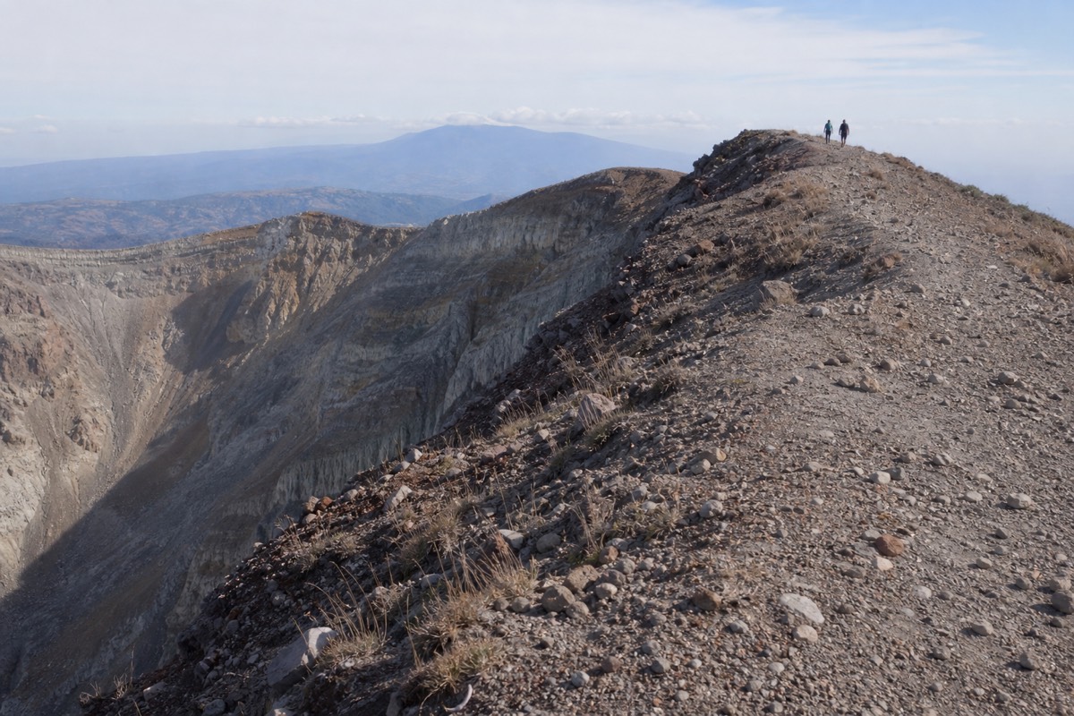
Rim discipline first. The upper crater is loose volcanic rock, and the edge is not a place to back up for a photo. Stand where the guide stands, keep children within arm's reach, and let the person taking the picture move, not the person in it. This is trail-condition advice, not volcanology.
| Rim habit | Why I insist on it |
|---|---|
| Stay behind the guide's line | The managed edge is stable; the inner slope is not |
| Layer on before you arrive | The summit is cooler and windier than the base, always |
| Poles collapsed or planted, not waved | Loose rock and a crowd of ten do not mix with swinging poles |
| Photos from the ground you are on | Nobody steps backward on a crater rim |
| Water at the top, not just the bottom | The last push is the driest and most exposed section |
Then the reassurance. The last eruption was October 2005. MARN's network watches the mountain daily. There are no advisories in force, and if there ever were, nobody would be standing where you are standing. That is the whole point of active-and-monitored: the word active describes the lake in front of you, and the word monitored describes why you are allowed to look at it. My guide to the hike's real difficulty covers the pacing that gets nervous hikers up here comfortably.
What does "active" actually mean for hikers?
In practice it means three things: you hike with a mandatory local guide on a fixed schedule, you stay on the managed rim and away from the acidic lake, and you benefit from a mountain that is professionally watched every day. It does not mean danger of eruption on your hike.
I tell nervous clients this on the drive up: the rules that feel strict are the reason the mountain is climbed safely by thousands of people. The group ascent starts around 9:30 to 10:00 with a last start at 11:00, the crater area closes around 13:00, and a local guide leads every group. Those controls exist so that if conditions ever shifted, everyone on the mountain would be accounted for and off it quickly.
The active status is also, honestly, the whole show. A dead crater is a bowl of rocks. This one steams, smells faintly of sulfur, and holds a lake the color of shallow tropical sea, and that is what makes the moderate climb feel so out of proportion to its reward. Reviews of the guided day keep circling back to that first view over the rim, and the 4.9 rating across 869 Viator reviews owes a lot to it. If you want the mountain's story in more depth, my facts page collects the geology in one place.
For most visitors the sensible move is to book the guided day tour and check live availability and prices on Viator, since it pairs a certified bilingual guide with included admission and hits the fixed ascent window without you doing any of the planning.
What signals would matter to a hiker, and who acts on them?
You will never be the one reading seismographs. If monitoring detected meaningful change, MARN would issue an advisory, park authorities would restrict access, and guided departures would stop or reroute. Your only jobs are to book with people who follow the system and to respect the guide's instructions on the day.
Here is how the chain works from a hiker's point of view.
| Signal | What it would mean | What happens for hikers |
|---|---|---|
| Normal readings, no advisory | Business as usual | Daily group ascents run on schedule |
| Elevated monitoring notice | Closer observation, not danger | Hikes typically continue; guides brief groups |
| Official MARN advisory | Meaningful change detected | Access restricted, tours pause or reroute |
| Closure order | Precautionary shutdown | Nobody goes up, refunds and rebooking apply |
The guided day fits this chain neatly because free cancellation runs to 24 hours before departure, so a sudden change costs you nothing. The tourism board's official page on Ilamatepec presents the volcano as a flagship experience precisely because this managed system works.
So yes, Santa Ana is still active, and I would not trade that for a safer-sounding word. The steam is the reason the summit feels alive, the monitoring is the reason you can stand there calmly, and the fixed guided schedule is the reason the whole thing runs like clockwork. Come see what an active volcano looks like when a country takes watching it seriously, and while you are planning, note how it compares with its steeper black neighbor in my Izalco versus Santa Ana guide.